Advanced Navigation Grabs $68 Million Series B Funding
Retired U.S. Army Gen. David Petraeus will lead a new committee to support company’s global expansion.
Expert nationwide installation services for fleet technologies.
Australia-based Advanced Navigation has announced a $68 million Series B round of funding led by KKR KKR 0.00%↑. Round participants include new investor Alpha Intelligence Capital and existing investors Main Sequence, former Australian Prime Minister Malcolm Turnbull, In-Q-Tel and Our Innovation Fund.
The company, which raised a total of $85 million, customers include including Airbus [EADSY], Boeing BA 0.00%↑, Google GOOG 0.00%↑, Apple AAPL 0.00%↑ and General Motors GM 0.00%↑. Products include underwater acoustics, GNSS antennas and receivers, radio frequency systems, inertial sensors, robotics and quantum-enhanced inertial navigation.

Advanced Navigation says it will use the new funding to accelerate R&D programs that are focused on robotic, navigation, photonic, and quantum sensing solutions. In addition, the company said it plans to use the funding to “enhance its global sales and marketing capabilities to reach new customers.”
As part of this global expansion effort, retired U.S. Army Gen. David Petraeus will lead a new international advisory committee that supports the company’s global expansion. In addition, Louis Casey, KKR’s growth technology lead and Vance Serchuk, KKR Global Institute executive director, will join Advanced Navigation’s board of directors.
Last month, the company launched a new fiber-optic gyroscope (FOG) inertial navigation system, the Boreas D70, for survey, mapping and navigation applications.
Meet urban mobility key leading players, policy makers, governments, companies, institutions, NGOs, startups at Autonomy Mobility World Expo! Official Location Business News media partner.
Google Maps Releases New Electric Vehicle Location Feature
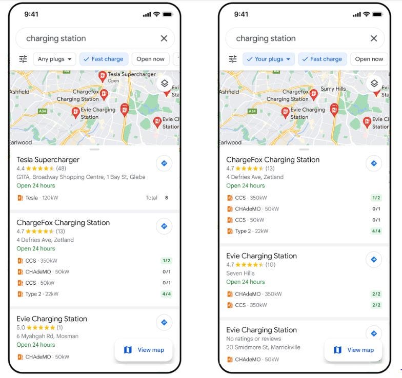
Google Maps GOOG 0.00%↑ last week rolled out an updated version for Android and iPhone that is packed with new features, including the ability to search for electric vehicle stations with fast chargers.
Users can search for “EV charging stations'' and select the a fast charger filter to see where chargers 50kW or higher are located. They filter also allows drivers to find out if charging plugs are compatible with their electric car.
While the company rolled out its Live View in September, Google said the feature will start launching this week in London, Los Angeles, New York, Paris, San Francisco and Toyko on Android and iOS. The company says the feature will allow users to tap on the camera icon to see nearby stores and coffee shops, banks, ATMs and others. AR-powered directions and arrows show the users where the features are and how far away.
Google also launched an “accessible places” setting on its Maps app. The function, crowdsourced from its Google Maps community, to allow users to find what businesses have wheelchair accessible entrances, seating, restrooms and parking.
Other new Google Maps location features include:
A feature added to Google Lens that allows a user to take a picture or screenshot of food and add the words, “near me” to find the restaurant or store that sells the item.
PTV Group Enters U.S. Fleet Tracking Market
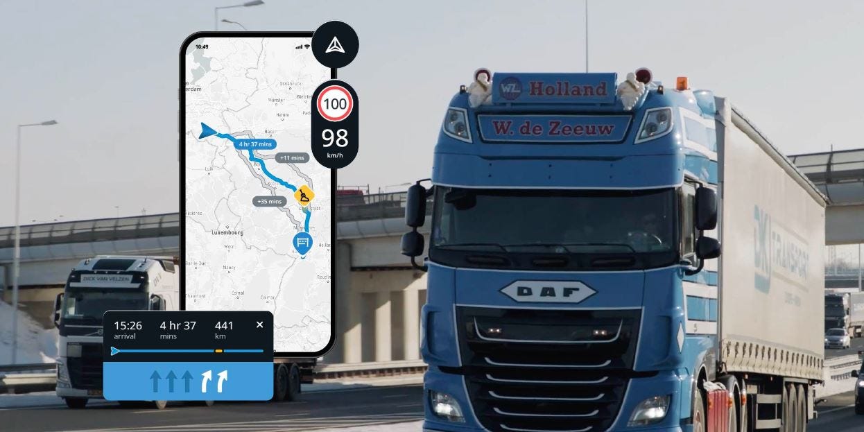
Germany-based PTV Group entered the U.S. fleet tracking market recently with a new truck navigation app. CEO Christian Haas says the PTV Truck Navigator G2 compliments existing U.S. tracking systems.
“With our app, we deliver a useful addition to other leading systems. For example, a TMS system that sends orders to our navigation app via an interface,” he said. “The exciting thing about our product is that it works on any Android smartphone. PTV Navigator does not compete with telematics devices--on the contrary, it enhances them.”
In Europe, Haas said the company works with many telematics providers – not only in truck navigation. “Many of them use our PTV Developer components within their tools to solve vehicle routing problems. And I see lots of potential in the U.S. market here as well,” he said.
As Location Business News reported, PTV Group will use TomTom [TOM2] to power its maps, truck routing and other functions. PTV Truck Navigator G2 will consider a truck’s size, weight, cargo, road hazard restrictions and tunnels to calculate a route, the company said. Much of the route information comes from TomTom’s database of traffic data, historical traffic patterns and predictions, the company said.
TomTom, which has worked with PTV Group in Europe for 10 years, says the expansion will allow businesses to have more accessible location data. “By making fresh and accurate location easily assessable to businesses, we can create safer and more comfortable experiences for drivers and end-customers,” said Mike Schoofs, TomTom Enterprise managing director, in a statement.
Haas says TomTom’s new map ecosystem is definitely “a great gain” for PTV Group. “Together with TomTom, we want to create an impact. This also applies to improving the safety and efficiency of public roads,” he said. “For example, we work on a joint project for the German motor way operator, Deutsche Autobahn GmbH. TomTom data and our real-time traffic management software enable a comprehensive overview of the road network and the impact of bottlenecks and roadworks, allowing traffic mitigation measures to be anticipated and implemented.”
Haas said that the SDK to embed PTV Navigator G2 into third-party mobile solutions is planned for Android in early 2023. “For iOS, it will be later in the year,” he said.
Discover investment opportunities in deep tech and fintech startups.
What if you were able to unleash technological innovations, grow businesses, and truly impact the way we live? And what if you could do it while potentially making investment returns? Our goal is to make that vision a reality.
Propel(x) is an investment platform that gives accredited investors the power to potentially change the world. By funding breakthrough technology startups, you may empower companies that are finding potential cures for debilitating diseases, creating abundant energy for all, and even taking us into space.
Researchers Say Alternative Positioning System More Accurate Than GPS
In a widely released story the past week, researchers at Delft University of Technology, Vrije Universiteit Amsterdam and VSL say their alternative positioning system is more robust and accurate than GPS—especially in urban settings.
The researchers say their working prototype achieved accuracy of 10 centimeters, which would energize autonomous vehicles, quantum communication and next-generation mobile communications systems.
The project, called SuperGPS, uses innovations that include connecting a mobile network to an accurate atomic clock for perfectly timed messages for positioning. The researchers say the connections are made through an existing fiber-optic network.
The system also employs radio signals with a large bandwidth. Because building reflect radio signals, which hamper navigation devices, the large bandwidth sorts out the signal reflections to enable better positioning accuracy, said Gerard Janssen of Delft University of Technology.
Your next business idea, delivered weekly.
Trends tells you the next big thing – months before everyone else. Their dynamic team of business analysts already outlined 1,000+ vetted business ideas you can start in a weekend, and they send new ideas and market signals straight to your inbox weekly.
Try Trends for a week for only $1!
Other Location News:
News tip? Send them to kdennehy@driverlessreport.com. Go to www.locationbusinessnews.com for more news and an archive of stories.
Top News:
🛰 Saying Goodbye to Galileo 1st Generation.
🛩 Honeywell and Newspace Research and Technologies Collaborate on Navigation Systems for Unmanned Aerial Systems. “Honeywell HON 0.00%↑ will provide its Resilient Navigation System, which enables UAVs to autonomously navigate in GNSS-denied environments.”
Maps:
🗺 New Broadband Maps Are Finally Here. “the FCC is unveiling the pre-production draft of its new broadband maps. These maps provide the best picture available to date of where broadband is and is not available across the country.”
🚛 Google Maps Rival Slowly Conquering a Market Google Isn’t Even Interested In. “Needless to say, the likes of TomTom [TOM2] and Sygic investing in truck navigation is living proof that Google is ignoring a growing market. Despite the user feedback in this regard, that is, as support for truck navigation in Google Maps is one of the most requested features so far.”
Connected and Autonomous Vehicles:
☹ Autonomous Delivery Startup Nuro Lays off 20% Of Workforce. “Nuro, the autonomous vehicle delivery startup backed by SoftBank, Google and Tiger Global Management, is laying off about 300 people, or 20% of its workforce”
😮 Amazon Was a Secret Player in Ford and VW-Backed Argo’s Demise. “The companies struggled to come up with a governance structure for sharing control of Argo, and one of the people said Amazon AMZN 0.00%↑ was turned off by the high cost of Argo’s technology.”
🤔 Otonomo in Talks To Merge With UK Auto-tech Rival Wejo. “Israeli auto-tech company Otonomo Technologies OTMO 0.00%↑ in talks with its UK rival Wejo Group WEJO 0.00%↑ about a possible merger. If such a merger were to be completed, Otonomo would be valued at $150 million, significantly higher than its current market cap of just $52 million but 96% lower than its valuation of $1.26 billion, when its SPAC merger was completed in the summer of 2021."
🚛 Waabi Announces 'Plug-and-Play' Autonomous Trucking Solution. “The product, which is called Waabi Driver, is intended as a full-stack autonomy solution for semi truck OEMs to integrate into their vehicles during the manufacturing process.”
🚗 World's Largest Autonomous Vehicle Test To Be Conducted in Nashville. “The world’s largest autonomous vehicle test, conducted by Vanderbilt University and several other universities in cooperation with Nissan, Toyota, General Motors GM 0.00%↑, and the Tennessee DOT, commenced last week.”
Financial:
✔ Ituran Surpasses 2 Million Subscribers and Presents Results for the Third Quarter of 2022.
✔ BeWhere Holdings Inc. Reports Third Quarter 2022 Results.
Beautiful, custom travel maps – starting at $20
Atlas.co is the only map company that lets you add your custom route to your personalized map. The process is simple:
- Select your trip type and add your trip
- Style your map, move / edit your labels
- Select your size and material type and submit your order!
Location Industry Briefs
Send your news releases to kdennehy@driverlessreport.com. Go to www.locationbusinessnews.com for more news and an archive of stories.
Swift Navigation Expands Skylark Capabilities
San Francisco-based Swift Navigation has expanded the capabilities of its Skylark precise positioning service to several product tiers. The company will now offer new services providing RTK (real-time kinematics) and DGNSS (differential GNSS) options. In addition, new BeiDou (BDS) signal support and regional coverage has been added, the company said. Swift also announced that BDS signal is available to supplement existing for GPS and Galileo.
Contact: Swift Navigation, press@swiftnav.com, www.swiftnav.com.
GMV and u-blox Partner for Positioning Solutions
Thalwil, Switzerland-based u-blox [UBXN] has partnered with GMV to provide ready-to-use positioning solutions. The company says that functional safety is becoming “indispensable for automated or autonomous driving vehicles” for the auto and industrial sectors.

The new deal with GMV, which features safety algorithms and augmentation services, include’s u-blox’s positioning software and hardware. The positioning solution will be marketed by u-blox as part of its existing GNSS receiver portfolio and PointPerfect GNSS augmentation service, the company said. More details will be released in 2023.
In other company news, u-blox announced an automotive-grade variant, the ZED-F9K-01A GNSS module. The module offers a fully integrated lane identification solution, the company said.
ZED-F9K-01A will be on display at the upcoming CES 2023 in Las Vegas in January. Samples are available for evaluation, the company said.
Contact: Natacha Seitz, u-blox, 41 76 436 0788, natacha.seitz@u-blox.com, www.u-blox.com.
Pozyx Launches Static Location Tag Feature
Pozyx has launched its Static Tag feature to further reduce the power consumption of its tags and provide accurate real-time location data in areas with limited coverage. The feature, based on field tests with thousands of tags, improves battery consumption and positioning accuracy, the company said. The tag is suited for enhanced real-time location services (RTLS) efficiency in warehouses and production facilities, the company said.
Contact: Elly Schietse, Pozyx, marketing@pozyx.io, www.pozyx.io.
Quectel Offers Antenna Combo
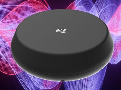
Quectel Wireless Solutions has announced the YB0027AA combination antenna that combines high performance cellular, Wi-Fi, Bluetooth and GNSS antennas. The new antenna can be screw-mounted on devices and also supports multiple connector types and cable lengths, the company said.
The company says YB0027AA offers a more flexible and reliable high-performance antenna solution for outdoor applications. Other applications include for emergency service vehicles, emergency service networks, autonomous vehicles and remote monitoring applications, such as in buses and shipping port machines, broadband failover and remote television broadcasting, the company said.
Contact: Quectel, marketing@quectel.com, www.quectel.com.
Honeywell Supports NASA’s Artemis I Launch and Orion Spacecraft
Honeywell HON 0.00%↑technology is helping enable NASA's Artemis I launch, with guidance and navigation systems, among others. The navigation and guidance systems include a barometric altimeter, which tracks the altitude of the Orion capsule in Earth's atmosphere as well as the inertial measurement system and GPS receiver, which track the position and movements of the capsule, the company said.
Contact: Adam Kress, (602) 760-6252, Adam.Kress@Honeywell.com, www.honeywell.com.
Convey911 Uses NextNav’s Vertical Location Service
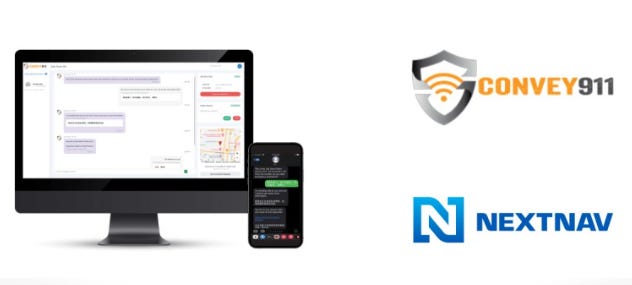
Convey911 has selected NextNav NN 0.00%↑ for its z-axis vertical location intelligence. Agencies using Convey911’s solution will now be able to leverage z-axis data and visualization that is powered by NextNav’s vertical location service, the company said.
Convey911 allows emergency personnel to connect with emergency callers via text and multimedia messaging in more than 135 languages. The integration with NextNav’s vertical location service will provide first responders with an emergency caller’s precise location data, including their elevation level, the company said.
Contact: Gillian Smith, NextNav, media@nextnav.com, www.nextnav.com.
Connexion Partners With Quickride
Connexion Telematics, the developer of General Motor’s GM 0.00%↑ OnTRAC, has announced a partnership with shuttle service Quickride to integrate dashboard technology that allows dealers to manage their courtesy fleet and shuttles. Features include fleet and courtesy transportation management; driver tracking, navigation, and route optimization; and a customer app with real-time shuttle updates.
Contact: Tony Vigiletti, Connexion, tony.vigiletti@connexionltd.com.
Rand McNally Expands Telematics Platform into New Markets
Rand McNally has expanded of its API-first Rand Platform into additional field service markets. Rand cites Toyota, Avis, and Aramex as customers, but now wants to move into the field service market to offer telematics solutions to fleets in construction, oil and gas and mining operations.

Some of the successes Rand McNally says fleet owners, with their telematics installed, have seen include: A 45 percent reduction in fleet maintenance and administration costs, an 80 percent drop speeding violations among drivers, improving safety and a 99 percent recovery in stolen vehicle and equipment assets.
Contact: Rand McNally, (800) 789-6277, https://fleet.randmcnally.com.
Otonomo Partners With Ramboll
Otonomo Technologies OTMO 0.00%↑ has partnered with Ramboll, who will use the company’s Smart Mobility Data Platform to enhance its consultancy reports and transport models. Ramboll will also offer streaming vehicle data to road authorities for traffic management and road safety applications, the company said. The new partnership will enable Ramboll to use the connected vehicle data available, including geo-enhanced floating car data, as well as extended vehicle sensors including, weather events, road friction and road sign placement.
Contact: Juliet McGinnis, Otonomo, press@otonomo.io, www.otonomo.io.
News Without Motives.
1440 is the daily newsletter helping 2M+ Americans stay informed—it’s news without motives, edited to be unbiased as humanly possible. The team at 1440 scours over 100+ sources so you don't have to. Culture, science, sports, politics, business, and everything in between - in a five-minute read each morning, 100% free.
MetAlert Launches GPS SmartSole With Canadian Distributor
MetAlert [MLRT], formerly GTX Corp., said Canadian distributor Red Dot Alerts has launched its new 4G GPS SmartSole, a wearable medical monitoring device integrated into an orthotic insole that allows “discreet tracking” and remote monitoring of Alzheimer’s, dementia, and autism sufferers.
MetAlert uses GPS, Cellular, RF, NFC and BLE technology to enable subscribers to track, in real time, the whereabouts of people or high value assets, the company said.
Contact: MetAlert, www.metalert.com.
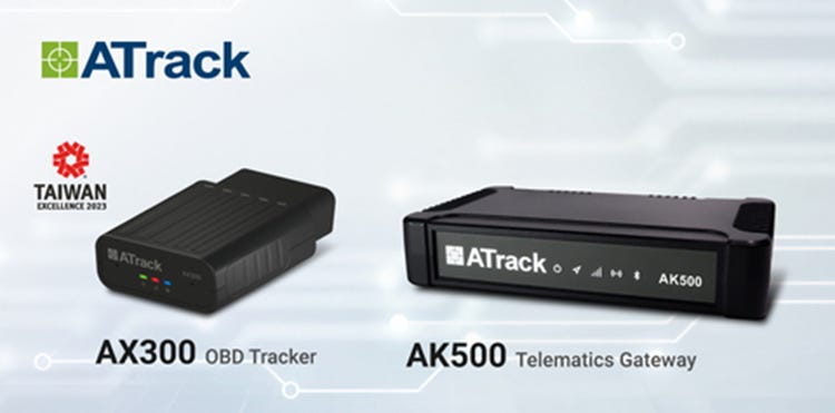
ATrack Launches 4G Vehicle Trackers
ATrack Technology has launched two 4G fleet management products—the AX300 OBD tracker and AK500 telematics gateway. The AX300 OBD tracker, which has compact size, supports ISO 15765-4, ISO J1939, and SAE J1708 communication protocols.
The AK500 Telematics Gateway incorporates an LTE Category 4 ultra-high speed wireless mobile network with 2.4GHz and 5GHz WiFi sharing, Bluetooth, engine diagnosis and real time position monitoring, the company said.
Contact: Chloe Wang, ATrack, Chloe.wang@atrack.com.tw, www.atrack.com.tw.
People
Qualcomm QCOM 0.00%↑ has named Jeffery Torrance as senior vice president and general manager for the company’s Connected Smart Systems unit.
Phunware PHUN 0.00%↑ has named Russ Buyse as CEO, effective Dec. 28, 2022. Most recently, Buyse served as COO of GlobaliD.
Jobs
Open Positions. Pointr.
GNSS Software Sales Manager, Industrial Accounts (US). Swift Navigation.
Head of Sales - The Americas. Advanced Navigation.
Multiple Openings. Hexagon.
Internships. Hexagon.
Click HERE to Join our growing Location Business News LinkedIn Group!


