Google Delays Launch of Find My Device Network
Google said it would leverage more than 1 billion Android devices to find lost items
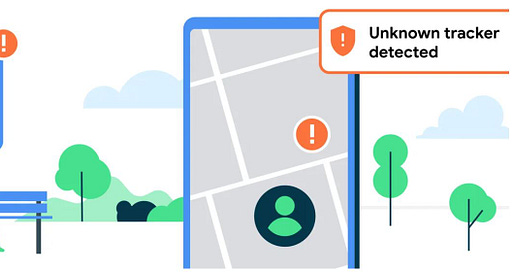
At its I/O 2023 conference, Google GOOG 0.00%↑ said it would launch its Find My Device (FMD) network that would leverage more than 1 billion Android devices to find lost items. However, the company now plans to delay the network, which was scheduled to launch this summer, according to a company blog.
Why? Of course it’s because of industry rival Apple AAPL 0.00%↑. Google wants the company to implement unknown tracker alerts in iOS—although Apple does have the messaging via its AirTags.
“At this time we’ve made the decision to hold the rollout of the Find My Device network until Apple has implemented protections for iOS,” according to the blog, which was authored by Erik Kay, Google’s vice president of engineering.
As Location Business News reported in May, Google, along with Apple, announced that they are working together to battle unwanted location tracking. The plan was to thwart illegal activity on such devices as the Apple AirTag, a coin-sized device that allows users to track others in real-time on an iPhone app.
The companies submitted a draft industry specification to the Internet Engineering Task Force, a standards development organization. Such companies as Samsung, Tile, Chipolo, eufy Security and Pebblebee said they support the draft specification that will offer examples and instructions for manufacturers.
Overall, Find My Device features will help users locate such missing belongings as headphones, phones, and other items like luggage and keys, using new third-party Bluetooth tracker tags, Google said. The company said that unknown tracker alerts are beginning to roll out to Android 6.0+ users this month.
Expert nationwide installation services for fleet technologies.
HERE at Top of Annual Location Ratings
Analysts at TechInsights, formerly Strategy Analytics, have recognized HERE Technologies as the top-rated location platform in its annual benchmarking report, the company said. The annual report says HERE is at the top in map-making, map freshness, automotive location services, and vision and growth leadership.
The report ranked the largest location companies including HERE, Google, Mapbox and TomTom [TOM2] across seven categories. HERE also co-led this year’s rankings in the developer community and environmental sustainability categories, the company said.
Currently, 34 million vehicles have shipped with HERE maps for automated driving, with the HD Live Map for SAE Level 2+ capabilities of the BMW 7 Series, available in North America, as well as the SAE Level 3 DrivePilot system of Mercedes-Benz, according to the report.
Overall, the report finds navigation to be the top use case for location services. “Navigation remains the primary use case for location services and software within the automotive sector, whether this is directly through embedded, or hybrid navigation software integrated with the in-vehicle infotainment (IVI) system, or indirectly through Portable Navigation Devices (PNDs), smartphone mirroring, or smartphone navigation apps,” the report said.
Power Your Business with Vetted Digital Marketing Experts
GrowTal's marketing experts are pre-vetted and experienced, so you can focus on taking your business to the next level. Anywhere from social media management and SEO to paid social channels and high-level strategists. GrowTal experts are ready to work.
BusRight Grabs $7 Million in Series A Funding
Startup BusRight has announced it has raised a $7 million Series A funding round led by Las Olas Venture Capital. BusRight said it will use the capital to double its employee headcount, accelerate product development and expand its customer base among U.S. K-12 education transportation systems.
BusRight says that school buses represent the largest mass transit system in the U.S., with an estimated 480,000 buses transporting more than 26 million students daily. In 2018 alone, public spending on student transportation topped nearly $30 billion, the company said.
The company says it provides value to K-12 schools through better bus routes, communication and safety. Bus drivers, who the company says are quitting in record rates, can use its app to optimize routes, use turn-by-turn navigation and real-time bus tracking. Parents can receive updated alerts on where their children are and obtain updated bus schedules, the company said.
“With traditional navigation designed only for cars and drivers prohibited from using mobile phones, routes must be memorized, which burdens drivers and offers little insight into where students are,” said Keith Corso, CEO and co-founder, who launched the company while a student at Northeastern University.
BusRight’s technology includes routing software, real-time GPS, dynamic driver navigation via military-grade tablets and a bus tracking app for parents. Instead of interfacing with multiple vendors to tackle routing, location and communication, BusRight says it provides one centralized platform and a personal concierge for every customer.
Additional investors include prior round lead Ubiquity Ventures, Underscore VC, Long Journey Ventures, SilverCircle, Automotive Ventures, Alumni Ventures, CreativeCo Capital, and “several prominent angel investors,” the company said. Founding partner at Las Olas Venture Capital, Mark Volchek, will also join the company’s board of directors.
Get your business discovered on TikTok
- Maximize ROI by reaching your most relevant audience - Reach new audiences in 20+ markets worldwide - Fast setup for every level of expertise - Flexible budget that works for businesses of all sizes
Optimize your Sales Strategy with Apollo
Search, engage and convert over 250 million contacts at over 60 million companies with Apollo’s sales intelligence and engagement platform.
Other Location News:
News tip? Send them to kdennehy@driverlessreport.com. Go to www.locationbusinessnews.com for more news and an archive of stories.
Top News:
😒 How China Is Threatening U.S. GPS Dominance With Beidou. “But experts say China’s Beidou system is about more than just military might. As GPS did for the U.S., Beidou is spurring massive economic development in China, to the tune of $156 billion by 2025 according to Chinese state media.”
🛰 Thales To Provide Cybersecurity for Galileo Second Generation. “These contracts represent a total value of over 60 million euros.”
👍 Let's Celebrate a Half-Century of GPS by Catching up to China. Dana Goward: “China’s and Russia’s threats to GPS are particularly of concern because both those nations have national terrestrial alternatives to GPS and GPS-like systems while the U.S. does not.”
📌 Soracom Partners to Expand iSIM Commercial IoT Growth. Soracom announced a collaboration with IoT chipset provider Sony Semiconductor Israel. The collaboration was expanded to include iSIM-compatible modules from Quectel and Murata.
⚡ Seven Major Automakers, Including GM, Stellantis and Honda, Join To Create Us Charging Network. “The companies – General Motors GM 0.00%↑, BMW Group, Honda, Hyundai, Kia, Mercedes-Benz and Stellantis STLA 0.00%↑ – plan to install at least 30,000 chargers in the United States and Canada.”
🏛 Bill to Reform FCC Satellite Licensing Unexpectedly Fails To Pass in House Vote. “The measure calls on the FCC to create a new framework for licensing satellites and seeks to reform rules to persuade operators to locate their operations in the U.S.”
😐 Utah Pilot Program Installs GPS to Track Cars for Road Use Tax and Tolls. “The Utah Department of Transportation, ETAN Tolling Technology and ClearRoad announced the Local Road Usage Charging and Tolling Integration Pilot as a test for a new way to charge drivers for using the streets.”
Maps:
👍 Apple Maps Launched a New Experience in DFW and Houston. “Apple Maps has rolled out a new detailed city experience in Dallas and Houston, which expands on the pre-existing features.”
📱 Google Maps for Android Rolling Out Much Faster Voice Input Powered by Assistant. “The new voice input replaces “Speech Services,” a component that was used by many Android apps for voice input years ago, but has been outdated both in its functionality and its interface for quite some time.”
👌 Android Auto Gets a Google Maps Redesign With Sidebar. “Attached to recent Google Maps updates and independent of your Android Auto version, a new design for the Maps app on Android Auto is rolling out.”
📲 Apple Quietly Releases 3D Maps in New Regions As the Google Maps Offensive Continues. “Apple's detailed city experience includes rich map details like 3D buildings, crosswalks, sidewalks, trees, and parks.”
🌸 Petal Maps Offers New Features. “The latest update brings Petal Maps to version 3.7.0 and includes three significant changes. The first concerns how Petal Maps displays ETAs for your routes.”
🗺 Laser Mapping Reveals a Forgotten Maya City in the Jungle.
Reach nearly 14,000 subscribers and 100,000 more via social media by advertising in Location Business News!
We can promote your webinar, service or product to a focused group of industry executives. Email us at info@driverlessreport.com for more information, or click here to view our one-page media kit.
Connected and Autonomous Vehicles:
😕 Urmson Zigs. Roger Lanctot: “The robotaxi irrational exuberance was running thick the past two weeks with Tesla, Waymo, General Motors' Cruise, Mobileye, and even Princeton's Alain Kornhauser hopping on the bandwagon.”
🚛 Waymo Puts the Brakes on Self-Driving Trucks Program. “Waymo is tapping the brakes on self-driving trucks and shifting most of its capital, resources and talent to one commercial bet: ride-hailing.”
🚘 US Lawmakers Struggle To Find Deal on Self-Driving Cars. “Republicans and some Democrats want fast action, raising concerns that China could surpass the United States in deploying cars without human drivers. Safety groups, plaintiffs' lawyers and labor unions are raising concerns about the legislation.”
🚙 BMW Tests Next-Gen Lidar To Beat Tesla to Level 3 Self-Driving Cars. “The latest example is the partnership between BMW Group and Innoviz Technologies INVZ 0.00%↑ to bring Level 3 autonomous driving to more vehicles through the development of next-generation Lidar sensors.”
🚍 Hesai Technology Advances Autonomous Vehicle Lidar Integration With Nvidia Drive and Omniverse.
🚗 Cruise Is Bringing Its Self-Driving Cars to Nashville. “Cruise CEO Kyle Vogt said Thursday it will expand its robotaxi service to Nashville as the GM subsidiary ramps up its commercial operations.”
😮 BMW Uses Autonomous Cars for Boring, Repetitive Tests. “The important thing here is why these cars, outfitted with additional sensors, are driving along the same route again and again, each time depressing the accelerator the same amount and applying the exact amount of pressure on the brakes: They're testing hardware with the least amount of variables you can encounter outside of a lab.”
😐 The Legal Saga of Uber’s Fatal Self-Driving Car Crash Is Over.
Other Stuff:
🤿 With a New App, Smart Devices Can Have GPS Underwater. “A team at the University of Washington has developed the first underwater 3D-positioning app for smart devices.”
👍 Researchers Tap Into 800-Year-Old Mathematical Theory to Design GPS on the Moon. Eötvös Loránd University has researched navigation methodologies to implement GPS systems on the Moon. “Per their official statement, they are considering a potential approach for developing a precise lunar GPS system, which draws upon an 800-year-old mathematical technique created by the Italian mathematician Leonardo Fibonacci.”
🤔 Quantum Sensors Have Potential To Replace GPS. “Less vulnerable to disruption than GPS, inertial navigation using quantum sensors is viewed as a way to navigate with similar or better accuracy than [GPS] when compromised or unavailable.”
Drones:
😮 New FAA Requirements for Drones Arrive in September. “The long-awaited and much debated Remote Identification requirements take effect Sept. 16, 2023, for drones across the United States. Remote ID allows drones to broadcast a signal that a third party can use to identify the drone in the air as well as the location of the operator.”
🛩 Drones Improve County Weed Department Operations. “Drones equipped with special technology enable them to reach dangerous or inaccessible areas to spray noxious weeds.”
🌍 Orkney Islands Become UK's First Location for Drone Mail Deliveries. “The inter-island flights will be conducted by Skyports using the Speedbird Aero DLV-2 aircraft, a multi-rotor drone with a maximum payload capacity of 6 kg.”
💲 Fundraising in the Drone Delivery Industry.
Financial:
✔ Sewio Reports Record-Breaking Fiscal Year.
✔ NextNav Announces Date for Second Quarter 2023 Earnings Call.
✔ Mobileye Drives Past Second-Quarter Targets, Raises Earnings Outlook.
✔ STMicroelectronics Reports 2023 Second Quarter Financial Results.
✔ MiX Telematics Reports First Quarter Fiscal Year 2024 U.S. GAAP Financial Results.
Get smarter in 5 minutes with Morning Brew (it's free)
There's a reason over 4 million people start their day with Morning Brew - the daily email that delivers the latest news from Wall Street to Silicon Valley. Business news doesn't have to be boring...make your mornings more enjoyable, for free.
Location Industry Briefs
Send your news releases to kdennehy@driverlessreport.com. Go to www.locationbusinessnews.com for more news and an archive of stories.
Xona Wins Air Force Contract
Xona Space Systems has won a $1.2 million Direct to Phase II SBIR U.S. Space Force contract. The company, which is working with the Space Force and the Air Force Research Laboratory, said it successfully demonstrated the capability of low-Earth orbit (LEO) PNT architecture using the Huginn demo satellite. The company is working with the government entities toward a secure LEO PNT architecture leveraging its PULSAR service.
Contact: Xona Space Systems, www.xonaspace.com.
Digital Matter Offers Worldwide Asset Tracking With New GPS Devices
Digital Matter has announced the expansion of its battery-powered IoT asset tracking portfolio with the addition of 4G Cat 1bis and 2G connectivity to enable worldwide asset visibility. The Oyster3 and Remora3 Global GPS devices feature ‘deploy once’ battery life and enable asset tracking and management across most of the world’s cellular networks, the company said.
In addition to GPS, the Remora3 Global features Bluetooth to communicate with nearby Bluetooth tags, sensors and beacons. This enables flexible tagged asset and condition monitoring, including temperature, humidity, impact detection and more, the company said.
Contact: Shay Kettner, Digital Matter, shay@digitalmatter.com, www.digitalmatter.com.
Favendo Rolls Out Modular RTLS Suite
Favendo has launched its Modular RTLS Suite allows to use real-time location data to reduce search times, increase security, improve processes and save money, the company said. The Modular RTLS Suite features a location engine, SDK, viewer, tagger, dashboard and other features.
By integrating partner technologies from Quuppa or Actility/Abeeway, hybrid RTLS solutions can be implemented that provide high flexibility, the company said. In addition to tracking use-cases, Favendo also offers a client-based indoor positioning wayfinding solution.
Contact: Larissa Sedlmeier, Favendo, marketing@favendo.com, www.favendo.com.
PreAct Rolls Out Mojave Lidar
PreAct Technologies has launched its Mojave Lidar low-cost sensor solution for such applications as smart cities, robotics, cargo monitoring, education & university research, building monitoring, patient monitoring, agricultural and others. “We created the sensor to allow companies to monitor volume and movement through high-density point clouds, which gives them the information they need to adjust their services without the ‘creepy’ factor of watching individuals on camera,” said Paul Drysch, PreAct CEO.
PreAct says Mojave is the only flash lidar on the market designed for the non-automotive industry, as well as automotive, applications. The unit costs $350.
Contact: Angela Simoes, for PreAct Technologies, (415) 302-2934, angela@mpublicrelations.com, www.preact-tech.com.
Quectel Announces SC696S LTE Cat4 Smart Module
Quectel Wireless Solutions has launched the SC696S series of multi-mode smart LTE modules equipped with Wi-Fi and Bluetooth capabilities. The modules leverage Qualcomm’s QCOM 0.00%↑ QCM6125 System-on-Chip (SoC) for IoT and Adreno 610 GPU.
The modules support a multi-constellation GNSS receiver. Applications include tax control machines, on-board equipment, robots, smart home devices, industrial handheld equipment, wearables, vending machines and other smart hardware.
Contact: Quectel, media@quectel.com, www.quectel.com.
OGC Seeks Comment on Mapping Standard
The Open Geospatial Consortium (OGC) seeks public comment on the candidate OGC API - Moving Features - Part 1: Core (OGC API - MF) Standard. Comments are due by Aug. 27, 2023. OGC API - MF provides a uniform way to access, communicate, and manage data about moving features across different applications, data providers, and data consumers, OGC said.
Contact: OGC, ogc.org.
Elo GPS Foils Vehicle Theft Attempts
Elo GPS helped a stolen vehicle victim, after being robbed at gunpoint, by sharing the her vehicle’s real-time location with the Wichita Falls (Texas) Police Department. The Elo GPS App keeps drivers connected to their car in real-time, so they're always aware of where and how their car is being driven, the company said.
In another recent incident in Seattle, a suspected AirBnB Burglar was apprehended because of data provided by the vehicle owner's Elo GPS account, the company said. Elo GPS, provided by Connected Dealer Services, offers a 24/7 Stolen Recovery Hotline with recovery specialists on standby to guide customers through the stressful reporting and recovery process and help coordinate with law enforcement on their behalf, the company said.
Contact: Elo GPS, www.elogps.com.
ProStar Integrates Mapping Software Into Leica Geosystems’ GPS/GNSS Receivers
ProStar Holdings [MAPPF] has announced its mapping software, PointMan, will be integrated with Leica Geosystems’ GPS/GNSS receivers for GIS asset data collection. The integration allows a data collection solution that captures, records and displays the precise location of underground infrastructure, the company said. The integration means that PointMan now supports Leica Geosystems’ mobile receivers running Android and iOS, including the Zeno FLX100 plus GNSS receiver.
Contact: Kerry Trivers, Leica Geosystems, (770) 326-9500, kerry.trivers@hexagon.com.
Amazfit and Komoot Partner To Offer Routing, Navigation
Amazfit, owned by Zepp Health ZEPP 0.00%↑, now offers routing and navigation connectivity with the outdoor activities app komoot. The company said that its smartwatches now offer GPS and long battery life.
Users of this GPS smartwatch, along with the recently-launched Amazfit Cheetah series of running watches and the brand's flagship Amazfit GTR 4 and GTS 4 series, are able to download route files from the Zepp App for navigation directly from the display, the company said.
Contact: Amazfit, www.amazfit.com.
Create a FREE ManyMe Account.
The early bird registration deadline is approaching for ION GNSS+ 2023. This year's technical meeting will take place Sept. 11-15, 2023 at the Hyatt Regency Denver (located adjacent to the Colorado Convention Center). A virtual registration option is available. To save $200 on registration rates for ION GNSS+ 2023, complete your registration by Friday, August 11.
Pasternack Rolls Out Marine Antennas
Pasternack has launched its line of commercial marine-grade ship/boat RF antennas, specifically for the harsh marine environments. GPS capabilities include L1 band and multiband capacities and a gain of 28 dBi, the company said.
Pasternack's new commercial marine-grade ship/boat RF antennas are in stock and available for same-day shipping.
Contact: Peter McNeil, Pasternack, (978) 682-6936.
InDrive Launches in South Florida
InDrive has announced its official launch in South Florida, the company's first U.S. market. Known for its bid-based business model, InDrive allows passengers and drivers to negotiate and agree on the price of each ride.
The app has built-in safety features that allow passengers to share trip details with their contacts, with real-time GPS tracking, during rides. InDrive also provides such services as intercity transportation, freight delivery, task assistance, courier delivery and employment search.
Contact: Dakota Orlando, for inDrive, dorlando@5wpr.com, www.indrive.com.
AgEagles Updates UAS
AgEagle Aerial Systems $UAVS has updated its eBee VISION intelligence, surveillance and reconnaissance unmanned aerial systems (UAS) featuring live, 4K resolution video imagery from a distance of up to 12 miles.
Offering up to 90 minutes of flight time, AgEagle’s eBee line can be deployed and operated by a single person. The UAV line now features cursor on target, target tracking, flight planning and GNSS-denied flight mode, the company said.
Contact: AgEagle, media@ageagle.com, www.ageagle.com.
Compliantly hire anyone, anywhere, in 5 minutes with Deel
Deel is your one-stop shop for hiring, paying, and managing your remote team. We stay on top of local labor laws across the world to ensure compliance and mitigate risk so that you don't have to.
People
Luminar LAZR 0.00%↑ named Emily Shanklin, formerly of SpaceX, as senior vice president of marketing. The company also named Kevin Hinge, chief supply chain officer at GoPro, as executive vice president of manufacturing, supply chain and quality. Both executives will report to CEO and founder Austin Russell.
Pointr named Carrie Saarinen as vice president of customer success. Saarinen has worked with SaaS companies since 2012.
Mike Apperson has been named channel partner executive at GPS Trackit.
Taoglas has named Leann Lehew as channel partner manager.
Jobs
Open Positions. Cruise.
Careers. Septentrio.
Current Openings. Advanced Navigation.
Customer Success Operations Manager. HERE Technologies.
Technical Project Manager. HERE Technologies.
Your partner in global employment
Over 1000 companies are hiring, paying, and taking care of their team members all over the world with Oyster’s all-in-one global employment platform.
Click HERE to Join our growing Location Business News LinkedIn Group!