Google Maps Facing German Antitrust Probe
Agency to see whether mapping giant limits customers' third party mapping options...
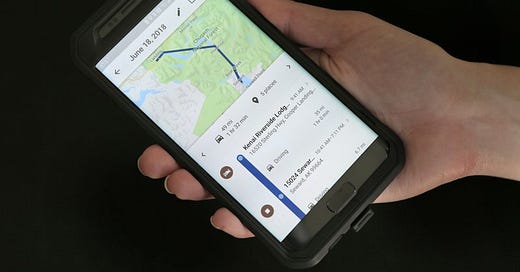
A German federal agency is investigating Google Maps over concerns that the mapping giant limits customers’ options to use alternative map companies.
According to published reports, the German Federal Cartel Office has opened a formal probe—to include Google’s Automotive Services.
Germany isn’t the only one who is looking into Google’s alleged monopolistic practices. Location Business News reported in April that the U.S. Justice Department stepped up its Google Maps probe to see if the company is promoting monopolistic practices in its mapping business that hampers third-party apps.
According to published reports, DoJ is looking whether Google’s Android Automotive, which requires car manufacturers to install Google Assistant, YouTube Music and Play Store, triggers antitrust action. DoJ is also scrutinizing Google Maps’ terms of service (ToS) to see whether it limits how developers use its map data. Right now, a third-party navigation company cannot use Maps APIs because it would compete with Google Maps.
In addition, three U.S. states and the District of Columbia have recently sued Google for alleged ‘deceptive’ collection of location data on Android devices. The attorney generals of Texas, Washington state and Indiana joined with the District saying that Google makes it hard for users to stop sharing their location data, among other allegations.
Hexagon Partners With Fujitsu to Solve Societal Challenges
Hexagon's Safety, Infrastructure & Geospatial division and Fujitsu Limited partnered this week to solve “societal challenges” with technology. The agreement, made at HxGN Live Global 2022 in Las Vegas, calls for the companies to develop use cases with such technology as IoT sensors, data processing, AI analysis and advanced data visualization in the cloud and high-performance computing infrastructure, the companies said.
The companies said they will develop joint solutions that deliver information and “deeper insights to customers” in government, the public sector, transportation and utilities to help reduce emissions, increase safety, optimize operations and more.
The partnership builds on the companies’ efforts to solve transportation challenges in Europe, including working together last year on a Munich city project that used smart monitoring systems to manage and understand the impacts of shared mobility services in the city. Hexagon, along with Fujitsu, provided Munich a SaaS product for tracking, visualizing and analyzing IoT data from a variety of mobility providers, the company said.
In other conference news, Hexagon’s Mining division said its Power of One platform that connecting sensors, software, in-field apps and cloudware, is now available and ready for deployment.
The company said the Power of One technology connects a mine to the boardroom through a single onboard system that uses a smart computer, antenna and display.
In other HxGN Live Global news:
Kompass BMS said it is entering into the North American survey and engineering market. The company offers a software platform built for geospatial surveying & engineering companies.
Trimble Exec Talks About First Deployment of Map-based Localization System
Last week, Location Business News reported that Trimble [TRMB] announced the first deployment of its map-based localization system for land-based autonomous vehicle applications. The customer, Japan-based IHI Corp., will retrofit its existing container and haulage trucks with a customized Applanix POS LV system.
This week, LBN talked to Louis Nastro, Trimble’s On-Road Autonomy Division’s director of strategy and marketing about the system’s technology and markets.
LBN: Do you view the container/trucking market as probably the first real market for autonomy products?
Nastro: “We see a lot of opportunity in this market, but also see a lot of opportunity in several markets including agriculture, construction, consumer automotive and mining. The first truly autonomous application was in deep open pit mining where we provide precision location and orientation for autonomous mining trucks in harsh conditions. For on road applications such as autonomous trucks we start with the POS LV for ground truthing and providing precise reference data and then migrate to providing our precise positioning engine with ASIL-certified Trimble RTX corrections. From development to deployment, we have solutions that meet the requirements of customers to aid them in every step of the process.”
LBN: Is Trimble providing the maps for this project, augments GNSS, or both?
Nastro: “Onboard the vehicle, Trimble provides both the onboard real-time position and orientation data required for successfully navigating the vehicle using Trimble RTX corrections. Using our SLAM technology, we also have the ability to generate maps to compare the position result with what the sensors are seeing and correlate the two to provide precise positioning even in areas of degraded or no GNSS. This is the map-based localization functionality within our SLAM framework. Presenting clients with the complete workflow for creating and utilizing the maps in real time allows for rapid deployment. Trimble Applanix POS LV technology enhances and augments GNSS and inertial data to provide an accurate base map using post-processed data.”
LBN: Does the company plan further partnerships within North America?
Nastro: “While Trimble is talking with several companies in North America to develop customized autonomous systems, we have several existing partnerships already in place. General Motors uses Trimble RTX technology as the high-accuracy GNSS/GPS correction source to deliver absolute positioning to vehicles equipped with GM's Super Cruise hands-free highway driving system. Trimble is partnered with HORSCH, one of the world’s leading manufacturers of modern agriculture technology, to develop autonomous machines. And, we are partnered with several automotive OEMs and Tier I suppliers providing our precise GNSS/inertial positioning engine and ASIL-certified Trimble RTX corrections for ADAS and ultimately, autonomous vehicle functionality.”
Companies Launch Slew of Products at Embedded World
Are trade shows coming back after a two-year worldwide pandemic draught? One example of a comeback is the number of companies attending and launching products and services at this week’s Embedded World conference in Nuremburg, Germany.
One company, Semtech Corp. [SMTC], announced its SaaS chip-to-Cloud service, LoRa Cloud Locator, that uses Semtech’s LoRa Cloud Modem and Geolocation services. The new service gives customers a low-power solution for indoor and outdoor asset tracking use cases, the company said.
“Asset tracking is one of the most common use cases across industry verticals,” said Karthik Ranjan, Semtech’s LoRa Cloud solutions and partnerships leader, in a statement. “Whether it’s tracking wheelchairs in a hospital, shopping carts in retail, pallets in supply chain, cattle in agriculture, or pets around a home, asset tracking can be found everywhere.”
At Embedded World, several companies launched GNSS modules. Quectel Wireless Solutions has announced the release of its LC76G module, a single-band compact GNSS module. The module, which has entered mass market production and based on the Airoha AG3352 platform, can receive signals from as many as 47 satellites and achieve 1.5-meter (CEP50 open-sky) positioning accuracy, the company said.
Markets for the LC76G include wearable personal trackers, wildlife and livestock tracking, toll tags, portable container trackers, shared mobility and low-cost asset trackers, the company said.
OriginGPS rolled out its ORG4572-MK05, a new miniature GNSS module, which the company says is the smallest Flash-based module of its kind. The ORG4572-MK05 has a 10 Hz update rate.
Citing worldwide component shortages, the company said it instituted a roadmap and also added two GNSS modules, the ORG1510-MK05 and the ORG4572-MKO5. These new models are based on available chipsets and have a lead time of 12 weeks, the company said.
Nestwave Partners With Traxmate
In addition to product announcements, some deals were also made at the conference. Nestwave has collaborated with Traxmate to integrate its NestCore IP and NestCloud services with Traxmate’s asset tracking platform. The companies say the integration will spur location technology for indoor and outdoor positioning, tracking, routing of smaller IoT devices.
The partnership also will leverage cloud-based positioning API for connected IoT devices from Combain, which is Traxmate’s parent company. Traxmate, which connects to 1,200 different tracking devices, serves mobile network operators, product manufacturers and service providers with white-labelled and on-premises versions of its platform, including both 2D and 3D environments, the company said.
“The collaboration opens up new possibilities for applications ranging from carrier tracking to the tracking of individual parcels and packets,” said Ambroise Popper, Nestwave CEO, in a statement.
Get your company’s products and services in the 2022 Location Industry Yearbook!
Other Location News:
News tip? Send them to kdennehy@driverlessreport.com. Go to www.locationbusinessnews.com for more news and an archive of stories.
🙂 Wireless Industry’s Z-Axis Achievement Provides Accurate Vertical Location for 9-1-1 Calls. AT&T, T-Mobile, and Verizon, working with Apple and Google, have deployed technology across their networks to provide vertical location information for 9-1-1 operators.
🥇 Telit Opens Its New Global Headquarters in California. “The new office is located in Irvine, in Orange County’s technology hub, and will support Telit’s strategy to grow its connected devices and solutions business worldwide.”
👌 Vodafone Launches Italy's First LTE-M Network. “One company has already signed up to use the new network. Vicenza-based Raliacom makes GPS tracking and telemetry modules for various verticals, mainly fleet and asset management. It also makes wearables for monitoring the health and precise location of elderly people.”
👍 Waymap's App Helps the Visually Impaired Navigate Public Transit. “The company just concluded a closed two-week trial of its navigation app at three stops within Washington’s Metro, and hopes to begin a public trial at 25 Metro stations and 1,000 bus stops by September.”
🚍 Walmart Installs Tracking Tablets in the 9,000 Tractors of Its Private Fleet. “Technology from Daimler-backed Platform Science notifies store employees as each freight delivery nears its dropoff point.”
📱 GoEzy Navigation App Launches in Providence. “The city said GoEzy is free and part of the smartphone ‘travel incentive’ study.”
☹ U.S. Marshal Used Cell Phone Location Service to Illegally Access Data, DOJ Says. “Prosecutors allege that Adrian Pena, 48, of Del Rio, Texas, later lied about having used the law enforcement tool, a service operated by Securus Technologies.”
🚜 John Deere Introduces GPS Antenna.
Location Industry Briefs
Send your news releases to kdennehy@driverlessreport.com. Go to www.locationbusinessnews.com for more news and an archive of stories.
TomTom’s New Navigation SDK for Mobile
TomTom’s [TOM2] new Navigation SDK enables developers to build professional navigation applications that can be customized for end users, the company announced in a blog. The modular SDK combines TomTom’s locations APIs with turn-by-turn navigation to create a full toolkit for developers, the company said.
Capabilities include: location, map display, search, routing and navigation.
Contact: TomTom, www.tomtom.com.
Polaris Wireless Says Z-axis Location Solution Available
Polaris Wireless has announced that the company’s Z-axis location solution is commercially available nationwide. The company’s technology is integrated into Schok’s flip phones, which are available at Walmart and other stores. The company’s technology, which has met the FCC’s 3-meter vertical location requirement, enables first responders to locate all wireless 911 callers with floor level accuracy in multi-story buildings, the company said.
Contact: Dalila Tapia, Polaris Wireless, (650) 919-8340, dtapia@polariswireless.com, www.polariswireless.com.
Geotab Partners With Renault to Combine Telematics Capabilities
Geotab has announced its collaboration with Renault to combine its vehicles' telematics capabilities with the MyGeotab fleet management platform. Geotab says the partnership will allow fleet operators to have a single point of access to make informed decisions and provide connectivity solutions.
Geotab says that customers can select Renault models built in 2010 or later to get a factory-fitted or retrofitted telematics solution for vehicles in the field. The new telematics solution is available in 21 European countries, including France, Germany, Spain, Italy, the UK and Ireland, the company said.
Contact: Tony Brown, Geotab, pr@geotab.com, www.geotab.com.
Pozyx Demonstrates RTLS at Belgian Test Center
Pozyx has partnered with Fabriek Logistiek, the Belgian warehouse test center, to demonstrate its warehouse orchestration system based on real-time positioning. The Pozyx RTLS, including a location-based trigger system, provides real-time asset tracking and identification, easier inventory management, greater operator effectiveness, better space utilization, reduced costs, and increased safety in the warehouse, the company said.
Contact: Elly Schietse, Pozyx, marketing@pozyx.io, www.pozyx.io.
Telit Rolls Out GNSS Receiver
Telit has announced the release of the SE873K5 GNSS receiver that is part of its SE873 family of modules. The receiver, which tracks all four GNSS constellations, provides information over a UART, I2C or SPI interface serial port using the NMEA Protocol, the company said.
Other features include supporting both local- and server-based Assisted GNSS (A-GNSS) for improved TTFX.
Contact: Leslie Hart, Telit, (919) 415-1510, Leslie.Hart@Telit.com, www.telit.com.
Luokung Closes HDtraffic Acquisition
Luokung Technology Corp. [LKCO] has closed the previously announced acquisition of Beijing Hongdajiutong Technology Development, or HDtraffic, which is a big data service provider for intelligent transportation and connected vehicles in China. The companies have established a joint development team with “a leading commercial vehicle OEM” to build a Data Middle Station.
Contact: Jay Yu, Luokung, 86-10-6506-5217, ir@luokung.com, www.luokung.com.
Ricoh Introduces GPS Unit
Ricoh Imaging Americas Corp. has announced the PENTAX O-GPS2, a GPS unit designed for use with PENTAX digital SLR cameras. PENTAX O-GPS2 provides precision positioning data gathered from GPS in the U.S., QZSS in Japan, GLONASS and Galileo.
The PENTAX O-GPS2 enables an ASTROTRACER function, which couples the unit with the camera's Shake Reduction (SR) system to trace and photograph celestial bodies. The unit records the latitude, longitude, altitude, universal time coordinated and direction of shooting location onto captured images, the company said.
Contact: Ricoh, www.us.ricoh-imaging.com.
Geoforce Launches Solar-Powered Asset Trackers
Geoforce has launched the GT2c and the GT2h asset tracking devices that feature solar-powered rechargeable batteries that have up to 10 years of service life. The GT2c device operates on LTE-M low-power cellular IoT networks. The GT2h device provides a unique hybrid solution that operates on cellular networks, but switches to Iridium-powered satellite connectivity if cellular coverage is lost, the company said.
Contact: Matt Hummel, (972) 546-3878, mhummel@geoforce.com, www.geoforce.com.
Inertial Labs Releases Rolls Out Kernel IMU Series
Inertial Labs has announced the release of Kernel-110,120, 210, 220 Inertial Measurement Units that measure linear acceleration and angular rates with three-axis MEMS accelerometers and three-axis MEMS gyroscopes, the company said.
The Kernel series can be integrated into Motion Reference Units, Attitude and Heading Reference Systems, and GPS-Aided Inertial Navigation Systems. The Kernel IMUs are ideal for such applications as autonomous vehicles, antenna and line of sight stabilizations systems, and buoy or boat motion monitoring.
Contact: Anton Barabashov, Inertial Labs, sales@inertiallabs.com, www.inertiallabs.com.
CMT Rolls Out DriveWell Messaging
Saying engaged drivers are more likely to be retained, Cambridge Mobile Telematics has announced the launch of DriveWell Messaging that provides engagement insights to its telematics customers. CMT research shows that when drivers are highly engaged in the first 30 days of a new program, they’re 160 percent more likely to be retained in a telematics program. DriveWell Messaging offers automated engagement campaigns via SMS and push notifications.
Contact: Matt Fiorentino, Cambridge Mobile Telematics, mfiorentino@cmtelematics.com.
Locix Named Gartner Cool Vendor
Locix has been named a Gartner Cool Vendor in the 2022 “Cool Vendors Indoor Location Technologies and Sensors” report. Locix provides asset management as a service to include special-purpose Wi-Fi anchors and asset device trackers, a cloud location engine and access to its open API, the company said.
Contact: Samantha Tan, for Locix, (669) 225-3565, stan@hoffman.com, www.locix.com.
People
Pointr has named Steve Parlin as Vice President of Strategic Business Development. Parlin has more than 20 years leading strategic business development, the company said.
Jobs
Director, Product Management. Maxar.
Product Manager Navigation. TomTom.