Is Elon Musk Expanding Starlink to Include Satellite Positioning and Imaging Services?
New trademark documents suggest so...while UT researchers reverse-engineer Starlink's signal
Expert nationwide installation services for fleet technologies.
Elon Musk’s satellite venture Starlink has filed new trademarks that include satellite positioning and imagery services. According to published reports, the new trademarks feature language that includes using the satellite constellation to provide real-time imagery.
In addition, other language cited potential geolocation services—and that the trademark filing would exclude U.S. GPS satellites, said trademark lawyer Josh Gerben in a Twitter post:

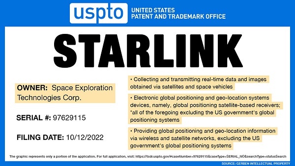
Gerben told Benzenga that the new satellite positioning services could be used in Musk’s Tesla TSLA 0.00%↑ vehicles. The real-time imagery, Gerben said, could be similar to what Google GOOG 0.00%↑ offers.
In the meantime, The Register reported, in a copyrighted story, that University of Texas researchers, once rebuffed by Musk’s SpaceX, were able to reverse-engineer Starlink’s satellite signal for use as a GPS alternative. UT Professor Todd Humphreys said that his team managed to reverse-engineer Starlink download signals to locate a receiver within 30 meters. He shared his team’s research in a non-peer-reviewed paper.
ESA Plans for Low-orbiting Navigation Satellites
In related space news, ESA’s Navigation Directorate said this week it is planning an in-orbit demonstration with new navigation satellites in low-Earth-orbit to supplement its existing 23 Galileo satellites.
ESA said the plan is to build “at least a half a dozen satellites to test capabilities and key technologies, as well as demonstrating signals and frequency bands for use by a follow-on operational constellation.”
Pointr Heads World’s Largest Indoor Mapping Deployment
One of the largest U.S. home improvement stores has partnered with geolocation company Pointr to provide digital mapping on their mobile app. The company said this is the largest indoor mapping deployment of its kind.
Pointr did not reveal the U.S. retail chain’s identity, but said the indoor mapping app will be available to customers at 2,000 stores and containing 280 million square feet of retail space for millions of shoppers. However, on its website, Pointr said it has worked with Home Depot HD 0.00%↑ and other retailers.
Boston-based Pointr said the deployment was made possible by AI mapping technology from MapScale. The company says that the AI retrieves existing maps of all stores in any format and converts them into interactive indoor maps, which is faster than manual conversion. The maps then can be updated and changed with cloud-based mapping tools.
The indoor mapping app allows customers to lookup the availability of products and find them inside the store and provides a 2D/3D interactive in-store map, the company said.
Overall, Pointr said that retailers are lagging in customer engagement levels as only 19 percent of the top 50 U.S. retailers have activated in-store maps. The company says the challenge for retailers is that it is time-consuming to manually create, and then update, digital maps for thousands of stores.
Contact: Marianne Slamich, Pointr, (978) 222-7929, marketing@pointr.tech, pointr.tech.
Trimble and GM Say More Than 34 Million Hands-free Miles Driven
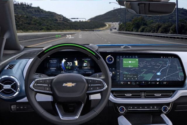
General Motors GM 0.00%↑ and Trimble TRMB 0.00%↑ announced that more than 34 million miles have been driven with Super Cruise engaged on vehicles. GM uses Trimble’s GPS technology to enable a vehicle to maintain its lane position in different weather, the company said.
Super Cruise has used Trimble’s Real-Time eXtended (RTX) technology to deliver GNSS corrections since 2017 on the model year 2018 Cadillac CT6. Trimble said that while standard GPS signals can have a margin of error up to 25 feet, its RTX technology removes GNSS errors in satellite data broadcasts for lane-level positioning.
"Trimble RTX has been in commercial use for more than 10 years and in 2018 was the first precise point positioning correction service to log miles in a commercial autonomous driving system. It works with Super Cruise to help a vehicle maintain its lane position,” said Patricia Boothe, Trimble’s senior vice president of autonomy, in a statement.
Standard GPS signals can have a margin of error up to 25 feet, which is not suitable for vehicles that require precise absolute position information to maintain lane-level positioning. Trimble's RTX technology removes errors in GNSS satellite data broadcasts to improve location accuracy on our roadways.
Contact: Trimble, autonomy.trimble.com.
News Without All the Nonsense.
Check out 1440 - the fastest way to an impartial point-of-view. The team at 1440 scours over 100+ sources so you don't have to. Culture, science, sports, politics, business and everything in between - in a five-minute read each morning, 100% free.
New Study Shows Need for Location Technology in Retail and Restaurants
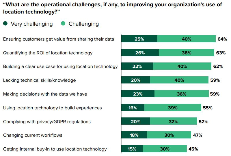
A new study by Radar and Forrester Consulting says that brick-and-mortar businesses face challenges that can be solved by location data and technology. The study, Deliver world-class customer experiences with location infrastructure,” surveyed 213 customer experience (CX) executives at regional and national retailers and restaurants.
Key findings include that location is essential for improving CX, which is a top priority over the next 12 months for retail executives.
The study also found that companies are transforming CX using location data to integrate digital and physical experiences. “Over the past two years, companies have changed the way they create customer experiences by implementing new technology and relying more on digital experiences,” the study said. “More specifically, they are focused on providing more location-aware experiences and integrating digital and physical experiences.”
However, the study also indicated that most companies aren’t using first-party location data and location technology enterprisewide. “Despite location data and ability of location technology to improve the customer experience, 59 percent of respondents agree that their companies need to invest more in location technology. Furthermore, only 19 percent of respondents report their companies use location technology enterprisewide,” the study said.
Get your company’s products and services in the 2022 Location Industry Yearbook!
Other Location News:
News tip? Send them to kdennehy@driverlessreport.com. Go to www.locationbusinessnews.com for more news and an archive of stories.
Top News:
🤔 Semtech, Sierra Wireless Get Second Requests From U.S. DOJ On Merger Deal. “In August, Semtech SMTC 0.00%↑ said it agreed to acquire Sierra Wireless SWIR 0.00%↑ for $31 per share in an all-cash deal, representing a total enterprise value of about $1.2 billion. The companies now said the issuance of the second requests extends the waiting period until 30 days after Semtech and Sierra Wireless have substantially complied with the [second requests].”
😮 Intel's Mobileye IPO Is Turning Into A Disaster. “Intel INTC 0.00%↑ management is aggressively pushing to realize the Mobileye IPO - despite a very unfavorable time and unappealing terms.”
🚀 Lockheed Martin To Build 57 Missiles With Radio Homing and Infrared Guidance. “The missile uses GPS and inertial gyro navigation to reach the vicinity of its targets. Once the missile reaches its target area, it listens for radio signals from enemy radar or communications to refine its targeting, and finally uses an imaging infrared sensor to pinpoint its target before impact.”
Maps:
☹ TikTok Parent ByteDance Planned To Use TikTok To Monitor The Physical Location Of Specific American Citizens. “The project, assigned to a Beijing-led team, would have involved accessing location data from some U.S. users’ devices without their knowledge or consent.”
🚗 The Feature That Makes Google Maps the Best Navigation App. “As everybody knows already, the satellite mode that Google GOOG 0.00%↑ offers provides access to high-resolution images that allow you to inspect any place on Earth from the comfort of your sofa. And you can imagine how useful this feature can be, especially when driving in a region you’ve never been to.”
🤷♂️ Google Maps Has a Big Electric Car Problem — Here's Why. “Electric cars can struggle over long distances, and it's about time Google took note.”
Policy:
🛰 We Are Dangerously Reliant on GPS To Tell the Time. “Whether intentional or not, unreliable signals are bad news all round. They can ground flights, as in Denver and Texas, disrupt emergency services and hit power networks.”
✈ Exclusive: FAA warns of aviation safety risks without U.S. mandate on 5G limits. “Airlines CEOs on Jan. 17 had warned of an impending "catastrophic" aviation crisis that could have grounded almost all traffic because of the 5G deployment.”
Connected and Autonomous Vehicles:
🚘 Tesla Cars Will Not Be Approved as Fully Self Driving This Year, Musk Says. “The Silicon Valley automaker sells a $15,000 software add-on called "Full Self-Driving" (FSD) which enables its vehicles to change lanes and park autonomously. That complements its standard "Autopilot" feature, which enables cars to steer, accelerate and brake within their lanes without driver intervention.”
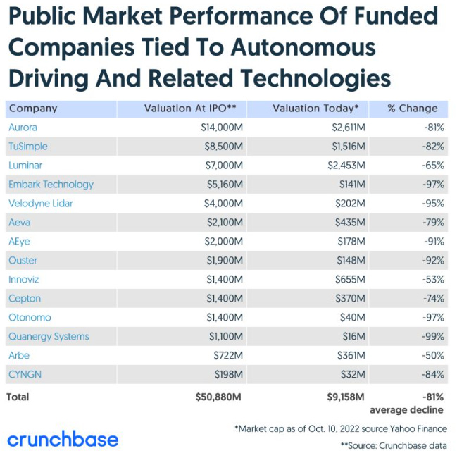
🤨 Self-driving Tech Startup Values crash 81 Percent in 2 Years. “Lidar companies lead the pack, with valuations plummeting up to 99 percent since IPO.”
🤔 What’s the deal with Google Android Automotive OS? “Big car maker Stellantis has cooled off on using Google’s operating system for new-generation infotainment.”
👍 Otonomo Gathers 4 Billion Connected Vehicle Data Points per Day.
☹ Some sad stats…
Financial:
✔ Inpixon Announces Pricing of $15 Million Registered Direct Offering Priced At-the-Market.

Location Industry Briefs
Send your news releases to kdennehy@driverlessreport.com. Go to www.locationbusinessnews.com for more news and an archive of stories.
AutonomouStuff Launches Honda CR-V By-wire Kit
Hexagon’s [HEXA B] Autonomy and Positioning division has announced that its AutonomouStuff unit is rolling out the Honda CR-V by-wire kit that aims to lower research and development barriers for autonomous development on mass-market vehicles. The by-wire kit features the latest PACMod from AutonomouStuff, which is a control module built internally and used as an interface between the computing system and vehicle, the company said.
The company said that PACMod has been used in autonomous vehicles since 2017 and has been continuously upgraded. The Honda CR-V by-wire kit is available for global R&D programs with both right-hand and left-hand versions, the company said.
Contact: Jessica Fielding, Hexagon-AutonomouStuff, (403) 919-3388, jessica.fielding@hexagon.com.
HERE Provides Navigation Services to Lotus ELETRE
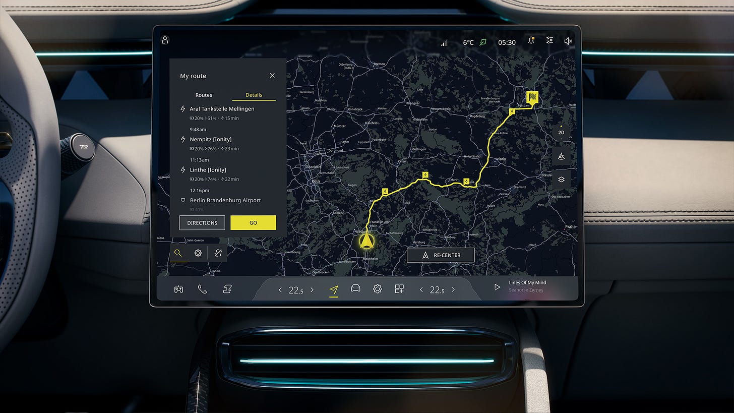
HERE Navigation is delivering integrated navigation services to the recently launched Lotus ELETRE. The electric SUV will feature HERE’s online and offline search, real-time traffic and turn-by-turn voice guidance. HERE Navigation runs on the ECARX digital cockpit head unit that was developed for Lotus ELETRE.
Lotus ELETRE will be the first European vehicle to offer EV Routing, Range Assistant and Predictive Routing with HERE Navigation, the company said. The SUV’s navigation features can be update over-the-air via HERE’s SDK.
Contact: Zara Barlas, HERE Technologies, 49 175 260 6210, zara.barlas@here.com.
New GNSS Time Module by u-blox
Thalwil, Switzerland-based u-blox [UBXN] has announced its dual-band GNSS timing module, NEO-F10T. The company said that with its nanosecond-level timing accuracy, NEO-F10T meets 5G timing requirements. First samples will be available in January 2023.
Other features include built-in security against malicious attacks, accurate timing with low-power consumption and compact form factor, the company said.
Contact: Natacha Seitz, u-blox, 41764360788, natacha.seitz@u-blox.com, www.u-blox.com.
VectorNav Becomes Exclusive GNSS/INS Provider for Indy Autonomous Challenge
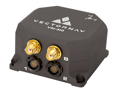
VectorNav Technologies has been chosen to be the exclusive supplier of GNSS/INS systems for the Indy Autonomous Challenge (IAC). VectorNav will supply IAC with its VN-310 Dual Antenna GNSS/INS with Real-Time Kinematic (RTK) positioning.
The company will integrate the receiver into the Dallara AV-21 racecars, enabling precision navigation and attitude estimation, the company said. VectorNav is providing each of the nine IAC teams with its VN-310 Dual Antenna GNSS/INS.
Contact: VectorNav, (512) 772-3615, sales@vectornav.com, www.vectornav.com.
Septentrio Launches GNSS Base Station
Septentrio has launched its AsteRx SB3 ProBase IP68-housed GNSS base station. The AsteRx SB3 ProBase complements the SB3 receiver family.
These receivers include the AsteRx SB3 Pro, rover receiver; AsteRx SB3 Pro+ rover and base receiver; and the AsteRx SB3 CLAS, for the Japanese market, the company said. AsteRx SB3 products are pin-to-pin compatible with Septentrio’s AsteRx SB ProDirect receiver, the company said.
Contact: Septentrio, septentrio.com.
InfiniDome Launches GPSdome2
Israel-based infiniDome has released its GPSdome2, which is designed for defending small to medium tactical UAVs as well as manned and unmanned ground vehicles. The system is compatible with almost any off-the-shelf GNSS receiver on the market, the company said.
GPSdome2 features dual frequency protection (GPS L1 + L2 or GPS L1 + GLONASS G1), creating up to 3 nulls, protecting from 3 jamming directions within each band in real time, the company said.
Contact: infiniDome, info@infinidome.com, www.infinidome.com.
Lytx Partners With Daimler Truck North America
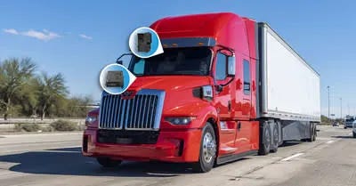
Lytx Inc. has partnered with Daimler Truck North America to integrate the company’s video telematics system and new camera solution into Freightliner and Western Star models.
Lytx will also provide a new feature for fleet managers called Parked-Highway/Ramp, which triggers when the Lytx DriveCam event recorder identifies a stopped vehicle When a Parked-Highway/Ramp event occurs, the fleet manager is notified so that they can quickly intervene by sending nearby safe parking locations via GPS directly to their driver, the company said.
Contact: Jason Andersen, Lytx, CorpComm@lytx.com, www.lytx.com.
FR8Focus Allows Real-Time Freight and Asset Tracking
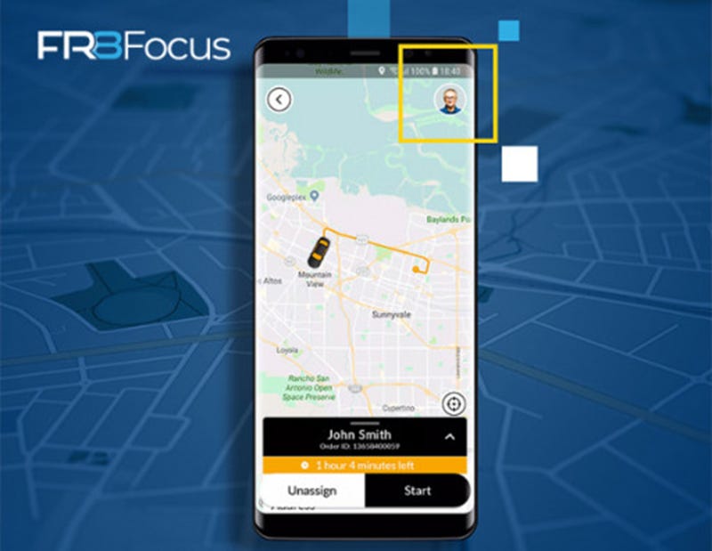
NorthStar Digital Solutions’ FR8Focus allows real-time digitization of freight and asset tracking for North American carriers. The product allows carriers to connect, mobilize, track and manage their fleets in real-time, the company said.
The company said it worked with a large LTL provider for two years, allowing it to create the product.
Contact: Joe Thull, Radaro, (612) 812-1280, Joe.Thull@radaro.com, https://radaro.com.au/en_us/fr8focus.
Topcon Features Location Products at Bauma 2022
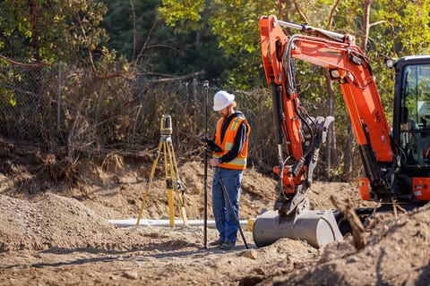
Topcon Positioning Systems plans to display its location products this week at Bauma 2022 in Munich. One product, the MC-Mobile will be displayed for mini-excavators. Through local positioning system (LPS) functionality, layout can be accomplished with the LN-150 tool for positioning information, a prism and tablet, the company said.
The company will also display its expanded GNSS network correction service, Topnet Live, which provides positioning for applications worldwide.
Contact: Staci Fitzgerald, Topcon Positioning Group, (925) 245-8610, CorpComm@topcon.com.
Hemisphere GNSS Launches GradeMetrix Scraper
Hemisphere GNSS has announced the release of the GradeMetrix Scraper Solution for pull pan and belly pan scrapers. GradeMetrix Scraper kits, which feature GNSS technology, will be available for purchase for new customers. Existing customers will have the option to add scraper support to their current GradeMetrix system via a software upgrade and machine activation, the company said.
Contact: Miles Ware, Hemisphere GNSS, (480) 348-6380, mware@hgnss.com, www.hgnss.com.
Trimble Donates $100,000 to World Food Program
Trimble TRMB 0.00%↑ has announced that will donate $100,000 to the World Food Program USA to support worldwide humanitarian crisis relief efforts.
World Food Program USA, the U.S. partner of the United Nations World Food Programme, mobilizes American policymakers, businesses and individuals to advance the global movement to end hunger, the company said.
Contact: Trimble, www.trimble.com/agriculture.
People
The National Academies of Sciences, Engineering, and Medicine announced that Victoria Sheehan will join the organization as the new executive director of the Transportation Research Board (TRB) on Dec. 5, 2022. Sheehan comes to the National Academies from the New Hampshire Department of Transportation (DOT), which she has led as its commissioner for the past seven years.
Autonomous Vehicle Industry Association has named Jeff Farrah as its first executive director. Farrah was general counsel of the National Venture Capital Association.
Rivian has hired former Waymo executive James Philbin to lead its autonomy and AI efforts. Philbin was director of software engineering at Waymo and worked at Amazon’s Zoox self-driving unit.
Topcon Positioning Systems has named Dave Bennett as director, corporate communications. Bennett held positions for 10 years at Topcon Positioning GB.
Jobs
Director Lean Product Portfolio Planning Positioning. u-blox.
Multiple Openings. Hexagon’s Autonomy & Positioning division.
Multiple Positions. Trimble.
Head of Technical Support EMEA. u-blox.
Customer Experience Specialist. Taoglas.
Click HERE to Join our growing Location Business News LinkedIn Group!


