Supply Chain Woes Haunt TomTom in Quarter Loss
Company believes supply chain shortages will continue to 2023

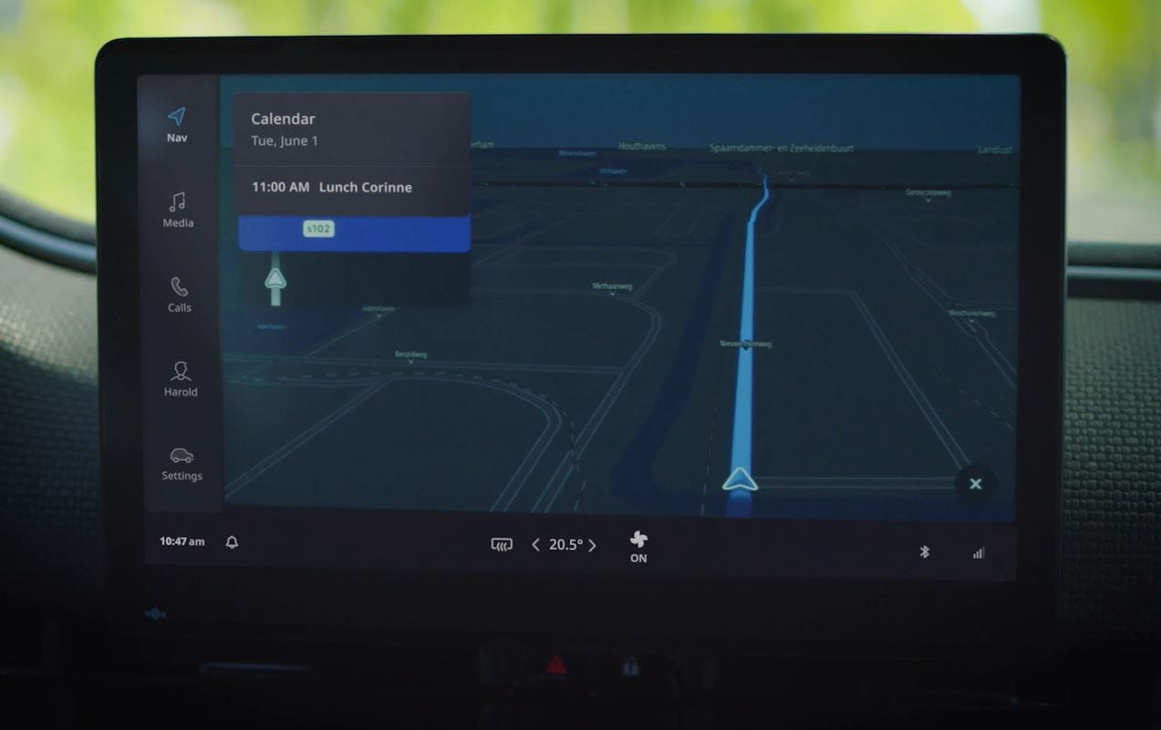
Citing continuing supply chain shortages, digital mapping company TomTom [TOM2] last week reported a larger-than-expected quarterly loss. For the fourth quarter, the company reported a loss of around $44.4 million, which was larger than most analysts had forecast.
For 2021, the revenue was 506.9 million euros. Location technology accounted for 112.9 million euros, down from 136 million euros in 2020.
“We look back on 2021 with mixed feelings. The global semiconductor shortages and other supply chain issues caused delays in car production that resonated throughout the entire industry,” said Harold Goddijn, TomTom CEO, at an earnings call.
However, Goddijn said that the company had its best order intake in years, which contributed to a 1.9 billion-euro backlog. “Included in that backlog is the partnership with Volkswagen. We will launch an EV-centric navigation service for the VW brands,” he said.
Overall, TomTom said that supply chain shortages will continue through 2023.
"Our [automotive] operational revenue was in line with expectations, however, reported revenue was negatively impacted by total contract value adjustments. Consequently, our [location technology] revenue ended just below our guidance for 2021,” said Taco Titulaer, TomTom CFO.
Titulaer said that while he sees location technology revenue to remain flat in 2022, most of the company’s earnings will come from the current automotive backlog.
TomTom Releases 11th Traffic Index
In other company news, TomTom released the 11th edition of its annual TomTom Traffic Index, which details traffic trends in 404 cities in 58 countries in 2021. The company said that 2021 was still “strongly influenced by the effects of the health crisis.”
The company said that in 2021 traffic was lower than 2019, which the company used as a baseline of pre-COVID times. Overall, worldwide congestion was 10 percent lower in 2021 vs. 2019, with a decrease of 19 percent specifically at peak hours, the company said.
Moody’s Says Solera’s Acquisition of Spireon Totals $737.5 Million
Moody's Investors Service says Polaris Newco's (dba Solera) financial ratings are unchanged following a recently announced acquisition of Spireon for an estimated $737.5 million. Last week, Location Business News reported that the financial details of the transition were not disclosed.
“Proceeds from [an] incremental term loan, together with about $338 million of equity and $100 million of revolver draw will be used to fund the acquisition of Spireon Holdings, Inc. in a transaction totaling $737.5 million,” according to Moody’s.
Moody’s says the proposed acquisition “will enhance Polaris' existing service offering into the field of GPS based tracking solutions to commercial fleet operators, franchise dealerships and independent dealers.”
Moody’s says company's “proprietary databases create barriers to entry, especially in less penetrated markets outside of the U.S. where Polaris is a leading provider.”
Conferences Combine For Geo Week
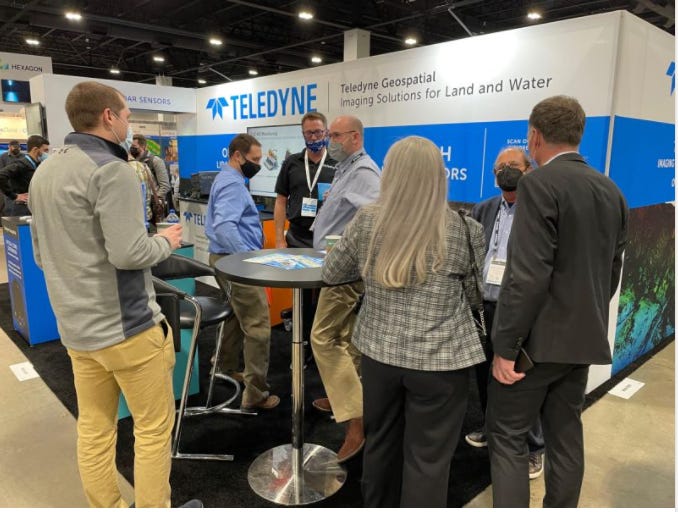
DENVER—The worldwide pandemic has significantly reduced the size of trade shows—if not cancelled many of them all together. However, Geo Week has found success this year by combining several conferences into one large trade show.
AEC Next Technology Expo & Conference, International Lidar Mapping Forum, and SPAR 3D Expo & Conference were combined into one trade show. The result was a sold out show floor with 140 exhibitors, include industry biggies Hexagon, Trimble [TRMB] and others, at the Colorado Convention Center here.
In addition, conference organizers partnered with ASPRS (American Society for Photogrammetry and Remote Sensing), MAPPS and USIBD (US Institute of Building Documentation) to increase attendance.
Some product rollouts were made at Geo Week, including three at the “Pitch the Press” event. NavVis demonstrated its wearable mobile mapping system, NavVis VLX. The NavVis VLX is a mobile mapping system designed for reality capture in AEC, which the company said is 10 times faster than a terrestrial laser scanner.
ProStar GeoCorp’s mapping solution, PointMan, allows users to connect their mobile device (Android/IOS) with major GPS/GNSS, cable, & pipe locating equipment manufacturers to capture infrastructure data.
Phase One has announced its iX Suite software package for aerial mapping project management at the Denver Geo Week. Compatible Phase One PAS airborne systems, iX Suite handles mission planning, flight management, data acquisition, image selection and processing and in a common workflow, the company said.
In other Geo Week news:
Phase One announced its iX Suite software package for aerial mapping project management. Compatible Phase One PAS airborne systems, iX Suite handles mission planning, flight management, data acquisition, image selection and processing and in a common workflow, the company said.
Toyota Research Institute Conducts Autonomous Drift Test
Toyota Research Institute (TRI) recently demonstrated programming a vehicle to autonomously drift around obstacles on a closed track. TRI's Nonlinear Model Predictive Control (NMPC), which extends the vehicle's operational domain, enables controlled, autonomous drifting to avoid accidents by navigating sudden obstacles or hazardous road conditions like black ice, the company said.
The above video shows that the test was conducted using a Toyota Supra that has been customized for autonomous driving research. The vehicle is equipped with computer-controlled steering, throttle, clutch displacement, sequential transmission and individual wheel braking, the company said. “Vehicle state information is obtained from a dual-antenna RTK-GNSS-aided INS system at a rate of 250Hz, and the NMPC controller runs on an x86 computer,” the company said in a statement.
Last year, TRI and the Dynamic Design Lab at Stanford University partnered to conduct safety testing to help avoid crashes and prevent injuries and fatalities, the company said. Automotive performance specialist GReddy and drift expert driver Ken Gushi also assisted.
Contact: Wendy Rosen, Toyota Research Institute, Wendy.Rosen@tri.global, http://tri.global.
Super Bowl Teams Feature Company’s Tracking Solution
Both teams in this year’s NFL Super Bowl are Boston-based Catapult [CAT] clients— who use its Catapult Vector to measure player performance. The Los Angeles Rams and the Cincinnati Bengals use the Catapult Vector, a wearable product that provides teams with performance data.
Catapult Vector uses GPS and LPS tracking technology, heart-rate monitoring, and inertial sensors. Catapult Vector allows NFL teams to leverage the company’s position-specific algorithms for quarterbacks and linemen to understand football positional demands, the company said. The data can be combined with Catapult’s video analysis product that teams use to make “coaching decisions, avoid injuries, and return injured athletes to play faster.”
Catapult, which has been a partner to the NFL since 1996, said this is the first year that Catapult has been working with all of the league’s 32 teams. Nearly half of the league’s teams are multi-solution customers, using both performance data and video analysis, the company said.
Catapult has most NCAA Football Bowl Subdivision (FBS) college teams as clients, including all four teams in this year’s College Football Playoffs.
Contact: Blair Hammond, Catapult Sports, Blair.hammond@catapultsports.com, www.catapultsports.com.
Other Location News:
News tip? Send them to kdennehy@driverlessreport.com. Go to www.locationbusinessnews.com for more news and an archive of stories.
😒 China's Beidou and Russian Glonass Sign New Deal to Rival America's GPS Satellite Navigation. “Latest satellite navigation systems deal among 16 signed as Vladimir Putin met Xi Jinping in Beijing.”
✔ A free, 216-page marketing guide, “EUSPA EO and GNSS Market Report,” authored by the European Union Agency for the Space Program (EUSPA), outlines current Earth Observation and GNSS markets.
🤞 Velodyne Issues Warrant for 39.6 Mln Shares to Amazon Subsidiary. “Velodyne had lost about 80 percent in value in 2021 amid internal conflict with management as well as the resignation of its former chief executive Anand Gopalan in July.”
😉 Google Maps Review Moderation Detailed as Yelp Reports Thousands of Violations. “Google explains how it keeps user-created reviews on Google Maps free of fraud and abuse in a new blog post and accompanying video.”
🛩 Dronetag Mini Add-on Device Offers Remote ID Compliance for Older Drones. “Dronetag’s Mini receives the drone’s coordinates from GPS, GLONASS, Galileo, and EGNOS satellites. It then sends the craft’s position, along with its identification data, in real time via mobile network to the central control system operated by aviation authorities.”
😲 Video above shows Taylor Ogan’s test of a Tesla Full Self-Driving Beta that is all over the Internet. Ogan, CEO of Boston-based hedge fund, is a Tesla Model Y owner.
😕 'Pay-As-You-Go' Car Tax Via GPS Tracking Recommended By Government Committee. “With the adoption of electric vehicles on the rise and plans to ban the sale of new combustion cars by 2030 the [UK] Treasury is facing a 35-billion-pound black hole in lost fuel duty and vehicle tax.”
👍 INRIX released a report that examined the pandemic’s impact on brick-and-mortar retail across the United States. “Using INRIX Location Analytics and INRIX Trip Data, it found that while in-person visits to retail locations had declined as a result of COVID-19, they were on an upward trajectory toward recovery.”
🧨Beidou and eLoran: China is Besting the U.S. in Navigation Warfare. “Beidou, China’s answer to GPS, has many features to serve both military and civilian users that are not found in the American system.”
🚘 Musk Looks Increasingly Isolated as Automakers Embrace Lidar. “Usage of the technology is spreading, with 17 automakers planning to produce lidar-equipped car models.”
🚆Ex-SpaceX Engineers Create Self-Driving Trains To Aid Trucker Shortage. “The company has raised $49.55 million in funding to develop its swarm of miniature trains.”
Advertisement
Have you ever been reluctant to reveal your personal email address online or in person?
The answer is almost universally YES! So, if you happen to be one of those who thinks twice about these matters, ManyMe might be the answer to your worries.
Advertisement
Location Business News has gone from zero to nearly 24,000 subscribers in a little more than 12 months. If you would like to gain more exposure for your products, services, or webinars/events, contact us at info@driverlessreport.com. We also have nearly 30,000 LinkedIn, Twitter and other social media followers. Our recent email open rates have been some of the industry’s best at 75-80 percent.
Location Industry Briefs
Send your news releases to kdennehy@driverlessreport.com. Go to www.locationbusinessnews.com for more news and an archive of stories.
Thales Alenia Space Awarded Contract For DFMC SBAS Prototype
Thales Alenia Space has announced that it has been awarded a French Space Agency CNES contract to develop a DFMC (Dual Frequency Multi Constellations) SBAS prototype. The prototype will be similar to such next generation SBAS as EGNOS, the European navigation satellite system.
This prototype will complement both GPS and Galileo in that the signals will be transmitted in multiple frequencies for better performances—particularly for aviation navigation and landing, the company said.
The company said that the prototype will be deployed and tested in an operational mode using a geostationary satellite. “The performances will be analyzed in details according to international standard criteria as accuracy, availability, continuity and service integrity,” the company said.
“When deployed, it would be the first time in history of European satellite navigation system that a DFMC SBAS signal-in-space is emitted over Europe & Africa and we are proud to enable it,” said Benoit Broudy, Thales Alenia Space vice president, in a statement.
Contact: Sandrine Bielecki, Thales Alenia Space, 33 (0)4 92 92 70 94, sandrine.bielecki@thalesaleniaspace.com, www.thalesaleniaspace.com.
NextNav and CRG to Build Indoor Maps
NextNav [NN] has partnered with Critical Response Group (CRG) to build indoor maps with embedded vertical location data. CRG will leverage NextNav Pinnacle to add to its mapping capabilities for thousands of building owners and public safety agencies nationwide, the company said.
CRG’s mapping data combines a gridded overlay, high resolution imagery, and floor plans together into one map. This provides customers and public agencies with the situational awareness needed to improve emergency response coordination, the company said.
Contact: Mahmood Abu-Rubieh, for NextNav, nextnav@launchsquad.com.
Skydio Wins $20.2 Million U.S. Army Contract
Redwood City, Calif.-based Skydio has won a $20.2 million contract from the U.S. Army for the company’s Skydio X2D and Skydio Autonomy for its Short Range Reconnaissance (SRR) Program of Record. The Firm-Fixed-Price Five Year Production Other Transaction (OT) agreement will be worth up to $99.8 million over the period of performance, the company said.
SRR program equips soldiers with a small UAS solution to conduct Reconnaissance and Surveillance (R&S) activities. The Army chose Skydio after evaluating 30 small UAS SRR vendors, the company said.
X2D features dual color optical thermal sensors, and is equipped with GPS-based night flight and strobe lighting, making it ready for both day and night operations, while providing up to 35 minutes of flight time on a single battery, the company said.
Contact: Kate Sheehy, Skydio, press@skydio.com, www.skydio.com.
Garmin Rolls Out inReach Mini 2
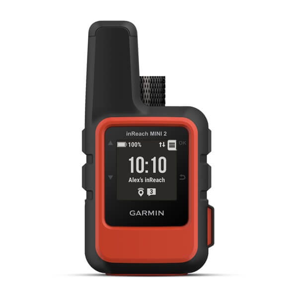
Garmin International [GRMN] has announced its inReach Mini 2 satellite communication device with two-way texting and SOS capabilities. The lightweight inReach Mini 2, with 30 days of battery life, integrates location and situational awareness features such as TracBack navigation and Garmin Explore Mobile app compatibility.
In addition to GPS, inReach Mini 2 also leverages GALILEO, QZSS and Beidou satellite networks for faster initial satellite acquisition time and more coverage in challenging environments than GPS alone, the company said. Suggested retail price is $399.99, with an $11.95 active satellite subscription plan.
Contact: Rehan Nana, Garmin, (913) 397-8200, media.relations@garmin.com.
Parkopedia Partners With Passport for US Parking Payments
Parkopedia has partnered with Passport to offer parking payments via its integrated in-car payment platform across Passport’s 5,000 locations in the United States. Passport’s payment API integrates with Parkopedia’s payment platform.
Contact: Adam Calland, Parkopedia, 44(0)7838219129, adam.calland@parkopedia.com, www.business.parkopedia.com.
Honeywell Smart Drone Radar Avoids Collisions
A drone piloted by the Honeywell [HON] IntuVue RDR-84K radar system has successfulling swerved around intruder aircraft in a series of tests, the company said. The tests, recently conducted in the Phoenix area, the tests showed that the radar can take over navigation and pilot an aircraft to safety using its onboard processor.
The RDR-84K has proven its ability to detect “noncooperating traffic” during testing while mounted on helicopters and drones. In addition to detecting traffic, the RDR-84K can map terrain and provide alternate navigation in the case of GPS failure, the company said.
Contact: Adam Kress, Honeywell, (602) 760-6252, Adam.Kress@Honeywell.com, www.honeywell.com.
Trucker Tools Adds Simple Truck to Shipment Tracking Platform
Trucker Tools has announced an agreement with Simple Truck that will enable access to real-time truck location data from Simple Truck ELD units. The location data will be within the Trucker Tools Smart Capacity carrier and capacity management platform. Simple Truck has more than 4,000 of its devices installed and operating with independent owner operators and small truckload fleets, the company said
Trucker Tools has nearly 190,000 small-fleet truckload operators active on its carrier engagement platform, with more than 90 percent of those running 10 trucks or less, as well as single-truck owner-operators, the company said.
Contact: Gary Frantz, Trucker Tools, (925) 594-1434, gary@gnfcomms.com.
Aeva Introduces Aeries II 4D Lidar
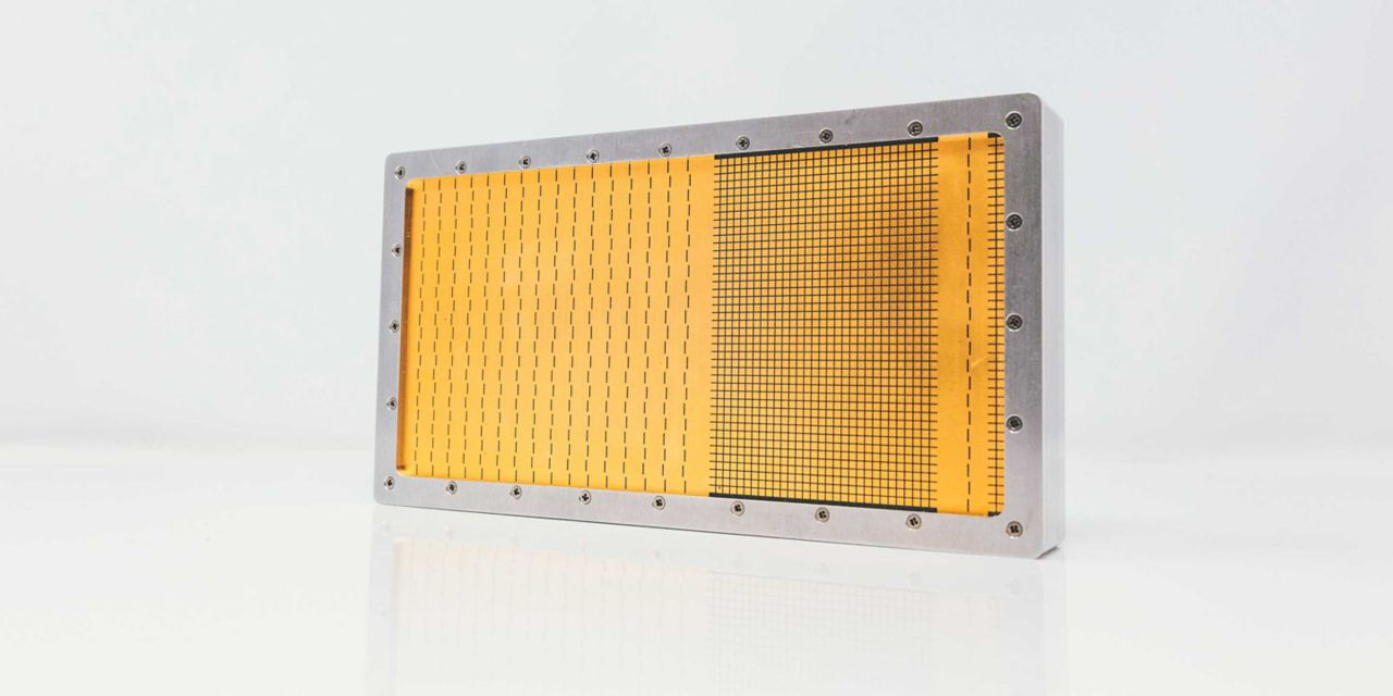
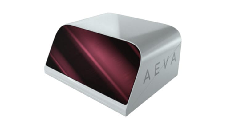
Aeva [AEVA] rolled out Aeries II, a 4D Lidar sensor for automotive, industrial and other applications. The sensor leverages Aeva’s Frequency Modulated Continuous Wave (FMCW) technology and the first Lidar-on-chip module design, the company said.
The company said the unit’s 4D localization precludes the need for such additional sensors as IMU or GPS, making autonomous navigation in GPS-denied and featureless environments like tunnels possible.
Contact: Michael Oldenburg, Aeva, press@aeva.ai, www.aeva.com/aeries-ii.
Essence Group Products Featured in Qualcomm Accelerator
Essence Group has joined the Qualcomm [QCOM] Smart Cities Accelerator Program to offer its security and safety products for workers, buildings, and assets. Products include the Umbrella wearable Personal Safety Panic devices, winner of the Twice Picks award for innovation at CES 2022, includes GPS and Wi-Fi to enable dispatch operators the ability to locate the device both indoors and outdoors on demand, the company said.
Contact: Essence Group, info@essence-grp.com, www.essence-grp.com.
Teledyne Sells Lidar to Dewberry
Teledyne Geospatial has announced the sale of its bathymetric lidar CZMIL SuperNova to professional services firm Dewberry in support of state and federal coastal zone mapping programs, surveying of wetlands, lacustrine and riverine systems, submerged habitat detection and offshore mapping for renewable energy governance.
The CZMIL SuperNova’s ability to deliver Quality Level 1 (QL1) data from altitudes greater than 1,200 feet and its Secchi depth penetration range (down to 70 meters in optimal conditions) will allow Dewberry to deliver the quality data required for their projects, the company said.
Contact: Jennifer Parham, Teledyne Geospatial, Jennifer.Parham@teledyne.com.
Ember Cube Features GPS Location Information
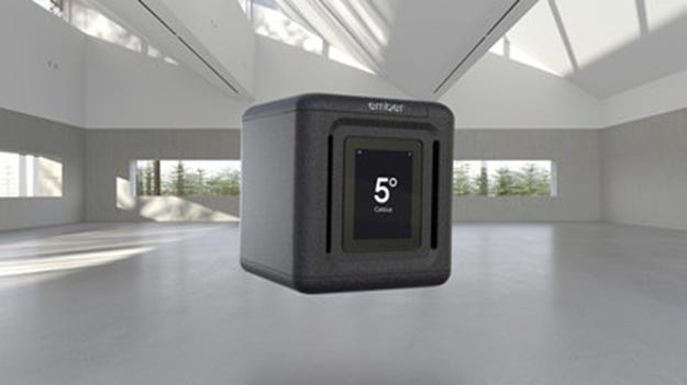
Ember Technologies and Cardinal Health [CAH] have partnered to offer a self-refrigerated, cloud-based shipping box called the Ember Cube. The product features cloud-based temperature reporting, GPS location tracking, and return-to-sender technology.
Ember Cube uses an onboard cellular radio to report real-time temperature and humidity tracking and GPS location information that can be viewed via the company’s cloud-based dashboard, the company said. One application, for healthcare providers, allows the user to take advantage of the unit’s built-in cellular radio to communicate with a shipping service to schedule a pick-up, automatically providing its current GPS location.
Contact: Kristi Collura, Ember, kristi.collura@ember.com.
People
Swift Navigation has named John Kalkman Executive Vice President. Kalman worked at Microsoft [MSFT] for 20 years, most recently as VP and GM of global customer success. He also held leadership positions at Samsung and has been an advisor to Swift Navigation for two years.
Pointr has announced that Patrick Murphy was named Senior Partnerships Manager. Murphy brings more than 6 years of experience in strategy and partnerships in the SaaS business.
Nearmap has named Penny Diamantakiou as Chief Financial Officer. Diamantakiou
has the NSW Telstra Women's Business Award, was an ambassador for the Executive Women Australia Networking organization, and is a graduate of the Australian Institute of Company Directors.
Lytx has appointed Wayne Hewett to its board of directors. Hewett currently serves as a board member of United Parcel Service Inc., Wells Fargo & Co., and The Home Depot Inc., and is chairman of Cambrex Corp.
Jobs
Product Managers. u-blox.
Privacy and Compliance Counsel. TomTom.
Customer Engagement Team. Mapbox.
Sr Legal Counsel - Oceania. HERE Technologies.
Product Marketing. NextNav.
Senior Technical Product Manager – Vertical Location Services. NextNav.
Corporate Legal Counsel. Taoglas.
Channel Sales Manager. Pix4D.
Program Manager. Sheeva.AI.
Customer Success Manager. Inpixion.
Get your company’s products and services in the 2022 Location Industry Yearbook!


