Trimble and Qualcomm Introduce Meter-Level Accuracy for Smartphones
Partnership Builds on 2019 Automotive Agreement

More Android smartphones will benefit from location through Trimble [TRMB] and Qualcomm Technologies’ [QCOM] announcement this week that they are integrating Trimble RTX GNSS technology into Snapdragon 8 Gen 1 and Snapdragon 888 Mobile Platforms.
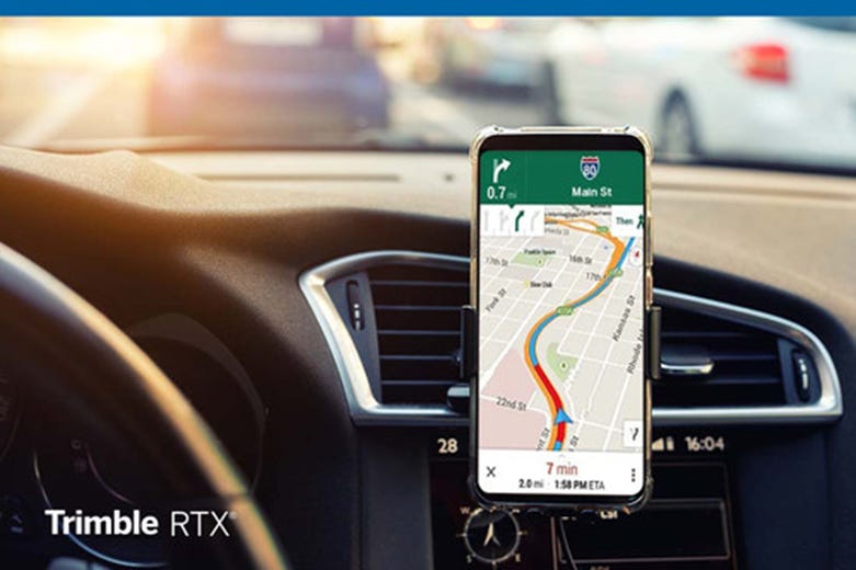
Integrating the Trimble RTX technology with Snapdragon Mobile Platforms enables smartphone manufacturers, service providers and application developers to provide mobile users with meter-level accuracy, which is 5 times better than location services available today, the company said. Another way Android smartphone users may benefit is enhanced location-based car navigation with lane-level guidance.
The announcement builds on a 2019 partnership that Qualcomm and Trimble entered into for road-level navigation and emergency services applications, as well as developing Advanced Driver-Assistance Systems (ADAS) and autonomous driving solutions for OEMs and Tier 1 suppliers.
However, the integration of location into smartphones was not in the works at the time of the automotive partnership, said John Sprivulis, Trimble Advanced Positioning’s director of business development for wireless and mobility.
Sprivulis said that some of the initial applications that would benefit from higher accuracy may include mapping and driving. “Another possible benefit for Android phone users is to have better situational awareness about user’s immediate surroundings and other objects around it—bicycles, cars, other phone users etc.—to enable richer experience and collaboration,” he said.
Better location could mean that a ridesharing app could precisely display a more accurate pick-up location. In addition, lane-level accuracy could enable drivers to get better map detail and directions when using real-time navigation apps, the company said.
The Trimble RTX technology in Snapdragon 8 and Snapdragon 888 Mobile Platforms is expected to be available in the second quarter of 2022.
Google Launches Last Mile Fleet Solution and Fleet Routing API
Hoping to help fleet operators optimize delivery operations, Google announced the launch of Last Mile Fleet Solution from its Google Maps Platform. The company also launched its Cloud Fleet Routing API from Google Cloud.
Google said that the pandemic’s challenges accelerated ecommerce adoption and strained supply chains—at the same time increasing consumer delivery speed expectations. The company said that the two new products help fleet operators through such features as mapping, routing, in-app routing through Google Maps, and analytics capabilities.
Based on the extensive use of Google Maps by commercial telematics solution providers, new Google solutions for optimizing delivery times should be well received, said Clem Driscoll, founder and president of C.J. Driscoll & Associates.
“Through Google Prime and other services, consumers and businesses are increasingly relying on fast delivery of products. Predictability of delivery times during the day is a logical extension of this, and product suppliers are anxious to offer this capability to their customers,” Driscoll said. “Google Prime has shown the logistics industry that consumers will pay a premium for timely delivery of packages. While the impediments are different, service providers are also seeking affordable solutions that will enable them to provide their customers with tighter estimates on the arrival times of technicians and other service personnel.”
Google said that the Cloud Fleet Routing API focuses on route planning to allow operators to determine the number of packages going into delivery vans and optimize tasks. The Last Mile Fleet Solution, which builds on the On-demand Rides & Deliveries mobility solution from Google Maps Platform, allows operators to focus on the delivery itself, the company said. The company said that last mile delivery can be more than half of total shipping costs.
Last Mile Fleet Solution is currently ready for fleet operators, while Cloud Fleet Routing API will be “generally available” in the second quarter.
Olo and Radar Partner for Trip Tracking Functionality
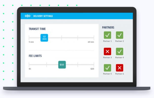
On-demand restaurant commerce platform Olo [OLO] has partnered with Radar to integrate its geofencing technology. The geofencing technology will enable trip tracking functionality for restaurant brands’ digital order fulfillment processes and consumers.
When a customer places a pickup order through an app powered by Olo, and assuming the customer has opted into location permissions, Radar can track the customer's ETA to the restaurant, said Nick Patrick, Radar co-founder and CEO.
“When the customer is approaching—for example, 5 minutes away from the restaurant—Radar can notify Olo, which in turn can notify the restaurant to start preparing the order,” he said. “Together with Olo's order management capabilities, Radar's industry-leading location tracking accuracy means short wait times and seamless pickup experiences for customers."
The trip tracking capabilities minimize wait times, maximize operations of the kitchen and staff, and ensure consumers get their food as fresh as possible, the company said. “Partnering with Olo allows us to extend our reach to improve the off-premise experience for more guests at some of the largest QSR brands in the space,” Patrick said.
Current customers include CKE Restaurants, parent company of Carl’s Jr. and Hardee’s restaurants.
Olo, which has more than 200 technology partners, says more than 500 restaurant brands use its platform with millions of restaurant orders per day. Radar, founded in 2016, is backed by such venture capital firms as Insight Partners, Accel, Two Sigma Ventures, Heavybit, Prime Set and Bedrock Capital.
Contact: Olo, olo@icrinc.com, www.olo.com; Radar, radar@launchsquad.com, www.radar.com.
Other Location News:
News tip? Send them to kdennehy@driverlessreport.com. Go to www.locationbusinessnews.com for more news and an archive of stories.
🙂 Nvidia Launches Drive Map for Autonomous Vehicles. “The new mapping platform will have coverage of more than 300,000 miles of roads in North America, Europe and Asia by 2024.”
👍 T-Mobile Teams up With BMW for the First 5G-connected Cars in the US. “According to T-Mobile, you’ll be able to connect up to 10 devices at a time to your car at a time.”
🌅 Qualcomm Technologies Inventor Stephen Edge on the Development of Location Services. “Location technologies are ubiquitous today, although they might not have been without Qualcomm Technologies’ Principal Engineer, Stephen Edge.”
😮 DJI Has the Power to Control Where Drones Can Fly. Ukraine Wants Them to Use It. “Geofencing and drone detection technologies developed in peacetime in part to comply with regulations allow the company to create no fly zones. Should DJI use them in Ukraine?”
🚇 China's First Subway Beidou Satellite Navigation System Starts Construction in Beijing. “They use BeiDou system in outdoor spaces, while deploying indoor positioning base stations using 5G to achieve indoor positioning signals, thus users can achieve high-precision positioning via signals.”
🚲 Audi joins Spoke Safety, Qualcomm, Commsignia to help protect bicyclists through connected technology. “Using C-V2X technology, the companies are working together by conducting C-V2X demonstrations with particular bicycle to vehicle use cases to explore solutions to make Audi vehicles aware of bicyclists and other VRUs, as well as create safety alerts that can help prevent incidents among all road users.”
✔ What 5G Location Services Improvements Are in Release 17? “In Rel-17, NR positioning is further improved for specific use cases such as factory automation by targeting 20-30cm location accuracy for certain deployments. Rel-17 also introduces further enhancements to latency reduction to enable positioning in time-critical use cases such as remote-control applications,” Ericsson said.
🤞 IoT Remains a Wild West at MWC 2022. “Companies specialising in geolocation for IoT were another clique that turned out in force at MWC. Some of those present and working in the space were technology ‘household’ names, such as Polte and chipset vendor Qualcomm; others, like Nestwave, are receiving growing recognition, while still others were would-be disruptors, such as Loctio or Deeyook.”
🛩 Verizon Selects Oregon Site for Its Drone and Robotics Test Facility. “Verizon Robotics made the announcement Tuesday, saying it will focus its advanced air research, drone partnerships, and long-range robotics development and testing work at Pendleton Range.
😦 The EU Is Regulating Data Shared Between Connected Cars, and Why That's a Good Thing. “It’s a lot of data, and an intense battle over it is developing. Carmakers and a collection of insurers, leasing companies and vehicle repair companies are at odds over who should have access to the data generated by drivers and their vehicles, as Nick Carey writes for Reuters.”
Advertisement
Have you ever been reluctant to reveal your personal email address online or in person?
The answer is almost universally YES! So, if you happen to be one of those who thinks twice about these matters, ManyMe might be the answer to your worries.
Advertisement
Location Business News has gone from zero to nearly 24,000 subscribers in a little more than 12 months. If you would like to gain more exposure for your products, services, or webinars/events, contact us at info@driverlessreport.com. We also have nearly 41,000 LinkedIn, Twitter and other social media followers.
Location Industry Briefs
Send your news releases to kdennehy@driverlessreport.com. Go to www.locationbusinessnews.com for more news and an archive of stories.
Amazon Location Service Adds Two HERE Maps
Amazon Location Service this week added two new HERE Technologies map styles for developers, HERE Explore and HERE Explore Truck. With HERE Explore, developers have a new global map that features roads, buildings, landmarks, and water features, including a fully designed map of Japan, the company said.
With HERE Explore Truck, developers can display a global map containing truck restrictions and attributes e.g., width, height, HAZMAT, symbolized with highlighted segments and icons, the company said.
Amazon Location Service allows developers to add maps, points of interest, geocoding, routing, tracking, and geofencing to their applications, the company said. Amazon Location Service is available in the following AWS Regions: US East (N. Virginia), US East (Ohio), US West (Oregon), Europe (Frankfurt), Europe (Ireland), Europe (Stockholm), Asia Pacific (Singapore), Asia Pacific (Sydney) Region, and Asia Pacific (Tokyo).
U-blox Module Gets KDDI Certification in Japan
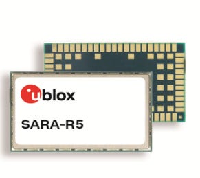
Thalwil, Switzerland-based u-blox [UBXN] has announced the certification of its SARA-R5 module on KDDI’s LTE-M networks. The module is the first product based on UBX-R5, u‑blox’s low-power wide-area (LPWA) chipset, to achieve operator certification in Japan, the company said.
The SARA-R5 series is 5G-ready and marketed for such LPWA IoT applications as industrial automation, sensor applications, connected health, metering, asset and vehicle tracking, as well as telematics, the company said.
Contact: Natacha Seitz, u-blox, 41 76 436 0788, natacha.seitz@u-blox.com, www.u‑blox.com.
BlueIOT to Install RTLS in Indonesian Hospital
Real-time location systems provider BlueIOT Technology Co. has announced that it is ready to deploy an RTLS in an Indonesian hospital with more than 8,000 square meters this spring.
The Beijing-based company, which uses Bluetooth Angle-of-Arrival (AoA) technology, says its location system provides accuracy down to 0.1 meter. The company said that the hospital, after product installation, will be able to streamline workflows and provide data analysis for medical research.
Contact: BlueIOT, global@blueiot.com, www.blueiot.com.
Mapbox Named GM Supplier of the Year
Mapbox was recently recognized as a General Motors Supplier of the Year in a ceremony in Phoenix. The company offers ready-to-use and customizable navigation experiences.
Recipients of the Supplier of the Year recognition included 134 suppliers representing 16 countries. The Supplier of the Year award recognizes distinguished global suppliers that exceed GM’s requirements, in turn providing GM customers with innovative technologies and among the highest quality in the automotive industry, the company said.
Contact: Kristen Ackerman, GM, (248) 308-8187, kristen.ackerman@gm.com.
FarmGO Uses Quectel Modules and Antennas
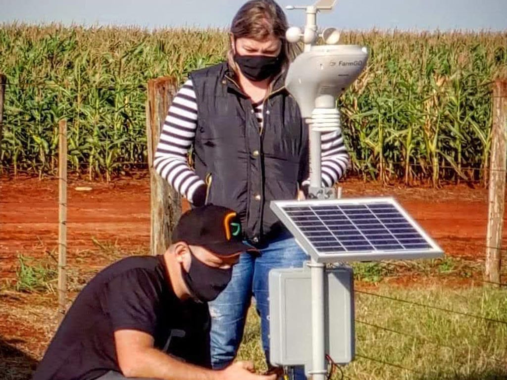
Brazil-based FarmGO is using IoT modules and antennas from Quectel Wireless Solutions for their smart agriculture platform to help farmers optimize activities. FarmGO features crop health monitoring, pest and disease monitoring, identification of anomalies, field inspection records, importation of planting and harvesting maps and importation of soil fertility data, the company said.
FarmGO is using the Quectel L76-L and EC21 modules as well as the Quectel YEMN001AA antenna. The Quectel L76-L GNSS module supports concurrent reception of GPS, GLONASS (or BeiDou), Galileo and QZSS.
Contact: Quectel, www.quectel.com.
Swift Navigation Opens Office in Japan
Swift Navigation has opened an office in the Minato ward of Tokyo, Japan. The new location, close to Shinagawa Station and within walking distance to Tokyo University of Marine Science and Technology, extends Swift’s international expansion—having opened its Australia office in 2019, the company said. “We look forward to continuing to build our local team in Tokyo to support Swift’s operations and bring the benefits of precise positioning to Japanese customers,” said Yoshitaka Asanuma, Swift Navigation’s managing director, Japan.
Contact: Swift Navigation, press@swiftnav.com, www.swiftnav.com/jp.
Quanergy Offering Lidar, Other Solutions for Material Handling Market
Quanergy Systems Inc. [QNGY] will display its Lidar sensors and smart 3D solutions at Modex22 in Atlanta next week to highlight the adoption of automation in the material handling market. Quanergy’s industrial IoT products include a new version of M1 Edge, as well as M8 Prime, MQ-8 and QORTEX DTC, the company said.
Lidar sensor M1 Edge features detection and collision avoidance, along with digital I/O for stand-alone operations. M1 Edge allows navigation both indoors and outdoors using natural features and/or retro reflective tags.
Contact: Neal Stein, Quanergy, Media@quanergy.com, www.quanergy.com.
Sewio Introduces New RTLS With Backchannel Feature
Czech Republic-based Sewio rolled out its RTLS version 2.6 that introduces a backchannel feature, which enables two-directional communication with tags. The headline feature, backchannel, allows two-way communication between the RTLS Studio and the tag via UWB signals, the company said.
A common way to leverage this feature, to save time and frustration, is by triggering a specific tag to flash its LED and guide a worker to the exact asset, the company said. This time-saving feature means that workers can go directly to the precise location of an asset rather than simply the general vicinity where it is stored with identical inventory, the company said.
Contact: Sewio, www.sewio.net.
WiSilica Chooses Nordic Gateway
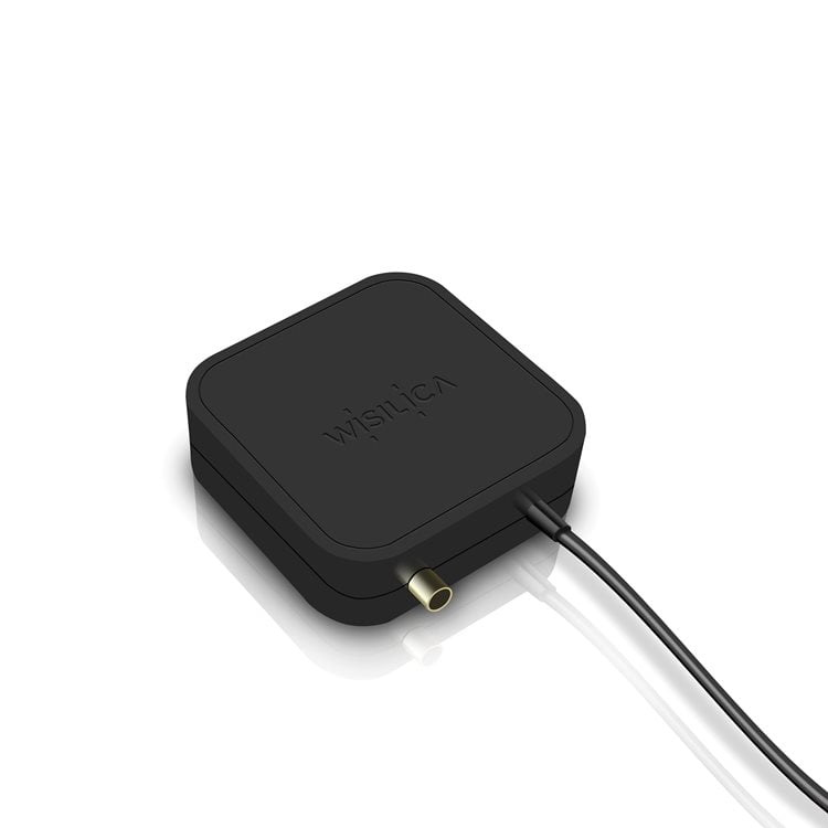
IoT platform and solutions provider WiSilica has chosen Nordic for its newly launched ENOR E-L/N gateway, the company said. The gateway provides Cloud server connectivity for Bluetooth Low Energy-based networks, enabling real-time data provision even when trackable assets move, the company said.
The gateway is based on Nordic's nRF9160 System-in-Package (SiP) with integrated LTE-M/NB-IoT modem, GNSS, and a dedicated application processor and memory. ENOR E-L/N also features an external GPS antenna for location tracking applications.
The gateway combines cellular network location data with GNSS for position monitoring in asset tracking applications, the company said.
Contact: Nordic, www.nordicsemi.com.
Spireon Saves Trucking Company $644,000
Spireon, now owned by Solera, says it has saved Summitt Trucking $644,000 in annual savings after the truckload/logistics company purchased its FleetLocate trailer management product and services. Summit said they worked with another telematics provider prior to working with Spireon. "Without an accurate cargo sensor, we were sending five to 10 drivers per day an average of 30 miles to look at 30 trailers on a lot, only to grab one trailer, losing $90-$100 per hour in revenue in each instance and spending more than $500,000 annually having our drivers go and look for empties," the company said.
Contact: Spireon, www.spireon.com.
MiX Telematics Adds 2,000 Brazil Subscriptions
MiX Telematics [MIXT] said it added 2,000 new subscriptions to its integrated fleet management technology for “an existing Brazilian-based bus and coach customer” in the country's southeast region. The total MiX Telematics fleet coverage with the company will grow to 4,015 subscribers, the company said.
Contact: Melanie Esterhuizen, MiX Telematics, melanie.esterhuizen@mixtelematics.com, www.mixtelematics.com.
IGEN Networks Launches Medallion GPS PRO
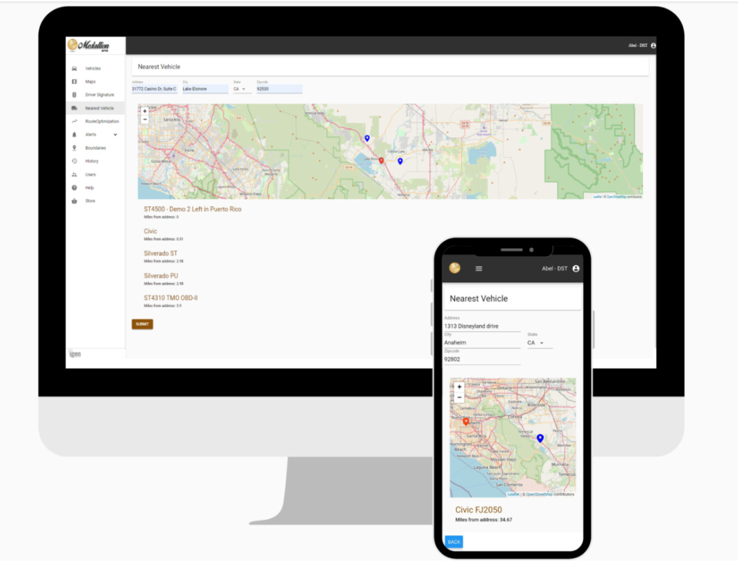
IGEN Networks [IGEN] has announced the launch of Medallion GPS PRO for medium-to-heavy duty commercial fleets. Medallion GPS PRO uses data systems inherent within heavier commercial vehicles to include the company’s patented Driver Telematics Signature algorithms for managing driver performance and safety, the company said.
Medallion GPS PRO based on 5G technology includes: real-time updates measured in seconds for the management of commercial fleets; and the ability to support an unlimited number of landmark locations for large-scale deployment of point-of-delivery and routing services.
Contact: Neil Chan, IGEN Networks, (855) 912-5378, info@igennetworks.net, www.igennetworks.net.
Inc. Ranks One Step GPS on Annual List
Inc. Magazine said One Step GPS ranks No. 42 on its third annual Inc. 5000 Regionals: Pacific list. The list ranks the fastest-growing private companies based in Alaska, Hawaii, California, Oregon, and Washington. One Step GPS, a California-based GPS fleet tracking company, offers products without the need for contracts or device expenses, the company said.
Contact: Benjamin Jacobs, One Step GPS, (888) 919-7536, benjamin@onestepgps.com, www.onestepgps.com.
People
FocalPoint named GNSS industry veteran Manuel Del Castillo as Vice President of Business Development.
Polte named David Baughman as Director of Sales. Baughman joins Polte from Sigfox.
ALLSAT named Reiner Hartlep as a customer advisor. Hartlep will be direct contact for the Leica Geosystems Baulösungen.
Jobs
Regional Sales Manager-United States. Quectel.
Current Job Openings. Swift Navigation.
Public Policy Analyst. Einride.
Get your company’s products and services in the 2022 Location Industry Yearbook!


