TUM Wins Indy Autonomous Challenge
Autonomous race cars reach high speeds, but race highlights challenges of GPS outages in demanding environment
JAVAD offers Triumph-LS Plus and Triumph 3 Latest-Generation Receiver. JAVAD GNSS is looking for new talent to join their team!
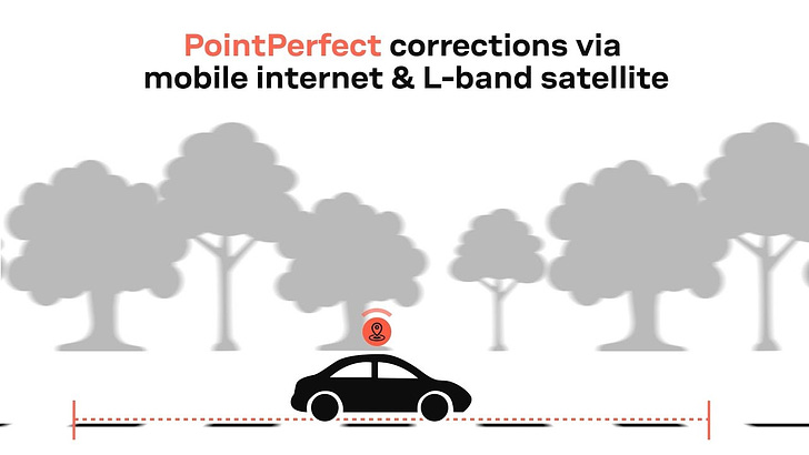
Join u-blox for a webinar about the new PointPerfect GNSS Augmentation Service.
In a celebrated test two years in the making, Technical University of Munich (TUM) beat out eight other teams from 21 universities to win a $1 million grand prize Saturday at the Indy Autonomous Challenge. TUM’s vehicle recorded the fastest two-lap average speed of 135.944 to win the event.
Initially, the race was touted as a dozen or so autonomous vehicles racing next to each other, not unlike a regular car race. However, race organizers made adjustments to the rules when it was apparent that the cars were not at a point that showed a consistent level of performance, so each team raced its cars individually, said Paul Mitchell, Energy Systems Network president and CEO.
“I would say we are not disappointed in the level of technology developed—it’s monumental and record-breaking,” he said. “Can we expect a multi-car competition in the future? My answer is that these are multimillion-dollar cars and sponsors who do not believe this is a one and done event. We aren’t putting these cars in a museum or in a lab.”
Because the cars did not race next to each other on the famous track at the Indianapolis Motor Speedway, some racing reporters say that the only thing the race proved was that driverless cars can go fast. Which was the case with EuroRacing, a team made up of students from Italy, Switzerland and Poland, who recorded the fastest one-lap speed, 139.009 mph.
The autonomous racing software developed through the competition could assist in developing commercial self-driving vehicles and enhance existing advanced driver-assistance systems (ADAS) and cornerstone technologies include GNSS and digital maps.
A number of location companies sponsored and donated equipment to the competition, including AutonomouStuff and NovAtel, part of Hexagon’s Autonomy & Positioning division. Cisco Systems [CSCO] was the overall sponsor.
There were two crashes on the famed oval track, including a Dallara IL-15 racecar for the PoliMOVE team. The team believes the shutdown of a GPS tracker caused the crash.
The competition was inspired by the 2005 Defense Advanced Research Projects Agency (DARPA) Grand Challenge, which pitted university teams against each other and spurred commercial development of autonomous vehicles. It’s a comparison that Mitchell believes doesn’t tell the whole story. “We are doing it in higher speeds and closer quarters,” he said.
MWC Los Angeles Attendance Down, But Companies Upbeat
This year’s Mobile World Congress Los Angeles had most of the carriers and manufacturers in attendance—and many companies in the location ecosystem. However, because of the worldwide pandemic, attendance was down, said several executives.
Despite attendance issues, some companies used the event as a launching pad for products and services. Taoglas and u-blox [UBXN] displayed the COWBOY e-bike at MWC. The COWBOY is a connected electric bike, with GNSS capability, for urban riders. The bike uses Taoglas' Accura GVLB258.A multi-band GNSS L1/L5 patch antenna in conjunction with u-blox's SAM-M8Q GNSS positioning module.\
Taoglas also rolled out its EDGE Vision technology that helps OEMs and enterprises manage workflows to ensure process safety, quality, and reduced business costs with the help of machine vision AI technologies, the company said. The technology integrates cellular, GNSS and machine vision.
In other MWC news, Halo Collar with Cesar Millan premiered at the trade show in collaboration with KORE [KORE]. Founded by inventor Ken Ehrman and dog expert Cesar Millan (pictured above), Halo Collar is the only technology that automatically downloads daily satellite updates to improve GPS accuracy, the company said. The collar also lets owners create as many as 20 wireless fences.
Contact: Emma Walsh, Taoglas, 353 (0)87 317 0897, mediarelations@taoglas.com; Natacha Seitz, u-blox, 41 76 436 0788, natacha.seitz@u-blox.com; Landon Garner, KORE, lgarner@korewireless.com.
ServiceNow Closes Mapwize Acquisition
Digital workflow company ServiceNow [NOW] recently closed the acquisition of France-based Mapwize, an indoor mapping and wayfinding company. Financial details were not disclosed.
ServiceNow plans to provide indoor mapping capabilities for employees as they reserve reserve seats, conference rooms, workspaces and workplace resources, as well as navigate offices, request services and report issues, said Jeffrey Gore, Service Now vice president of product marketing, employee workflows. “This will be essential for organizations as they manage new hybrid working models,” he said.
Gore, who said ServiceNow has retained the Mapwize team as part of the acquisition, says Mapwize’s mapping solutions, product features and technical talent will complement and enhance ServiceNow’s existing Workplace Service Delivery capabilities, which include space mapping and management and visitor control.
Mapwize capabilities will also help workplace teams manage and update floor maps based on usage trends and evolving real‑estate needs, the company said.
Mapwize was founded in 2014 by CEO Médéric Morel and CTO Mathieu Gerard and is based in Lille, France.
Contact: Theresa Ianni, ServiceNow, (216) 544-6817, theresa.ianni@servicenow.com, www.servicenow.com.
C.J. Driscoll Releases New U.S. Mobile Resource Management Systems Market Report
C.J. Driscoll & Associates has released the 2021-22 U.S. Mobile Resource Management Systems Market Study that says approximately 18.0 million GPS/wireless devices are used to manage fleet vehicles, trailers, construction equipment, and field service workers. By 2024, the market will expand to more than 25 million units and revenues will grow to over $8 billion.
The fastest-growing sector in commercial telematics is video telematics. Video is penetrating all fleet segments due to the desire of fleet operators to determine liability in the event of an accident and for driver coaching. It is the fastest growing commercial telematics application, leveraging emerging technologies such as Artificial Intelligence, Machine Learning and Edge Computing. Merger and acquisition activity has been strong, which shows the confidence of both strategic and financial investors in the near and long term prospects for the commercial telematics industry.
High valuations are common for fast-growing, profitable solution providers, the study says. Global expansion continues with U.S. suppliers entering the European, Latin American, and ANZ markets and overseas suppliers entering the North American market, the study says. Insurance telematics is becoming more important for fleet insurers and TSPs. Some commercial insurers are mandating that fleets adopt telematics while other insurers are offering fleets discounts for adopting this technology.
The 368-page 2021-22 U.S. Mobile Resource Management Systems Market Study provides in-depth information on each major MRM market segment, including the markets for GPS fleet management solutions for local service and delivery, long haul trucking, government, and other fleet segments. The study includes in-depth company profiles.
Contact: Clem Driscoll, CJ Driscoll & Associates, (310) 717-7961, clemdriscoll@cjdriscoll.com www.cjdriscoll.com.
Connecting IoT in the Business Enterprise: Is There an Optimal Approach?
By Brian Salisbury and Michael B. Mathews
Codepoint Technologies believes that wirelessly connected people and devices are fundamentally changing the way we communicate and manage information in the Business enterprise. Once limited to devices like the smartphone, wireless connectivity is fast becoming a popular means to connect all sorts of Internet of Things (IoT) devices. Whether they are sensors, smart devices (e.g., vehicles, buildings, switches, actuators, or mobile equipment), or wearables, by 2025 there will be more than 30.9 billion IoT devices. A significant portion (perhaps most) of these devices will connect wirelessly due to the physical impracticality of running wires to each device. Currently, there are three primary choices for wireless data connectivity:
Regional Wireless (Cellular)
Short Range Radio (Wi-Fi / Bluetooth / BLE)
Low Power Wide Area Network (LPWAN)
The article continues on the Location Business News website.
Codepoint Technologies was co-founded by Michael Mathews and Zhong Li to develop technology enabling more efficient and flexible IoT solutions. The first generation of products using this technology are focused on enterprise applications, particularly in campus deployments using an enhanced LoRa implementation that provides indoor and outdoor connectivity and location.
Starter kits are now available which include tag form factor devices and a LoRa gateway bundled with cloud service and a basic tracking application. Additional devices such as door sensors, moisture detectors, etc will soon be available so that system integrators can deploy solutions comprising multiple types of devices running on a common platform.
Codepoint is actively seeking system integrators and application developers to partner with for development and delivery of enterprise IoT solutions.
Contact: Michael Mathews, Codepoint, michael.mathews@codepoint.xyz.
Other Location News:
News tip? Send them to kdennehy@driverlessreport.com. Go to www.locationbusinessnews.comfor more news and an archive of stories.
👏 Galileo 10th Launch Anniversary: The Day the European Union Broke Through the GNSS industry. “On Dec. 1, 2021, two new satellites are expected to lift off from Kourou French Guyana on a Soyuz rocket.”
😮 Why Navigation Apps Like Google Maps and Waze Sometimes Route You Into a Traffic Jam. “But at the end of the day, there’s no navigation app that’s always 100 percent accurate. And if you’re using them on a regular basis, you probably know that sometimes, these apps just route you into heavy traffic, substantially increasing the ETA.”
🛰 Japan Successfully Launches Replacement for Decade-old Navigation Satellite.
😲 OQ Technology Successfully Proofs Indoor Tracking Inside a Moving Car via Its 5G IoT Nanosatellite. “During tests, OQ was able to send the terminal’s GPS location to the satellite from inside a fast-moving car without having a direct line of sight to the sky.”
👍 Geotab and General Motors Expand Integrated Telematics Offerings for Fleet Customers into Canada. “With this integration, data from compatible GM vehicles, 2016 or newer, with OnStar embedded factory first-hardware can be securely transferred into Geotab’s web-based fleet management software.”
🚕 Some Say Self-driving Robotaxi Isn’t a Business; Billions Are Being Bet That It Is. “Almost all the top players like robotaxi plans because if you sell the ride, you sell the whole automotive value chain — vehicle, fuel, maintenance, insurance and more — and control the customer and all the revenue for this whole chain.”
✔ Verizon, Nissan Connect for Car Safety Using MEC. “It’s an example of cellular vehicle-to-everything (C-V2X) being applied to scenarios where drivers may find it difficult to see pedestrians or oncoming traffic if they’re obscured from view. The technology uses Verizon 5G Edge, LTE and a Nissan proprietary telematics test platform.”
😫 Location Data Firm Got GPS Data From Apps Even When People Opted Out. “The news highlights a stark problem for smartphone users: that they can’t actually be sure if some apps are respecting their explicit preferences around data sharing.”
✌ IAF to integrate IAI GPS system. “ADA, an Anti-Jam GPS System, was successfully operated during Operation ‘Guardian of the Walls’ in May.”
🤷♂️ Huawei Adds Dual-Frequency GPS to New Watch GT 3. More privacy stuff coming?
👌 Red Cat Subsidiary TEAL Drones Opens U.S. Manufacturing Facility. “Skypersonic provides software and hardware solutions that enable drones to complete inspection services in locations where GPS is not available”
🛩 The Drone Racing League and T-Mobile Bring Epic Championship Drone Race to the Las Vegas Strip. “The final race of the season will take place on a thrilling outdoor course along the Las Vegas strip at T-Mobile Arena on opening night of CES, Wednesday, Jan. 5, 2022.”
Advertisement
Have you ever been reluctant to reveal your personal email address online or in person?
The answer is almost universally YES! So, if you happen to be one of those who thinks twice about these matters, ManyMe might be the answer to your worries.
Location Industry Briefs
Send your news to kdennehy@driverlessreport.com. Go to www.locationbusinessnews.comfor more news and an archive of stories.
u-blox Rolls Out ANNA-B4 Module
Thalwil, Switzerland-based u‑blox [UBXN] has announced the ANNA-B4 module, compact Bluetooth 5.1 system-in-package (SiP). ANNA-B4 targets smart lighting networks and industrial circuit breakers as well as indoor positioning use cases, the company said.
Indoor asset tracking solutions are part of the emerging applications that stand to benefit from ANNA-B4’s small size and low-power demand, the company said. In addition, it supports Bluetooth direction finding, which lets users locate tagged mobile assets in indoor environments (smart buildings, factories, hospitals, and warehouses), the company said.
Contact: Natacha Seitz, u-blox, 41 76 436 0788, natacha.seitz@u-blox.com.
Mapbox Navigation SDK 2.0 Available For Developers
Mapbox said its Navigation SDK 2.0 is now available for Android and iOS, according to a company blog. The Nav SDK 2.0 GA has the latest version of the Maps SDK for deployment in production mobile apps via Google Play or Apple iTunes online stores, the company said.
The new release allows developers seamless integration of both active and freedrive modes. Features include customization options, predictive caching, 3D buildings and topography. Mapbox said that developers now can have a suite of features and tools to build out mobility and driving experience products.
Contact: Mapbox, www.mapbox.com.
HERE Partners With SAIC Motor and Autolive, Launches ISA Map
SAIC Motor, China’s largest automaker, has announced HERE Technologies will power its connected In-Vehicle Infotainment (IVI) systems of MG cars in South-East Asia, Oceania, Western Europe, Latin America, Middle East and India. The connected IVI system includes HERE Traffic which provides real-time information on traffic flow and conditions, the company said.V
HERE also announced that Autoliv is using HERE Speed Limits, Fleet Telematics and Weather APIs (application programming interfaces) for its Connected Safety Services. Autoliv is adding location context to road safety with its Driver Safety Score software.
Autoliv Driver Safety Score software can be used by fleet managers and insurance companies to offer lower premiums through reductions in risky driving behavior. HERE map data and location services help add context – weather, road regulations, traffic congestion – to the information collected from phone and vehicle sensors
In other company news, HERE launched its ISA Map to deliver vehicle systems and drivers road speed limit information. The HERE ISA Map was designed for automakers to comply with the European Union’s new Intelligent Speed Assistance regulation.
Contact: Adrianne Montgobert, 49 151 72 11 67 81 adrianne.montgobert@here.com.
Join u-blox for a webinar on the new PointPerfect GNSS Augmentation Service.
Rand McNally Upgrades Navigation Software
Rand McNally has announced an over-the-air upgrade to its Rand Navigation software. The upgrade, which involves a full map update and improvements to the routing and interface, will be available for all latest model Rand McNally TND and OverDryve tablet devices, the company said.
The update, which will be rolled out to the device in November, comes 18 months after the company launched its new, proprietary Rand Navigation platform. The OS update boosts the number of satellites used for improved GPS positioning on the Rand Navigation map base.
Contact: Rand McNally, http://www.randmcnally.com.
ORBCOMM Signs Deal With TSI
ORBCOMM has announced that it has been selected by Transportation Services Inc. (TSI) to upgrade its fleet of trucks with ORBCOMM’s in-cab telematics solutions. ORBCOMM’s driver-friendly solution delivers GPS fleet tracking and connects to the truck’s CANbus to collect important data from the engine, brake systems, fuel tanks and more, the company said.
By automating hours of service calculations, ORBCOMM enables TSI to comply with the Electronic Logging Device (ELD) and FMCSA Hours of Service (HOS) regulations, the company said. TSI said it is prepared for immediate installation of ORBCOMM’s in-cab solution on its trucks, and expects to complete the deployment in early 2022.
Contact: Lina Paerez, Orbcomm, (613) 875-1485, paerez.lina@orbcomm.com.
Digital Matter Introduces Asset Tracking Devices
Digital Matter has rolled out its Edge battery-powered asset tracking devices and Location Engine, a new cloud-based Location Solver, to enable global indoor/outdoor IoT asset tracking and management applications, the company said.
The company’s Edge portfolio supports multiple location technologies (GNSS, Wi-Fi AP MAC Address Scanning, and Cell Tower location or Geolocation Fallback with LoRaWAN), the company said. Applications including supply chain visibility, high-value pallet and package tracking, kegs and returnables tracking, emergency and hospital equipment management, cart and trolley tracking, and others, the company said.
Contact: Shay Kettner, Digital Matter, 61 8 6280 1217, 321686@email4pr.com, www.digitalmatter.com.
Sewio Leverages RTLS for Manufacturing Plant
Sewio, a UWB-based real-time location system (RTLS) vendor, today announced that VELUX Commercial leverages Sewio RTLS to boost the ergonomics, efficiency and safety at their manufacturing plant, the company said. The company said the integration leverages seven use cases, including virtual-reality training enriched with real-time traffic brought by RTLS.
Contact: Sewio, www.sewio.net.
Jobs
Javad GNSS is looking for new talent to join their team! JAVAD GNSS.
Sr. Product Marketing Manager. TomTom.
Product Operations Manager. Trimble.