U.S. DOT Announces $160 Million Annually for Smart Transportation Technology
Two programs offer the industry opportunities for vehicle and safety programs
Expert nationwide installation services for fleet technologies.
The U.S. Department of Transportation has announced that it will make $160 million available annually over the next five years through two programs that concentrate on smart transportation technology.
The first program, called Strengthening Mobility and Revolutionizing Transportation (SMART) Grants Program, offers $100 million in grants that use data and technology in the following areas:
Vehicle technology, like automation and connectivity.
Systems innovation, like delivery and logistics, traffic signals, smart grid, and data integration.
And new ways to monitor and manage infrastructure, like sensors and UAS.
The second program is the Federal Highway Administration’s $60 million Advanced Transportation Technology and Innovation (ATTAIN) that promotes advanced technologies to improve safety and reduce travel times for drivers and transit riders. State governments are also invited to apply, DoT said.
More information on the two programs can be found at https://www.transportation.gov/grants/SMART and www.grants.gov.
Polte Closes, Sells Assets
Polte Corp. has abruptly closed up shop and is selling off its assets, according to its website. The Dallas-based provider of Cloud Location over Cellular (C-LoC) technology said it will discontinue all services.
Company CEO Ed Chao said he didn’t have anything further to add about the company’s closing.
The company did not announce who they were selling assets to, according to its website:
As recently as July, the company partnered with GeoTraq to embed its technology into NB-IoT/LTE-M modules for asset tracking. In addition, the company had tested its technology’s accuracy in Europe with Deutsche Telecom.
One of Polte’s competitors has stepped up to make a pitch to the failed company’s customers. Link Labs said its “SuperTag can fill the void [Polte] has left.”
News Without All the Nonsense.
Check out 1440 - the fastest way to an impartial point-of-view. The team at 1440 scours over 100+ sources so you don't have to. Culture, science, sports, politics, business and everything in between - in a five-minute read each morning, 100% free.
ITS World Congress Showcases Vehicle Safety Technology
Smart technology programs that concentrated on safety were highlighted at this week’s ITS World Congress in Los Angeles. Ford F 0.00%↑ demonstrated a new smartphone-based communications technology that seeks to warn drivers of pedestrians, bicyclists and other obstacles.
A smartphone app, running on a pedestrian’s phone, would use Bluetooth Low Energy (BLE) messaging to communicate their location to a connected Ford vehicle, the company said. In the event of a crash, Ford SYNC alerts drivers by showing an in-screen graphic, with sound, of pedestrians and bicyclists.
Ford is working with Commsignia, PSS, Ohio State University, T-Mobile TMUS 0.00%↑ and Tome Software on the project.
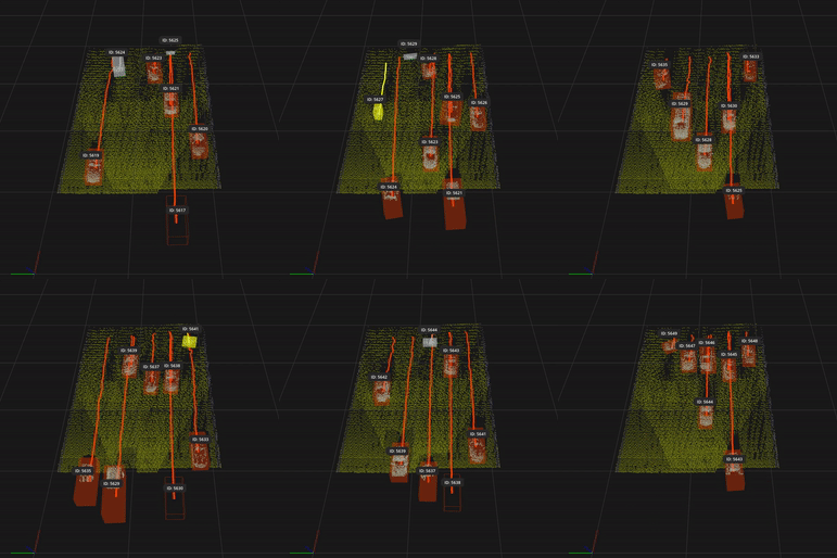
ITS World Congress also had several lidar vendors display new systems for both vehicles and infrastructure. One company, Cepton, has joined the Qualcomm Smart Cities Accelerator Program to use lidar in smart cities and smart connected spaces, the company said.
The company is also working on the GM Ultra Cruise program, through its Tier 1 partner Koito Manufacturing. “As is widely known, there is a trend for OEMs like GM to transition to subscription models. With lidar offering coveted safety and comfort enhancements, we anticipate a very high level of adoption of lidar over the coming years and that is what we are preparing the supply chain for with Koito,” said Mitchell Hourtienne, Koito senior vice president of business development.
Another lidar company, AEye, said that lidar offers traffic managers the ability to detect weather, lighting to provide accurate data for planning. The company’s 4Sight lidar allows for multiple applications and both long-and-short-range detection using only one sensor, the company said.
AEye made several announcements at ITSWC: a deal with Intetra for a lidar-based tolling station and one with GridMatrix for integration in to a software platform for traffic management.
In other ITS World Congress News:
The California Mobility Center (CMC) announced that Mark Rosekind has been named its first CEO. Rosekind was chief safety innovation officer at Zoox and the 15th administrator of the National Highway Traffic Safety Administration (NHTSA) from 2014 to 2017.
INRIX announced improvements to its IQ Signal Analytics that helps transportation engineers better understand traffic signal performance based on vehicle stops, delays, or speed. Signal Analytics now includes vehicle trajectory plots to help agencies diagnose and resolve signal timing issues, the company said.
Location Industry Makes Presentations at ION GNSS
DENVER—While known as a technical meeting, the Institute of Navigation’s ION GNSS 2022 here had several companies demonstrating new technology and products.
In a presentation, Joshua Morales, StarNav co-founder and CEO, said that both ground autonomous vehicles and unmanned aviation systems are proliferating worldwide—with government safety regulations struggling to keep pace. A key component to the deployment of these systems is GPS, which is vulnerable to outages and spoofing attacks, he said.
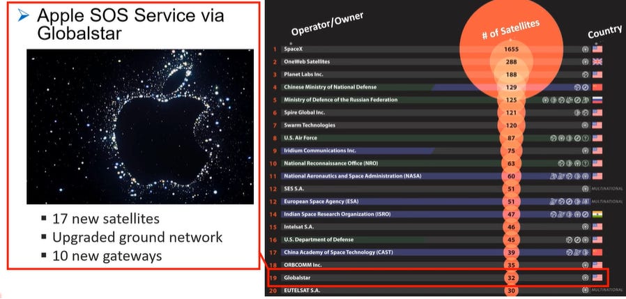
Morales said that while low Earth orbit, or LEO, satellites for navigation is not a new concept, he believes that Globalstar GSAT 0.00%↑ constellation can be a valuable backup to GPS. Of particular importance is the recent announcement by Apple AAP 0.00%↑ that it operate an SOS service via Globalstar for its new iPhone 14 smartphones, he said.
Morales said that initial testing of signal acquisition and tracking of Globalstar LEO satellites for navigation went well. “We used a Septentrio receiver for accurate ground truth. During this run there were two Globalstar sats available,” he said. “We had GPS for the first 30 seconds, then we initialized the calibration and drift rates.”
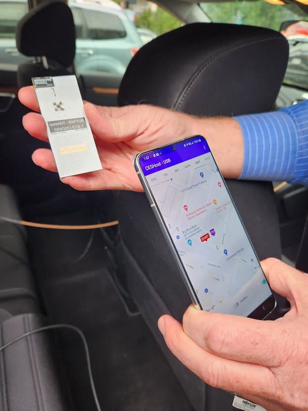
Another company, Silicon Valley-based oneNav, demonstrated its L5 GPS signal technology outside of the Colorado Convention Center.
“Right now, there is higher-end stuff on the market that offer L1 and L5 signals, but the RF and filters are not cheap. L5 has inherent advantages in that it is better in urban canyons and has AI techniques that mitigate multipath,” said oneNav’s Jim DeLoach. “We have our fully autonomous version of the software in the lab now.”
The L5 AI engine also allows the company to free up device space, which is the innovator’s dilemma as the small device market is growing, said Ellen Kirk, oneNav’s vice president, strategic marketing. “Drones and fitness devices have no space. Companies use L1 to get a first (satellite) fix and then it just sits there,” she said. “Using L5 alone is lower-power and less expensive.”
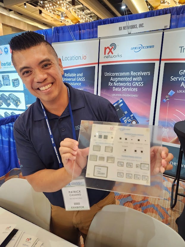
In other ION GNSS news, Rx Networks announced the release of its next generation GNSS modules from Unicore. Based on the new NebulasIV SoC, the UM960/980/982 and UT986 products offer all-constellation multi-frequency high-precision RTK positioning and/or heading capabilities.
The new modules are ideal for use in reference stations, survey/mapping, precision agriculture, heading applications, machine control, drones and robotics, vehicle navigation, precision timing and more, the company said.
Contact: Cameron Baird, Rx Networks, (604) 685-8988, unicore@rxnetworks.com.
Get your company’s products and services in the 2022 Location Industry Yearbook!
Vodafone New Zealand Partners With Digital Matter
Vodafone NZ has partnered with GPS tracking company Digital Matter to offer IoT asset tracking solutions for New Zealand businesses. As part of the deal, Vodafone NZ has bundled several of Digital Matter’s battery-powered IoT asset tracking devices and software directly with the company’s LTE-M and NB-IoT connectivity to offer an asset management solution.
The branded Vodafone Asset Management solution will monitor and optimize valuable assets, prevent theft and improve utilization, the company said. Vodafone NZ also operates New Zealand’s largest 5G network, with 3 million connections.
For its part, Digital Matter has been marketing IoT asset tracking solutions for telematics businesses, IoT product providers and network operators in the country.
“Vodafone New Zealand is delivering a simple and effective IoT asset tracking offering that has been customized to meet the unique challenges and requirements of the New Zealand market,” said Stuart German, Digital Matter’s business development director, in a statement.
Contact: Shay Kettner, Digital Matter, shay@digitalmatter.com, www.digitalmatter.com.
Impossibly crunchy, remarkably airy crisps made from simple ingredients
Try Snacklins' Savory Starter Pack with 10 snack size bags in 5 delicious flavors! Just $25 + FREE Shipping. Only valid for first-time customers.
Other Location News:
News tip? Send them to kdennehy@driverlessreport.com. Go to www.locationbusinessnews.com for more news and an archive of stories.
Top News:
💰 StarNav Competitively Selected for $1.1M Army Funding to Develop New Positioning Technology. “The U.S. Army has formally announced nearly $7 million in contract funding for six small businesses to transition various emerging tech solutions from concept to prototype. Each of the six companies will receive nearly $1.1 million in funding over the next 24 months through the Army Applied Small Business Innovation Research Program.”
Maps:
👏 Why Rating Systems for Places & POIs Suck…and a Possible Fix. “The fundamental problem with all these rating systems is that none of them take your own preferences into account, so the ratings you see are this amorphous, unwieldy glob of data that provides little information that is tuned to the individual.”
👍 Apple’s Google Maps Rival Brings New-Gen City Maps to More Users. “Chicago and Las Vegas are both provided with the new maps, which include everything from 3D buildings to more accurate digital versions of the roads, parks, sidewalks, and so on. At first glance, everything looks great, though this doesn’t necessarily mean that Apple’s AAPL 0.00%↑ work here is done.”
🤞 New Waze Update Launches for iPhone and CarPlay Users, Here’s What’s New. “Now at version 4.87, Waze includes a fix for a bug that impacted the way users could start a drive to saved places..”
Connected and Autonomous Vehicles:
🚘 Upset by High Prices, GM's Cruise Develops Its Own Chips for Self-driving Cars. “Cruise is taking a page out of Tesla's playbook, switching from Nvidia's NVDA 0.00%↑ products to customized chips to power their vehicles.”
🚙 Why Geofencing Will Enable L5. “Reaching full Level 5 autonomy means removing the “fence” from geofenced autonomous cars. Experts say that will require artificial intelligence that can make abstractions, inferences, and become smarter as it is being used.”
🤨 How XPeng’s City Navigation Will Stack up Against Tesla’s FSD. “XPeng, a Chinese smart electric vehicle startup, has launched its anticipated advanced driver assistance system (ADAS) that automates some driving functions in urban environments.”
Satellites:
🛰 Australia and NZ to Share SBAS Network. “The system, to be called the Southern Position Augmentation Network (SouthPAN) will increase accuracy of GNSS systems from the current 5-10 metres down to as little as 100 mm, providing capability for GNSS approaches with vertical guidance to LPV and LNAV/VNAV PBN RNP APCH approaches in supported areas.”

Location Industry Briefs
Send your news releases to kdennehy@driverlessreport.com. Go to www.locationbusinessnews.com for more news and an archive of stories.
Mazda Selects Telenav as Navigation Partner in Europe, Australia and New Zealand
Telenav has announced that Mazda Motor Corp. has chosen the company’s Navigation SDK and Cloud Search products for its in-vehicle navigation in Europe, Australia, and New Zealand. Telenav is offering its navigation engine and one-box cloud search capability to Mazda customers. The company recently won the J.D. Power award for navigation supplier in the Compact and Premium SUV category.
Contact: Sanjay Khatr, Telenav, (408) 410-3331, sanjayk@telenav.com, www.telenav.com.
NextNav Partners With Hot Pepper Mobile
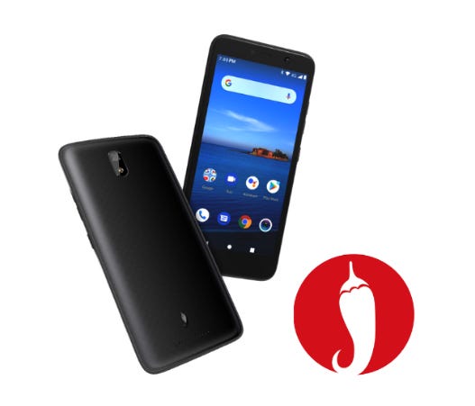
NextNav NN 0.00%↑ has partnered with Hot Pepper Mobile to bring its Pinnacle vertical location technology to Hot Pepper’s upcoming feature phone “on a tier-one carrier’s network, scheduled for release in 2023.” The partnership will add z-axis geolocation capabilities for 911 emergency services, search and rescue, and lone worker safety, the company said.
The license will also allow Hot Pepper Mobile to supply phones equipped with z-axis 911 technology to all major wireless US carrier partners, the company said.
Contact: Gillian Smith, NextNav, media@nextnav.com, https://nextnav.com.
Quectel Offering 5G Tech in India
Quectel Wireless Solutions has announced that its technologies and services will support the initial 5G rollout in India. Thirteen cities will get 5G services including Ahmedabad, Bengaluru, Chandigarh, Chennai, Delhi, Gandhinagar, Gurugram, Hyderabad, Jamnagar, Kolkata, Lucknow, Mumbai and Pune. Quectel will offer its 5G modules, including the RM510Q-GL, the RM50xQ and the RG50xQ, in addition to several antennas.
Contact: Ashley Liu, Quectel, media@quectel.com, www.quectel.com.
HERE Partners With Automakers To Meet EU Regulations
HERE Technologies, at the recent IAA Transportation Conference, said it is working with leading commercial vehicle manufacturers to implement Intelligent Speed Assistance (ISA) technology to support new European Union regulations. Since July, the EU regulations require drivers in trucks, vans and cars to have legal speed limits always displayed, the company said.
The HERE ISA Map has been adopted by 15 global automakers, representing more than 30 brands, the company said. HERE’s ISA Map includes speed limits visible on road signs and implicit speed limits derived from road signs without numerical values, the company said.
Contact: Sebastian Kurme, HERE, 49 173 515 3549,sebastian.kurme@here.com.
Sanborn Acquires Applied Geographics
The Sanborn Map Co. has acquired Applied Geographics. Terms of the acquisition were not disclosed. AppGeo will continue to operate under its brand name as a wholly owned subsidiary of Sanborn, the company said. The company has strategic partnerships with such companies as Esri, Google, AWS, HERE, Hexagon, and Vexcel.
Contact: Sanborn, www.sanborn.com.
Inpixon Partners With Schauenburg for Mining Location Tech
Inpixon INPX 0.00%↑ has signed a collaboration agreement with Schauenburg Systems to sell the company’s location technologies to mining companies in South Africa. Under the agreement, the parties will attempt to sell hundreds of thousands of Inpixon nanoLOC chips and other for real-time tracking, collision avoidance and proximity applications. The company's first joint project target is one of the larger gold mines in South Africa, the company said.
Contact: Inpixon, (212) 671-1020, marketing@inpixon.com, www.inpixon.com.
Furuno Unveils Time Synchronization GNSS Receiver
Furuno has rolled out time synchronization GNSS receiver modules that deliver nanosecond precision for 5G mobile systems, radio communications systems, smart power grids and grand master clocks. The new products include GT-100, GT-9001 and GT-90.
GT-100 is the company's first timing multi-GNSS receiver module supporting concurrent L1 and L5 reception, the company said. This mitigates the effects of solar flares, which can lead to time errors, and strengthens measures against GNSS vulnerabilities such as jamming and spoofing.
Contact: Furuno, https://www.furuno.com/en/products/gnss-module/GT-100.
Orolia’s New GNSS Testing Solution
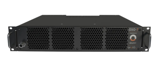
Orolia has released the GSG-7, the latest GNSS signal testing solution offered through the Skydel-based simulators product line. The GSG-7 features a small form factor, an internal RF combiner, high-end performance with a 1000 Hz simulation iteration rate, the company said.
Powered by Orolia’s Skydel simulation engine, the GSG-7 can be programmed to simulate operations with all current GNSS signals, the company said.
Contact: Charles Jones, Orolia, (585) 450-2889, charles.jones@orolia.com, www.orolia.com.
CMT Launches FuelStar App
Cambridge Mobile Telematics has launched FuelStar, a new app that helps consumers save up to 40 percent on gas by showing them how to drive more efficiently. FuelStar analyzes driving patterns that consume gas faster and teaches people how to make small changes in their driving habits to help them save money at he gas pump, the company said. CMT said it does not and will not sell or share a user’s personal information — including location data — with third parties. FuelStar is available free on Apple’s App Store.
Contact: Matt Fiorentino, CMT, mfiorentino@cmtelematics.com.
Garmin Rolls Out Marine Emergency Satcom Device
Garmin International GRMN 0.00%↑ has announced the inReach Mini 2 Marine Bundle, a satellite communication device with two-way messaging and SOS capabilities. In an emergency, inReach Mini 2 users can trigger an interactive SOS message to the Garmin International Emergency Response Coordination Center (IERCC), the company said.
The unit can be paired with compatible marine electronics on board, including the GPSMAP 8400/8600 Series and GPSMAP 7x3/9x3/12x3 Series chartplotters. In addition to GPS, it leverages the Galileo, QZSS and BeiDou satellite networks.
Contact: Carly Hysell, Garmin, (913) 397-8200, media.relations@garmin.com.
Combain Releases New API Version
Combain’s Location API now can do both a geolocation lookup and reverse geocoding in a single request to reduce latency and data communication, the company said. The API gives the location, building name, floor name and index. The new API is suitable for outdoor/indoor applications.
Contact: Combain, https://combain.com/api/#request-body.
RuggON updates Mobile Data Terminal With GNSS Dead Reckoning
RuggON has upgraded its VIKING mobile data terminal to include Android 11 OS and GNSS dead-reckoning technology. VIKING delivers computing performance for transport fleets and public transportation companies, the company said.
The GNSS dead-reckoning function plots navigation when satellite signals are partially or completely blocked by buildings or vehicles, the company said.
Contact: RuggON, (213) 269-4168, usa@ruggon.com, www.ruggon.com.
2M Locating Using ProStar Mobile App
ProStar Holdings [MAPS] has announced that 2M Locating is using the company’s PointMan mobile application for their utility mapping operations. 2M will use the app to locate underground utilities. 2M Locating uses ground penetrating radar, electromagnetic, GPS and drone/UAV technologies to locate and map underground utilities.
Contact: Joel Sutherland, ProStar, (970) 822-4792, Investorrelations@prostarcorp.com, www.prostarcorp.com.
RoadMentor Allows Real-Time Mapping
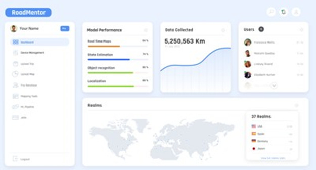
Hyperspec has introduced a platform called RoadMentor that allows users to create, train, and deploy machine-learning (ML) models for real-time mapping. Hyperspec integrates the map into the ML training loop so that real-time mapping models can be developed, giving ADAS enabled and autonomous vehicles the ability to perform outside of the HD map geofence, the company said.
The release of RoadMentor increases test coverage from less than 5 percent to more than 95 percent across all roads, enabling edge case library build out across the long tail of scenarios, the company said.
Contact: Hyperspec, www.hyperspecai.com.
Golden Software Enhances Grid Displays
Golden Software has upgraded its Surfer gridding, contouring, and 3D surface mapping package with improved grid display and data coordinate conversion options. The Surfer software enables users to model data sets, apply advanced analytics tools and communicate the results, the company said.
Surfer is used by more than 100,000 people worldwide, many involved in oil and gas exploration, environmental consulting, mining, engineering, and geospatial projects, the company said.
Contact: Golden Software, (303) 279-1021, www.GoldenSoftware.com.
People
Rise Up has named Jeremy Prince managing director. Prince was CEO of SIGFOX, now owned by Unibiz.
Jobs
Senior Manager, Sales Operations. Swift Navigation.
Product Manager. Hexagon.
Technical Account Manager. Parkopedia.
Product Marketing Specialist. GeoComm.


