China Pumps $1.78 Billion Into BeiDou
Is the rise of BeiDou the biggest threat to global U.S. satellite navigation interests?
China’s BeiDou satellite navigation system (BDS) has received about $1.78 billion for new projects to compete with its main rival, the U.S.-based Global Positioning System.
According to South China Morning Post, the huge financial windfall came at the Third International Summit on BDS on the 30th anniversary of the system. These funds include nearly $1.1 billion to adopt the Chinese satnav system for industrial and consumer use, according to a state-run Hunan Daily. Another earmark for the funding goes to an Indonesian disaster prevention agency for an early warning system.
At the same time, China’s Ministry of Industry and Information Technology said it has chosen 39 pilot cities for large-scale BeiDou applications. According to published reports, the government has chosen the cities, but requires each to increase the BDS usage rate as it heads into a third-generation system.
Latest BeiDou satellites launched in September (China Central Television).
GPS is losing its dominance, some say, as BeiDou is increasingly available in Africa and Southeast Asia. As more countries adopt the Chinese system, rather than GPS as a main GNSS component, it grows in prominence over the U.S. system.
“Satnav and overall PNT are tools and weapons in every facet of great power competition. China certainly understands this—and many in the U.S., including the President’s Advisory Board, also understand it, said Dana Goward, Resilient Navigation & Timing Foundation president. “Unfortunately, the few senior leaders in government who are in a position to do something don’t seem to understand it—or are unwilling to give the issue the time and attention it deserves.”
The Chinese government has said publicly that its output for not only its satellite navigation system, but total location services industry, totaled $74.5 billion. The report said that BDS-equipped electronics numbered 27 million, according to China Daily.
With China’s successful launch of two new satellites in September, the BeiDou Navigation Satellite System now has 50 satellites in active service. The newly launched satellites, part of a third-generation model, were the second batch launched into medium-Earth orbit since the system was declared operational in July 2020 by the Chinese government. A total of 64 satellites have been launched.
Expert nationwide installation services for fleet technologies.
Waymo Finalizes $5.6 Billion in Investments, Gave 100,000 Paid Rides
Despite legions of naysayers in the media, there is strong financial interest in autonomous vehicles as Waymo closed $5.6 billion in an investment round late last week. Led by its parent company Alphabet GOOG 0.00%↑, other investments came from Andreessen Horowitz, Fidelity, Perry Creek, Silver Lake, Tiger Global, and T. Rowe Price.
The company, in addition to its ride-hailing service in San Francisco, Phoenix, and Los Angeles, also continues its partnership with Uber UBER 0.00%↑ in Austin and Atlanta next year. The company will use the investment proceeds to develop its Waymo Driver AI-powered autonomous driving system for business applications.
The company also announced some eye-opening stats. Waymo said fully autonomous freeway operations and in Phoenix and San Francisco have enabled it to provide more than 100,000 paid weekly trips. The company says that number is 10 times the rides it gave last year.
The funding, first announced in July, brings Waymo’s total raised to more than $11 billion after it raised $3.2 billion and $2.5 billion, respectively, in two earlier rounds.
Waymo, which also recently introduced its 6th-generation Waymo Driver, plans to move into such cities as Buffalo, New York, and Washington, D.C., where it says are more complex environments to drive in.
Waymo also said it was going to develop a training model for its robotaxis that is built on Google’s multimodal large language model (MLLM) Gemini. The company hopes the end-to-end training model will help its driverless vehicles make decisions on avoiding obstacles and where to drive.
Waymo isn’t the only autonomous driving giant to receive huge funding. This week, it was announced that Toyota and NTT will invest $3.3 billion in research and development to anticipate accidents via AI software, Nikkei reported.
The companies hope to have a system in place by 2028 to market to other automakers. This includes a driver-assistance feature that monitors traffic around the car through sensors and AI analysis for the data.
The D-Day Visitor's Handbook: Your Guide to the Normandy Battlefields and WWII Paris by Kevin Dennehy and Steve Powers. The guidebook uses location technology from what3words to locate monuments, museums and other attractions. Get your guidebook today!
Loqate Partners With Grabmaps for Location Data Capabilities
United Kingdom-based Loqate has partnered with GrabMaps to integrate location data for Malaysia into its platform. The companies hope to expand the partnership to Singapore, Thailand, the Philippines, and Indonesia.
For its part, Loqate, a global location intelligence specialist, offers its 14,000 business customers the ability to verify, validate, and geocode customer addresses. The GrabMaps location data will allow Loqate, which says it is seeing double-digit growth in e-commerce in Southeast Asia, to offer its customers more accurate addressing to improve service delivery, the company said.
GrabMaps, which was launched in 2022, serves more than 700 cities in eight Southeast Asian countries. It offers food, package, taxi and pay online delivery services.
The company says it powers more than 800 billion API calls each month across search, dispatch, ETA calculations, routing, navigation and others. It says it has helped to add more than 800,000 kilometers of missing roads to OpenStreetMap.
Other Location News
News tip? Send them to kdennehy@driverlessreport.com. Go to www.locationbusinessnews.com for more news and an archive of stories. Location Business News is looking for your company’s product use cases to feature in each issue. Send us five paragraphs and an image/photo for consideration. Include a contact name, phone, email and web address.
Top News:
😦 Space Force Scrambling To Get GPS Ground System Upgrades Done by 2025. “The troubled OCX ground system to allow users access to the jam-resistant M-Code GPS signal will go into operational tests by the end of the year, and the Space Force also has shaken up its effort to field M-Code radios and receivers, said Cordell DeLaPena, who heads those programs for Space Systems Command.”
😮 Maxar's Working on a 3D-Mapping Tool To Replace GPS. “Maxar’s nascent Pinpoint tool will use a drone’s video feed to infer its surroundings in 3D, then match that to maps built with the company’s P3DR, for Precision 3D Registration, said chief product officer Peter Wilczynski. The plan is to test and have it ready for use next year, officials said.”
💲 Netmore Buys Everynet – To Create Biggest LoRaWAN Operator on the Planet. “It also adds more than one million provisioned sensors to its books, including 400,000 track-and-trace devices, 300,000 smart gas meters, and 200,000 smart water meters.”
🛰 National Security Space Association’s Plan For the Next President. “Mike Tierney, NSSA’s head of legislative affairs, recommended that the next administration nearly double the Space Force’s annual budget to $45-50 billion to provide for adequate satellite defense technologies to counter kinetic, directed energy, and cyber-attacks, including $300 Million for an alternative navigation system to reduce reliance on GPS.”
👍 Ericsson Targets High-Performing Programmable Networks With New 5G Advanced Software. One of the seven new 5G Advanced products include Outdoor Positioning, which allows CSPs and enterprises to introduce location-based services, with or without GPS support, on the 5G Standalone architecture.”
⚡ FCC Assigns 75 Megahertz for Intelligent Transportation. “The FCC last week allocated 75 megahertz of spectrum for smart highway technologies, such as automated toll booths, monitoring traffic jams, travelers’ alerts, and enabling traffic signals to be altered remotely to aid ambulance drivers.”
🚚 Royal Mail Becomes World's First Delivery Company To Use Wiliot's Digital Tags. “The company has tagged its 850,000 wheeled containers with Wiliot's tiny computers that look like stickers, which allow them to transmit live data on location as well as humidity and temperature as they are transported around the country.”
🙂 KSB Hospital in Switzerland Taps Siemens for 2,000 IoT Tags, 7,000 IoT Sensors. “The smart tags, part of Siemens’ Xcelerator portfolio, offer real-time location services that are being attached to hospital beds, wheelchairs, and other medical equipment.”
📌 GPS Resiliency Is Falling Short, but There Is a Solution. “Ground-based PNT must be a part of efforts to upgrade and back up GPS if we are to meet rapidly evolving threats.”
📝 Axient, Recently Acquired by Astrion, Secures OTA for Resilient GPS Constellation Development.
🏛 Commerce Department IoT Panel Says Car Dealers Should Display Privacy Labels on Vehicles. The report, issued by Commerce’s IoT Advisory Board with help from officials with the National Institute of Standards and Technology (NIST), also says industry as a whole should offer universal opt-outs allowing consumers to more easily manage privacy settings across various IoT devices.
🛩 Ex-Google CEO Eric Schmidt Says US Military Should Ditch Tanks in Favor of Drones: 'Give Them Away.'
👍 Helen Mirren Says 'It's So Sad Kurt Cobain Died When He Did Because He Never Saw GPS.' “I always say, it’s so sad that Kurt Cobain died when he did, because he never saw GPS,” said Mirren. “GPS is the most wonderful thing, to watch my little blue spot walking down the street. I just find it completely magical and unbelievable.”
✈ Aerodata Earns EASA Certification for GPS Anti-Jamming and Anti-Spoofing Tech.
⚡ Boffins Explore Cell Signals as Potential GPS Alternative. “Faced with growing threats to aviation GPS systems, researchers at Sandia National Labs argue we're overlooking a readily available alternative that could work effectively with further research: cellular signals.”
Maps:
🗺 City Guide App by Foursquare To Be Replaced With New Swarm App. “Foursquare has announced that it will officially sunset its City Guide app on Dec. 15, 2024, marking the end of an era for the platform that has long served users in discovering local businesses, venues, and attractions. The decision, while difficult, is driven by the company’s intent to concentrate efforts on its companion app, Swarm, which will now become the central focus for users seeking check-ins and location-based engagement.”
📲 Apple Releases Major Apple Maps Update After 384 Days. “Apple AAPL 0.00%↑ has been extremely slow in improving the availability of a detailed city experience. The company has become so slow that it didn't even release a single update in the last 384 days. After more than a year, the time has come for Apple Maps to receive another detailed city experience expansion. The new-generation Apple Maps is now available in Amsterdam, though if you explore the update, you'll understand quite fast that it's a half-baked release.”
👍 The Open Geospatial Consortium (OGC) has announced that the Overture Maps Foundation joined as a principal member. For more than 30 years, OGC said it has advanced open, interoperable geospatial solutions and building a global community of collaboration and innovation. “As users demand spatial data that is up-to-date and matches the changing world, it is critical to have open standards that are as dynamic as the challenges we address,” said Marc Prioleau, executive director of Overture Maps Foundation, in a statement.
📱 Users Unite Against the New Google Maps, Want This Top Feature Removed. “Google Maps has received several notable updates in the last few years, but the two biggest improvements were certainly the new color theme launched in the fall of 2023 and the incident reporting expansion that happened this year. Coincidentally, both have also become the most controversial Google Maps update in a long time, with users calling for the search giant to remove them and return to the previous app configuration (without these features).”
😕 Essential Waze Feature Is Broken, Here's Everything You Need to Know. “The toll pass system integrated into Waze is broken after the latest update, meaning the app no longer considers your passes when generating a route.”
🤷♂️ Google Maps on Android Auto Gets the Major Update You Can't Have. “Google Maps has received several big updates this year, including a speedometer on CarPlay and incident reporting on CarPlay and Android Auto, but the search giant doesn't want to stop here. The company worked with Ford F 0.00%↑ to release exclusive capabilities for Mach-E and F-150 Lightning users who run Android Auto in their cars, and unfortunately, nobody else will benefit from these goodies.”

Webinar Promotion. Are you getting enough industry execs to sign up for your webinars? We’ve been promoting them for 15 years and know the ins and outs of webinar marketing. We will run a one-month campaign (with weekly reminders on our social media as the webinar gets closer). This includes ad placement in the newsletter, social media posts and a dedicated. email blast to our subscribers. We really hit it hard on social media in the final five days as people always register at the last minute. Email us at info@driverlessreport.com for more information, or click here to view our one-page media kit.
Connected and Autonomous Vehicles:
👉 Tesla's Robots and Self-Driving Cars vs. The World. “In short, while AI-powered robots and robotaxis are becoming more capable, they're not yet smart enough to reliably replace humans for anything other than limited purposes.”
🙂 Fleetio and Ford Pro Announce Expanded Connected Fleet Integration.
👌 Mary Barra Still Thinks GM Will Make an AV With No Steering Wheel. “Barra told the crowd at TechCrunch Disrupt 2024 on Tuesday that she still has an eye on a robotaxi with no steering wheel but that she made the call to kill the Origin after an exhausting, years-long attempt to change the Federal Motor Vehicle Safety Standards (FMVSS).”
🛺 Oxa Unveils Autonomous Ford E-Transit Van and Minibus. Oxa has announced its autonomous Ford E-Transit van and minibus, are now driving on UK and U.S. roads powered by Oxa Driver software.”
🚘 Safety Cloud Included in Volkswagen Suite of Safety-Enhancing Vehicle Features. “These innovations include HAAS Alert’s Safety Cloud to send real-time in-dash notifications to help Volkswagen avoid potential hazards on the road ahead, sends digital notifications to warn oncoming vehicles when a Volkswagen vehicle is disabled.”
🚛 Torc Robotics Begins Autonomous Truck Validation. “Torc Robotics announced it began advanced validation of the company's autonomous trucks without a driver in a multi-lane closed-course environment.”
Financial:
✔ Hexagon’s Interim Report Q3 2024.
✔ u-blox Reports Third Quarter 2024 Trading Update.
✔ Trimble Third Quarter 2024 Earnings Call and Webcast.
😐 L3Harris Reports Challenges on Classified Space Programs in Q3.
💲 Luokung Technology Full Year 2023 Earnings: 81.55 loss Per Share.
Location Industry Briefs
Send your news releases to kdennehy@driverlessreport.com. Go to www.locationbusinessnews.com for more news and an archive of stories.
BAE Systems demonstrates next-generation M-Code Increment 2 GNSS User Equipment Tech
BAE Systems demonstrated M-Code signal tracking with an Increment 2 GNSS receiver powered by the company's Next-Generation Application Specific Integrated Circuit (ASIC). This demonstration was part of the Military GPS User Equipment (MGUE) Increment 2 Miniature Serial Interface (MSI) program, the company said.
BAE Systems, which won a $247 million U.S. Space Force contract for the system in 2020, says Increment 2 is “a significant leap forward in core signal processing capability and supports advanced signal processing.” The demonstration also builds on the company’s Selective Availability Anti-Spoofing Module (SAASM) and M-Code Increment 1 products.
Contact: Shelley Walcott, BAE Systems, (603) 508-9107, shelley.walcott@baesystems.us, https://baesystems.com/gps.
HERE Navigation Powers Connected Driving Experience in Dacia’s Duster and New Spring
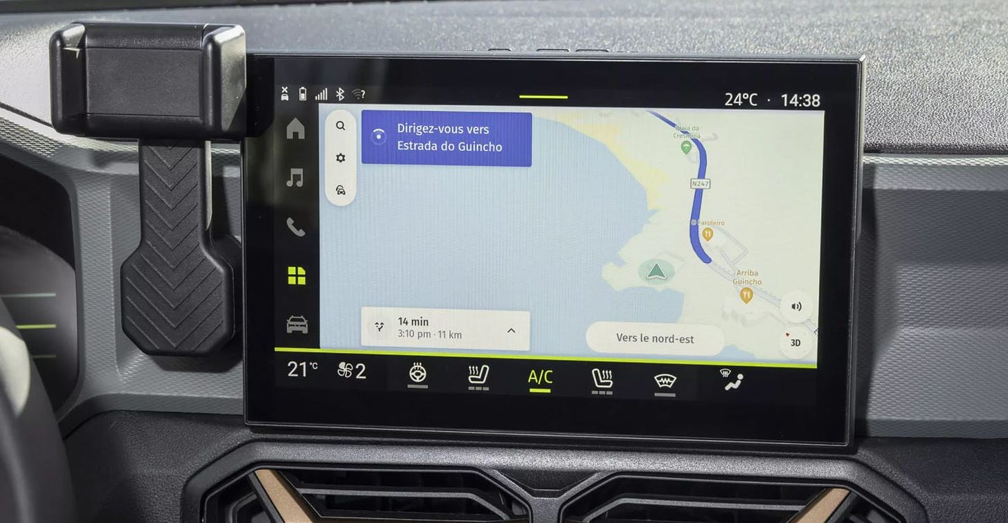
HERE Technologies has announced that Renault brand Dacia has selected HERE Navigation to power the new Duster, sport utility vehicle and New Spring electric car. HERE Navigation is a cloud-based navigation application for connected vehicles.
Duster and New Spring drivers will now have automotive-grade maps, online and offline search, real-time traffic information, and turn-by-turn voice guidance in an easy-to-use interface, the company said. The application’s over-the-air update capabilities offer drivers fresh map content and latest service updates, the company said.
Contact: Sebastian Kurme, HERE Technologies, 49 173 515 3549,
sebastian.kurme@here.com.
Geotab Partners With EROAD To Provide Solutions to Fleet Managers
Geotab has partnered with New Zealand-based EROAD to provide fleet management solutions for businesses across Australia and New Zealand. The partnership's first product is the launch of EROAD Locate telematics solution for light commercial vehicles.

The product will be introduced in New Zealand and Australia, targeting fleet operators who need a solution to track and manage their vehicles, the company said. Geotab's partnership with EROAD, which is one of the largest telematics providers in the Australia and New Zealand markets, seeks installations with estimated 800,000 light commercial vehicles in those countries, the company said.
Contact: Geotab, www.geotab.com/au.
Topcon Positioning Systems Expands Topnet Live
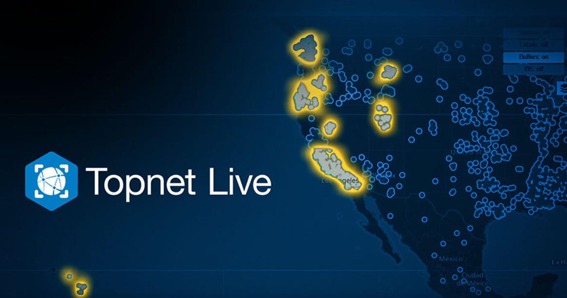
Topcon Positioning Systems has expanded its reference station service, Topnet Live, to California, Hawaii, Oregon, Nevada, Utah and Washington. This brings a total of 180 full-wave geodetic reference stations added to the network, the company said.
The network corrections offer centimeter accuracy for high-end engineering, surveying, construction and agriculture measurement and guidance systems, the company said. The service is used for such markets as turf industry, for automated mowing and input applications, line marking and imaging, as well as UAV operation for mapping and delivery.
Contact: Staci Fitzgerald, Topcon Positioning Systems, (925) 245-8610, corpcomm@topcon.com.
Rand McNally Introduces Practical AI
Rand McNally has rolled out its Practical AI framework within its SafetyDirect solution that uses machine learning to analyze driver and vehicle performance data. Practical AI features an Automated Event Ranking that classifies and prioritizes safety events, the company said. AER leverages data collected from proprietary onboard ADAS systems, ranking safety events—such as sudden braking, lane departures, and other driving behaviors—based on their severity, the company said.
Contact: Rand McNally, www.randmcnally.com/for-the-fleet.
Kia Launches CarPay and Partners With Parkopedia for In-Car Parking Payments
Kia has launched CarPay in-car payment service that enables customers to pay for items and services from inside the vehicle, starting with the EV3, the company said. The first application available will be with Parkopedia, which will allow European users to locate available parking and pay for it conveniently through the vehicle’s navigation screen.
Parkopedia services, available in 19 European countries, are integrated into vehicle navigation systems for seamless operation and help drivers to find the nearest available parking spot at their destination, the company said. The EV3 and all future Kia models will feature CarPay.
Contact: Adam Calland, Parkopedia, 44(0)7838219129, adam.calland@parkopedia.com, https://business.parkopedia.com.
Airista Awarded Asset Tracking and Management Solutions Contract With Premier
Real-time location services provider AiRISTA has been awarded a national group purchasing agreement for asset tracking and management solutions with healthcare company Premier. The agreement allows Premier members to receive special pricing and terms for AiRISTA's suite of RTLS hardware and software solutions, the company said. The agreement also provides discounted prices for hardware and software products provided by AiRISTA.
Contact AiRISTA, salesinfo@airista.com.
Create a FREE ManyMe Account.
Suntech Launches ST4410G Carton Box Tracker
Suntech International USA has expanded its tracker portfolio with the ST4410G carton box tracker. Use cases include cargo tracking, recovery and real-time visibility on shipments, supply chain and more, the company said.
This device, manufactured in South Korea, has already shipped with Suntech do Brasil and Suntech México. The company says the certified device is going to be launched for the North American market.
Contact: Tim Newburg, Suntech USA, tnewberg@suntechus.com, www.suntechus.com.
Kontakt.io Launches New Mobile Apps for Hospital Asset Tracking
Kontakt.io has introduced two new mobile applications to help hospitals cut time responding to staff duress alerts and expedite equipment searches for patient care, the company said. With the Kio Staff Safe Alerts mobile app, security personnel can receive alerts triggered by the wearable BLE staff badge. The Kio Nurse mobile app helps caregivers and biomedical teams locate any asset with a live map view.
Contact: Olivia Wang, Kontakt.io, x.wang@kontakt.io.
Disrupt-X and ORBCOMM Partner on IoT Services
Disrupt-X has partnered with ORBCOMM to integrate ORBCOMM’s IoT services into the ALEF platform. The platform will now have added asset tracking, monitoring, and remote management.

Disrupt-X allows ALEF users to monitor assets in real-time and manage them remotely, even in areas with poor cellular connectivity, the company said. The partnership was signed at Gitex Global 2024 in Dubai this month.
Contact: ORBCOMM, www.orbcomm.com.
Arduino Partners With Truesense
Arduino has partnered with Truesense to integrate Truesense’s UWB technology for smart IoT and industrial real-time tracking systems capabilities into its hardware products, software solutions, and cloud services. “We are combining the accuracy and secure ranging of our UWB technology with the leading open-source ecosystem, to provide developers with powerful tools to quickly build robust smart IoT and industrial real-time tracking systems,” said Armando Caltabiano, Truesense CEO, in a statement.
Contact: Truesense, info@truesense.it, www.truesense.it.
Teledyne Geospatial Rolls Out Coastal Mapping Solution
Teledyne Geospatial will launch its Fathom coastal mapping solution at HYDRO 2024, in Rostock-Warnemünde, Germany, November 5-7. Fathom features a lidar sensor for deep and shallow water bathymetry.

Fathom also includes a built-in topographic lidar and a multispectral camera for coastal survey at a coverage of 50 km2/per hour.
Contact: Jennifer Parham, Teledyne Geospatial, jennifer.parham@teledyne.com.
People
Drone company ZenaTech ZENA 0.00%↑ has named Philander Franklin, vice president of business development for the Americas. Simon Henry was named vice president of business development for EMEA and Steve Rhode was appointed director of software sales and customer support.
Ericsson ERIC 0.00%↑ announced that MajBritt Arfert, the company’s chief people officer, will step down at the end of May 2025.
Roger Lanctot has started a new position as an advisor at Mavi - OnMyWay Commerce.
LoRa Alliance has announced the appointments of Alper Yegin as CEO and Olivier Beaujard as board chair.
Cambridge Mobile Telematics has appointed Eric Notteau as senior director for Spain and Portugal.
Brett Kruger has been named manager, safety critical systems at Hexagon's Autonomy & Positioning division.
Jobs
Associate Manager of Marketing Operations. Trimble.
Strategic Marketing Manager. Trimble.
Mobile Mapping Sales Consultant. KOREC Group.
Product Manager - Maps and Location Referencing. TomTom.
Product Manager - Analytics. TomTom.
Click HERE to Join our growing Location Business News LinkedIn Group!

