Google To Pay Nearly $40 Million Over Deceptive Location Tracking
Company has paid more than $500 million in location tracking fines
In another fine over misleading location tracking practices, Google GOOG 0.00%↑ will pay $39.9 million to Washington state. In addition, the company will be held to court-ordered reforms “to increase transparency” over its location tracking settings.
“Google denied Washington consumers the ability to choose whether the company could track their sensitive location data, deceived them about their privacy options and profited from that conduct,” said state Attorney General Bob Ferguson, in a statement. “Today’s resolution holds one of the most powerful corporations accountable for its unethical and unlawful tactics.”
As Location Business News reported in November, Google agreed to pay $391.5 million to settle a multistate investigation into allegations it tracked user locations without their permission. That investigation, led by Oregon and Nebraska with 38 other state attorney generals, found that Google mislead its users to think they had turned off location tracking features on their smartphones. However, the user location data was stored and then used for Google’s lucrative ad business.
Google, which has made nearly $150 billion from advertising, uses consumer data to sell its ads. “Consequently, it has a financial incentive to dissuade users from withholding access to that data,” said a Washington state press release.
Washington was initially part of the larger multistate effort, but independently filed its own lawsuit, which led to more than double the amount it would have received from the earlier settlement, according to a state news release. The state of Arizona also filed independently and reached an $85 million settlement with Google last October.
Google didn’t make comment on this most recent fine, but pointed reporters to its statements from November.
Expert nationwide installation services for fleet technologies.
Hexagon and Hitachi Zosen To Provide Terrastar-X Enterprise Corrections in Japan
Hexagon’s Autonomy and Positioning division and Hitachi Zosen have announced an agreement to launch the TerraStar-X Enterprise correction service in Japan. Among other applications, TerraStar-X Enterprise will provide lane-level accuracy for automotive and consumer markets in the country, the company said.
Hitachi Zosen, which is a large Japanese GNSS player, offers a network of 1,300 reference stations operated by the Geospatial Information Authority of Japan (GSI). As part of the deal, Hitachi Zosen subsidiary, Nippon GPS Data Service (NGDS), will provide Hexagon with GNSS data from the reference station network.

The data will allow Hexagon to offer services that are redundant and accurate, mainly for automotive applications that require high accuracy for safety, the company said. Currently, the service is available for testing the greater Tokyo area, but Hexagon said it will be expanded nationwide.
“Our collaboration with Hitachi Zosen and NGDS allows us the opportunity to expand our service offerings and better equip our automotive and consumer customers with access to TerraStar-X Enterprise across major markets,” said Sara Masterson, director of positioning services at Hexagon’s Autonomy and Positioning division, in a statement. “Our testbed in Japan is available to technology partners wanting to experience the high performance from TerraStar-X in their advanced driver assistance systems, smartphone applications, micromobility or safety-critical applications.”
Hexagon has operational testbeds for TerraStar-X Enterprise in various locations throughout North America, Europe and China, the company said.
Optimize your Sales Strategy with Apollo
Search, engage and convert over 250 million contacts at over 60 million companies with Apollo’s sales intelligence and engagement platform.
Porsche Offers Apple Maps EV Routing
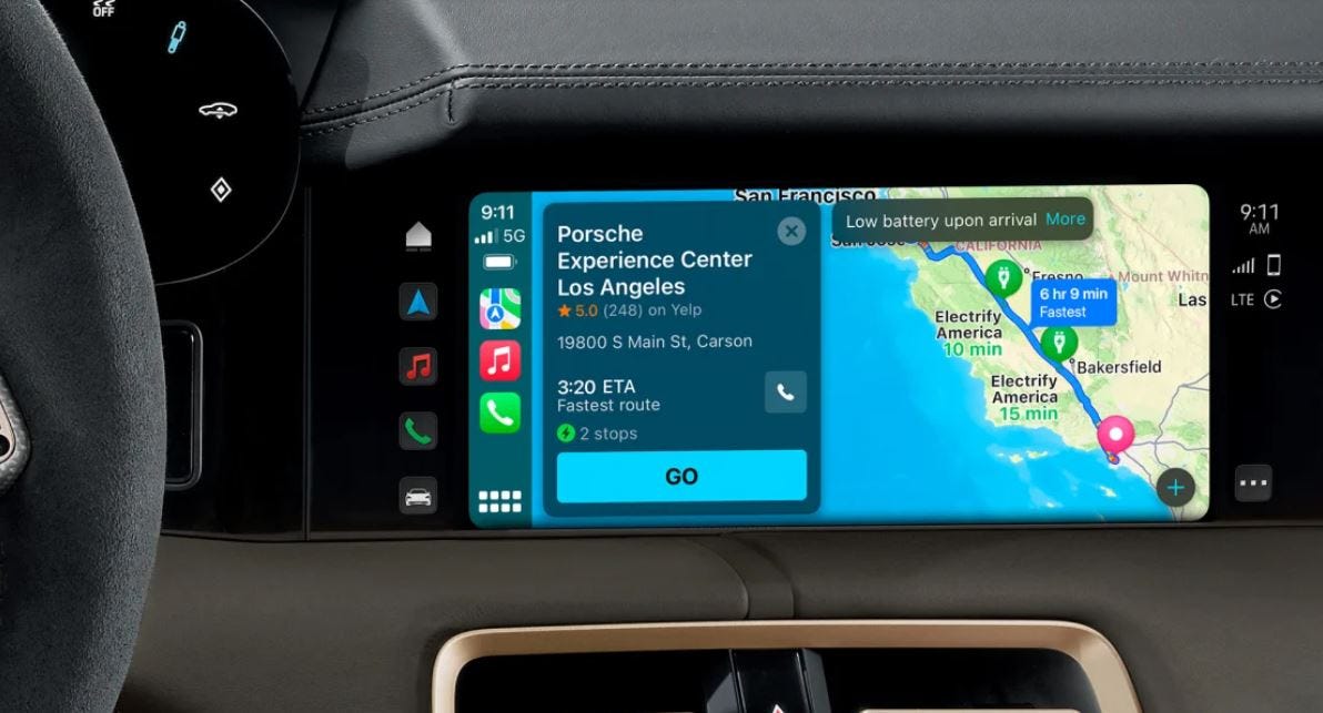
U.S.-based Porsche Taycan owners can now use Apple Maps EV Routing to navigate and route-plan within Apple CarPlay. Drivers no longer have to exit the CarPlay ecosystem to plot a route—to include charging stops, the company said.
Because every Taycan comes with a Porsche Charging Planner, users can optimize stops based on anticipated state of charge (SOC) upon arrival, traffic conditions and average speed, the company said.
Apple Maps EV routing also uses real-time vehicle information to recommend charging stops along a route. This includes analyzing elevation changes along a route to find charging stations, the company said.
Apple, which first announced EV Routing at its WWDC 2020 conference, initially announced Ford F 0.00%↑ and BMW as partners. However, while Ford rolled out the capability on its Mustang Mach-E last year, BMW has not launched EV Routing on any vehicles, according to published reports.
Apple Maps EV routing works for users with the latest My Porsche app on an iPhone.
FCC Allows Short-Range Radars in the 60 GHz Band
The U.S. Federal Communications Commission has adopted new rules that allow the 60 GHz spectrum band to support such radar technology applications that alert drivers to children left in dangerously hot cars, improving mobility and health by detecting hand gestures and respiratory functions. In addition, the new rules can assist drones in construction, emergency rescue and commercial settings, the agency said.

FCC said that the new rules will accelerate the time for devices to reach the marketplace for use by consumers and in commercial applications. Other users in the 60 GHz band include unlicenced indoor/outdoor communication devices that support the WiGig standard and wireless local area networking devices.
The federal agency’s new rules allows operations beyond what it refers to as “limited types of permissible uses.” Previously, the FCC had issued target waivers to permit such applications as “hot car” monitoring for children in vehicles.
Get smarter in 5 minutes with Morning Brew (it's free)
There's a reason over 4 million people start their day with Morning Brew - the daily email that delivers the latest news from Wall Street to Silicon Valley. Business news doesn't have to be boring...make your mornings more enjoyable, for free.
Other Location News:
News tip? Send them to kdennehy@driverlessreport.com. Go to www.locationbusinessnews.com for more news and an archive of stories.
Top News:
🛰 New Beidou Satellite Launches Into Orbit. China launched a Long March 3B rocket last week to transport a satellite into space for the country's Beidou Navigation Satellite System.
🌑 CAPSTONE Takes Moon Shot, Successfully Tests Navigation Technology. “CAPSTONE successfully tested a navigation technology akin to Earth’s GPS for the first time in May, advancing a capability that could help future space missions more efficiently navigate at the Moon.”
👍 ISRO to Launch NVS-01 Navigation Satellite on May 29.
🚜 Tractor Maker Deere's Future in Precision Agriculture Hinges on Space-Based Connectivity. “The company, like competitors CNH Industrial CNHI 0.00%↑ and AGCO AGCO 0.00%↑, has been investing in precision agriculture using sensors, software and data analytics.”
💰 Viasat's Proposed Acquisition of Inmarsat Receives U.S. Federal Communications Commission Approval. “The FCC's decision leaves the European Commission's (EC) competition review as the key ongoing regulatory process in relation to the transaction.”
🤞 Imperial College Working With Royal Navy on Groundbreaking System To Replace GPS on Ships. “A new quantum compass that could replace GPS on ships has been tested on water for the first time”
🚀 Iridium Adds to Constellation Resilience with Launch of Spare Satellites. Iridium IRDM 0.00%↑ has announced it launched five spare satellites.
🙂 NGA to Map Lunar Geography To Enable GPS on the Moon. “The National Geospatial-Intelligence Agency is working with NASA to develop a positioning and navigation system to guide visitors around the surface of the moon.”
Maps:
🌎 Mapillary and Overture Maps Foundation are Partnering. “We recently updated the Mapillary terms to permit the use of Mapillary to develop, edit, and contribute content to the interoperable open map data project Overture Maps Foundation alongside OpenStreetMap.”
🏬 Omborigrid Partners With Pointr To Offer Store Mapping Solutions. “Pointr uses a combination of AI and computer vision to analyze CAD files of a store and automatically convert that into a digital map. Once the map is created, it can easily be repurposed for many different devices and use cases, this can include voice or touchscreen kiosks or mobile apps.”
📱 New Mapbox Route Notifications. “The new route notifications option in the Mapbox Directions API makes it easier for developers to add important safety features to their applications, including safety insights, road suitability checks, and detailed communications about route changes.”
😐 ZF Joins the Navigation Data Standard Association. “Joining NDS enables ZF to contribute to the global standard for digital map data needed for a wide range of digital mobility applications.”
Reach nearly 15,000 subscribers and 70,000 more via social media by advertising in Location Business News!
We can promote your webinar, service or product to a focused group of industry executives. Email us at info@driverlessreport.com for more information, or click here to view our one-page media kit.
Indoor Positioning:
Collaboration Between Indoor Positioning Solution TDK VENUE and Ugo. “TDK’s indoor positioning solution VENUE can track people and objects in indoor environments where GPS/GNSS signals are unavailable.”
Connected and Autonomous Vehicles:
🚑 V2X Activation Equips 1.8 Million Stellantis Vehicles with Emergency Vehicle Alert System. “More than 1.8 million Chrysler, Dodge, Ram and Jeep vehicles in the United States and Canada give drivers in-vehicle notification of an active fire truck, ambulance or other nearby roadway hazards with the Emergency Vehicle Alert System (EVAS) feature of the Uconnect connected vehicle platform.”
🚘 Waymo's Self-Driving Cars Will Be Available on Uber's App, Starting in Phoenix. “Waymo, Alphabet’s GOOGL 0.00%↑ self-driving unit, has agreed to a multi-year strategic partnership with Uber UBER 0.00%↑that will see some of Waymo’s autonomous vehicle technology join Uber’s platform.”
🚙 Ford's Level 3 Driver-Assist Feature Won't Be Able To Handle Busy City Streets Anytime Soon. “BlueCruise, Ford’s F 0.00%↑hands-free driver-assist system, will be available in 500,000 vehicles by 2024. And a Level 3 system, which is also called conditional or unsupervised autonomy, will be first available in Ford’s next-generation EVs.”
Drones:
🛩 Amazon's 100 Drone Deliveries Puts Prime Air Far Behind Alphabet's Wing and Walmart Partner Zipline. “Nearly a decade after announcing grand plans for 30-minute drone delivery of items up to 5 pounds, Amazon AMZN 0.00%↑ told CNBC it’s now completed just 100 deliveries in two small U.S. markets.”
😮 Ukraine Is Losing 10,000 Drones a Month to Russian Electronic-Warfare Systems. “Sophisticated Russian systems such as the Shipovnik-Aero jamming station are hard to detect and can imitate other signals”
Marine Tracking:
🚢 Spire Global and BlackSky Partner to Provide Maritime Custody Service. Spire SPIR 0.00%↑ and BlackSky BKSY 0.00%↑ have developed a Maritime Custody Service (MCS) that can detect, identify and track more than 270,000 vessels worldwide.
Financial:
💲 CEO Austin Russell Just Made a Big Bet on Luminar Stock. “Luminar LAZR 0.00%↑CEO Austin Russell purchased 1.3 million shares of company stock.
✔ Ituran Presents Its First Quarter 2023 Results.
Compliantly hire anyone, anywhere, in 5 minutes with Deel
Deel is your one-stop shop for hiring, paying, and managing your remote team. We stay on top of local labor laws across the world to ensure compliance and mitigate risk so that you don't have to.
Location Industry Briefs
Send your news releases to kdennehy@driverlessreport.com. Go to www.locationbusinessnews.com for more news and an archive of stories.
TomTom and Alteryx Launch New Location Intelligence Offering
TomTom (TOM2) has announced an expanded partnership with Alteryx to integrate TomTom’s Maps APIs into Alteryx products and location insights packages. These include the Alteryx Designer and the newly launched Location Intelligence offering on the Alteryx Analytics Cloud Platform.
Alteryx uses TomTom’s location data and Maps APIs to incorporate spatial data into its analytics tools, the company said. Integrated TomTom data amplifies analysis by adding more than 50 layers of cartographic data, such as roads, waterways, parks and more, the company said.
Contact: TomTom, mediarelations@tomtom.com, www.tomtom.com.
Commsignia and Mitsubishi Electric Partner on V2X Solutions
Commsignia and Mitsubishi Electric Corp. have announced a partnership to deliver Vehicle-to-Everything (V2X) technology that combines Commsignia's V2X solution and Mitsubishi Electric's High-Definition Locator (HDL) technology. This integration will go into a V2X platform that will support autonomous-driving and advanced-driver-assistance systems (ADAS). Mitsubishi Electric is mass-producing HDL systems that accurately determine vehicle locations based on proprietary high-precision positioning and mapping data, the company said.
Contact: Mitsubishi Electric Corp., prd.gnews@nk.mitsubishielectric.co.jp, www.mitsubishielectric.com.
Combain Introduces AI Indoor Positioning Solution and AR Indoor Survey App
Combain has announced the launch of its AI Indoor Positioning solution and an augmented reality (AR) Indoor Survey app. The Combain AI indoor positioning solution combines advanced machine learning algorithms with sensor fusion technology to provide accurate indoor location information, the company said.
The Combain AR Indoor Survey app leverages augmented reality technology to streamline the collection of training data for the AI indoor positioning system, the company said.
Contact: Andreas Ekengren, Combain, 46 722 059 680, andreas.ekengren@combain.com, www.combain.com.
Transflo and Assured Telematics Merge
Transflo has announced a merger with fleet management provider Assured Telematics to deliver an end-to-end solution suite and a connected technology ecosystem. Transflo offers focused mobile and cloud-based technologies that manage more than 208 million mobile communications each year and digitize more than 800 million shipping documents annually, the company said.
ATI offers advanced telematics and analytics solutions, including comprehensive data insight modules for customers ranging from large truckload fleets, government fleets, utility, and construction companies, the company said.
Contact: Laura Sayers, Transflo, (713) 419-2381, Laura.Sayers@transflo.com, www.transflo.com.
Safran Announces New Version of Skydel Software
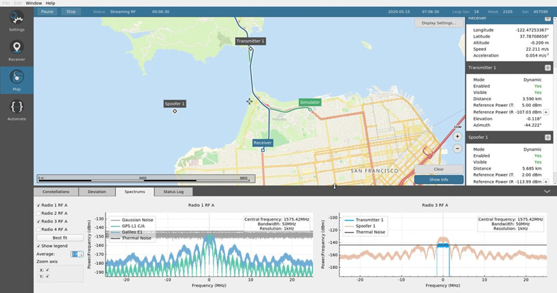
Safran Electronics & Defense has announced the newest version of its Skydel software for GNSS simulations. Skydel version 23.5 can generate a high capacity of signals – with all the constellations and multiple frequencies – from a single workstation, the company said.
The new version offers GPU memory access improvements for GNSS users, experts, manufacturers and those looking for an LEO-capable simulation system, the company said. Finally, this version provides a new BeiDou signal (B3I), as well as improved support for that constellation, the company said.
Contact: Charles Jones, Safran Navigation & Timing, charles.jones@nav-timing.safrangroup.com, www.safran-group.com.
G+D Acquires MECOMO
Giesecke+Devrient (G+D) has acquired MECOMO AG, a specialist in tracking and tracing solutions. MECOMO, based in Munich, Germany, is a software systems house that provides end-to-end telematics solutions for industrial and logistics enterprises.
Through the acquisition of MECOMO, G+D becomes an IoT solution provider with a portfolio for customers in the transportation and logistics sector, the company said. Financial details were not disclosed.
Contact: Christoph Lang, Giesecke+Devrient, 49 89 4119-2164, christoph.lang@gi-de.com.
Ouster Expands Supply Agreements With May Mobility
Ouster OUST 0.00%↑ has expanded its supply agreements with May Mobility to provide lidar sensors for May Mobility’s autonomous vehicles. These expansions include a commitment for a combined purchase of more than one thousand Ouster OS1 and Alpha Prime VLS-128 sensors through 2024.
Ouster has shipped hundreds of sensors to May Mobility for its commercial programs, the company said. In addition, May Mobility’s vehicles are outfitted with four Ouster OS1 digital lidar sensors for short and mid-range detection and one Alpha Prime sensor for long-range detection, the company said.
Contact: Heather Shapiro, Ouster, press@ouster.io, www.ouster.io.
Hexagon-Novatel Announces 7.09.00 Firmware With PTP Functionality
Hexagon-NovAtel has announced the general release of 7.09.00 firmware providing the Precise Timing Protocol (PTP) feature to enable users to synchronize accurate time from GNSS with other devices and sensors on a shared network. The new PTP feature brings GNSS stable timing to a user’s other sensor systems connected through a local network to best support positioning, navigation and timing (PNT) and automotive and autonomous applications, the company said.
Contact: Jessica Fielding, Hexagon’s Autonomous & Positioning, (403) 295-4958, jessica.fielding@hexagon.com, hexagonpositioning.com
Create a FREE ManyMe Account.
HawkEye 360 Begins Manufacturing of Satellite Clusters 12 and 13
Space Flight Laboratory (SFL) announced HawkEye 360 has initiated manufacturing of the 12th and 13th Clusters of its radio frequency geolocating microsatellite constellation. The six satellites are being built on SFL’s 30-kg DEFIANT platform at the HawkEye 360 facility in Virginia under the SFL Flex Production program, the company said. In April 2023, the organizations launched and deployed Cluster 7, the first three satellites integrated in-house by HawkEye 360.
Contact: Robert Zee, SFL, (416) 667-7400, info@utias-sfl.net, www.utias-sfl.net.
RoboSense Joins NVIDIA Omniverse Ecosystem
RoboSense has announced it is now connected to the NVIDIA Omniverse ecosystem, using the development platform based on Universal Scene Description (USD) to accelerate the development, testing, and validation of its sensor technology. RoboSense's second-generation smart solid-state lidar model is integrated into NVIDIA DRIVE Sim.

DRIVE Sim is a reference application built on NVIDIA Omniverse, the connecting fabric between software ecosystems, the company said. RoboSense will use the simulation platform to test and validate its new lidar systems—as well as provide ADAS developers access to simulation models, the company said.
Contact: Grace Ye, RoboSense, media@robosense.ai, www.robosense.ai.
Esri Opens New Saint Louis Office in Emerging GEOINT District
Esri will open a Saint Louis office in the Globe Building at the center of downtown's burgeoning Innovation District. Esri will join Maxar Technologies, General Dynamics, T-Kartor USA, and Ball Aerospace within the Globe Building. Downtown Saint Louis is poised to become a national hub for geospatial intelligence (GEOINT) as construction of the $1.75 billion National Geospatial-Intelligence Agency (NGA) campus is scheduled to be completed in early 2026, the company said.
Contact: Jo Ann Pruchniewski, Esri, (301) 693-2643, jpruchniewski@esri.com, www.esri.com.
Continental Integrates Imagery's Autonomous Driving Technology to Support Automated Parking
Imagery has announced that Continental [CTTAY] will integrate part of its technology in the Continental Autonomous Driving (AD) platform offering for passenger vehicles. The first feature, autonomous parking, allows the vehicle to explore a parking lot, detect a suitable parking space, and park the vehicle all without the driver touching the steering wheel, the company said. Imagery's Motion Planning layer will be used to draw upon learned behavior to navigate new roads independently, the company said.
Contact: Imagry, www.imagry.co.
InfiniDome Wins 1st Place AUVSI XCELLENCE Award
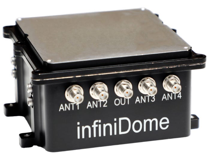
InfiniDome has been named the 1st place winner in the Technology category of the XCELLENCE Awards by the Association for Uncrewed Vehicles Systems International (AUVSI). InfiniDome was selected for its work in uncrewed systems technology.
InfiniDome’s GPSdome2 protects GNSS systems from jamming in such platforms as UAV, UGV, and USV, the company said.
Contact: InfiniDome, info@infinidome.com, www.infinidome.com.
JAVAD GNSS Opens Kentucky Facility
JAVAD GNSS has opening a Fort Wright, Kentucky, facility that will create as many as 20 engineering positions. The facility will focus on research, development and engineering design for satellite navigation and will be a creative center for professional engineers in firmware development and electronic design, the state said. The new Fort Wright office will accelerate product development and R&D while tapping engineering graduates from the local universities to stimulate creativity and new technology adoption, according to the state.
Contact: JAVAD GNSS, javadgnss.com.
Trimble Announces Formula 1 Exec as Keynote Speaker
Trimble TRMB 0.00%↑ has announced that Formula 1's Mark Gallagher will be its keynote speaker for the 2023 Insight Tech Conference + Expo, which will be held September 24 – 27 at The Venetian in Las Vegas. Gallagher, a long-time Formula 1 executive, has held senior roles in the high-performance environment of F1 motor racing for more than 30 years. The 6th annual Insight Tech Conference + Expo is expected to bring in more than 1,500 industry attendees.
Contact: Trimble Transportation, www.transportation.trimble.com.
People
Shelby Noakes has been named chief revenue officer (CRO) at GPS Trackit.
Pointr has named Mehmet Arikkan as vice president, engineering.
Safran Timing Technologies has named Cyril BOISSY as sales director. Boissy joins the company from SYRLINKS.
Iridium IRDM 0.00%↑ Jacqueline Yeaney has been elected to the company’s board of directors.
Wiliot has appointed Antony Yousefian as vice president of Climate & Circularity.
Your partner in global employment
Over 1000 companies are hiring, paying, and taking care of their team members all over the world with Oyster’s all-in-one global employment platform.
Jobs
Esri Careers. Esri.
Regional Sales Manager. Trimble.
Strategic Sales Manager- (Automotive). TomTom.
Global Partnerships Manager. Garmin.
Head of Commercial Sales - The Americas. Advanced Navigation.
Sr Product Owner Manager (Leadership). HERE Technologies.
Click HERE to Join our growing Location Business News LinkedIn Group!


