Mercedes-Benz First To Offer Level 3 Autonomous Driving For Sale in US
Two types of sedans come with Drive Pilot that doesn’t require users to keep eyes on road
Mercedes-Benz has become the first automaker to offer Level 3 autonomous driving technology to U.S. consumers. Both the EQS and S-Class sedans have a Drive Pilot feature that costs $2,500 for a year’s subscription.
While Mercedes’ Level 3 cars have been sold since December, and only in California and Nevada, there are a bunch of restrictions, according to Fortune magazine. These include operating on specific roads in both states during the daytime and clear weather, at speeds less than 40 mph, and cannot be operated in construction zones.
Still, Mercedes, which rolled out the Drive Pilot-equipped cars in Germany two years ago, has beaten its competition, namely Tesla TSLA 0.00%↑ to the market in one way. The company’s Drive Pilot doesn’t require users to keep their eyes on the road—which Tesla’s Full Self-Drive data requires.

One of the features Mercedes touts is its “high-precision positioning system that is much more powerful than conventional GPS systems.” The company said it can determine positon of a vehicle within inches. Other features include lidar, camera, radar and ultrasonic sensors, and a HERE Technologies digital HD map to provide a three-dimensional image of the road and the surroundings.
Not everyone is a fan of the Mercedes Drive Pilot program—and that includes its maps. “Mercedes Drive Pilot is limited to pre-selected roads due to its dependence on high-definition maps. So, even though Mercedes advertises it as a Level 3 autonomous driving system, it’s based on ‘dead-end’ technology that can’t evolve to Level 4 or 5 autonomous driving,” said Chris Piche, founder and CEO of Smarter AI. “Tesla Full Self-Driving has no such limitations. It’s designed as a fully autonomous level 4/5 system, which currently operates under customer supervision as a Level 2 system. And because it runs on any road, FSD collects real-world data which Tesla uses to continuously improve its AI models.”
Piche believes that for full autonomous driving to be a reality in 10 years, it requires robust AI systems that can navigate diverse road and traffic conditions without human intervention. “This entails real-world data collection to train and improve AI models. Unlike systems limited by pre-defined maps, full autonomy depends on adaptable algorithms that can learn and evolve from real-world experience, like Tesla's Full Self-Driving approach,” he said. “Additionally, regulatory frameworks must evolve to ensure safety while promoting innovation in autonomous vehicle technology.”
Expert nationwide installation services for fleet technologies.
Millions in Lawn Mowers? u-blox Anticipates $100 Million in Sales
Saying it has partnered with the majority of robotic lawn mower manufacturers, Thalwil, Switzerland-based u-blox anticipates more than $100 million in expected market segment revenue. The company says the sales, starting this year, are because of the strong presence of GNSS technology in robotic lawn mowing.
“Achieving centimeter-level accuracy in GNSS broadens the possibilities for implementing this technology across multiple markets. I am confident that we’ll witness a growing adoption of high-precision positioning technology in various products,” said Stephan Zizala, u-blox CEO, in a statement.
The company said that the development of real-time kinematic (RTK) GNSS systems, capable of delivering centimeter-level accuracy, have significantly increased the performance of robotic lawn mowers. The precise positioning and navigation eliminate the need for boundary wires, ensure systematic mowing without overlap, provide even mowing and desired patterns while protecting sensitive areas like flowerbeds from accidental damage, u-blox said.
Overall, the robotic lawn mower market is expected to reach 2.6 million units this year—and grow by 18.5 percent in the next few years, according to an ABI Research report that was quoted by u-blox. The company believes that there will be a 33 market robotic lawn mower penetration rate for GNSS technology by the end of the decade.
The D-Day Visitor's Handbook: Your Guide to the Normandy Battlefields and WWII Paris by Kevin Dennehy and Steve Powers. The D-Day Visitor’s Handbook includes everything you need to know to plan and make your visit to the site of the biggest seaborne invasion in history. This compact guidebook not only describes the most significant land invasion of World War II, but provides detailed battlefield maps and tours, identifies monuments and attractions, and locates museums and historical sites to make your planning easier and less stressful.
The guidebook uses location technology from what3words to locate monuments, museums and other attractions. Get your guidebook today!
TomTom Tops Counterpoint’s Location Applications and Services Rankings
Saying HERE Technologies and Google GOOG 0.00%↑ have slipped into second and third place, respectively, TomTom [TOM2] came out on top in Location Applications and Services category of Counterpoint’s latest Location Platform Effectiveness Index.
The index analyses the capabilities and performance of more than 25 of the world’s major location and mapping players, Counterpoint said. TomTom led in real-time traffic, navigation, routing and infotainment, while HERE was first in tracking and positioning, and EV Services, according to the report.
Google placed first in its consumer app segment as “Google Maps remained the undisputed leader for navigating from point A to point B, locating businesses or finding points of interest in a specific locality,” the company said.
In infotainment categories, TomTom led the other companies with its Digital Cockpit modular infotainment software platform, Counterpoint said. “This allows TomTom to offer the full IVI stack to automakers in one complete solution that powers navigation, voice assistant, location search and more. Google is the closest competitor that offers an entire IVI stack to carmakers, but the solution is not open or as flexible,” the company said. “HERE opted for a different strategic path and chose not to develop an infotainment platform.”
Other Location News
News tip? Send them to kdennehy@driverlessreport.com. Go to www.locationbusinessnews.com for more news and an archive of stories. Location Business News is looking for your company’s product use cases to feature in each issue. Send us five paragraphs and an image/photo for consideration. Include a contact name, phone, email and web address.
Top News:
🏛 GM, Onstar, and LexisNexis Deny Sharing Personal Data, Telematics Without Customer Permission. “The suit, which has been filed seeking class action certification, alleges the companies invaded Romeo Chicco’s privacy by compiling ‘erroneous reports of derogatory and negative driving information made without Plaintiff’s knowing consent.’”
✈ Russia Is Constantly Targeting Our Planes, Pilots Say – Here's How It Happens. “Even if you were to ask a tech expert how jamming or spoofing is done they wouldn’t be sure,” says Nick Eades, who was the world’s most experienced Boeing 747 pilot when he retired in 2022. “The Americans who look after the GPS system look at ways to prevent it from happening, but in a few weeks the people behind it will have found another way to corrupt the signals.”
🛩 U.S. Marine Corps to Buy $249 Million Worth of "Organic” Kamikaze Drones. “Several kinds of loitering munitions are currently in use, but more are being developed all over the world. A company called AeroVironment, for instance, has in its portfolio something called the Switchblade 300 Block 20.”
💲 Droneshield Lifts Capital Raise to $105M as Investors Flock to Defense Tech. “The Sydney-based company plans to use $80 million of the funds to build up inventory so it can capitalize on customer opportunities, with equipment ranging from from handheld detection and defeat systems to its DroneSentry-X Mk2 offering that can be mounted onto vehicle roof racks to both detect and take down drones.”
🌍 Maxar Closes in on the Launch of its WorldView Legion Satellites. “3D mapping: “Maxar has been building highly precise 3D data and these 3D globes for a while,” said GM Susanne Hake. “Collecting more imagery means we can actually refresh those 3D layers much more often.”
🏔 Many of Colorado's Favorite 14ers Just Had Their Elevations Changed. The GDS measured the height of Colorado’s 58 peaks of 14,000 feet or higher with high-tech GPS technology, down to fractions of feet, and it released its findings. No peaks were added to the list, and none lost their standing as fourteeners, but their rankings were shuffled.
🌍 Netstar Unveils Largest Real-Time Vehicle Telematics Bureau in Africa.
Maps:
📱 How This Google Maps Rival Tries to Copy Waze's Number One Feature. “The best example of a partially failed attempt at building a Waze rival is Apple AAPL 0.00%↑ The iPhone maker brought incident reporting to Apple Maps, allowing users to report accidents, speed traps, and other generic hazards. The feature is yet to take off, mainly because it's only available in limited regions, and Apple Maps is exclusive to iPhones (whereas Waze runs on iPhone and Android).”
👍 Forget GPS, Three Simple Words Reveal Any Location in the World. “The app recently teamed up with BMO Stadium in Los Angeles – home of the Los Angeles Football Club – to publish specific what3words addresses for key locations such as gates, the team store, concession stands, and the box office.”
🌦 Mapbox Maps SDK Enables AccuWeather To Streamline Map Services. “AccuWeather recently revamped its maps to provide a more cohesive brand experience for consumer and enterprise users across all key platforms including web, iOS, Android and AccuWeather Enterprise Solutions. The Mapbox Maps SDKs helped streamline development cycles and enabled AccuWeather to consolidate from six different mapping providers to just one.”
The company also launched the general availability of Geocoding v6 – the latest and most iteration of Mapbox Geocoding API.
🚒 The 'Terrifying' Apple iPhone Feature Hardly Anyone Knows About - But It Could Save Your Life. “A young woman has revealed how Apple's 'confronting' crash-detection feature works by sharing the text she received when her sister was in a car accident. The 'very scary' text came from her sister's phone number and revealed her location on a map alongside an alert that she had been in a crash. 'Crash detected SOS. I called emergency services from this approximate location after iPhone detected a crash,' the automated message read.”
🗺 Apple Maps Who? Google Maps to Get Satellite Support, Making Rivals Feel Obsolete. “Google Maps beta version 11.125 includes code strings for an option allowing the user to connect to a satellite. The feature will allow users to update their locations every 15 minutes, albeit it can be used only five times a day. The limitations aren't surprising, considering that satellite connectivity isn't very convenient, but the feature could still be useful in an emergency.”

Webinar Promotion. Are you getting enough industry execs to sign up for your webinars? We’ve been promoting them for 15 years and know the ins and outs of webinar marketing. We will run a one-month campaign (with weekly reminders on our social media as the webinar gets closer). This includes ad placement in the newsletter, social media posts and a dedicated email blast to our subscribers. We really hit it hard on social media in the final five days as people always register at the last minute. Email us at info@driverlessreport.com for more information, or click here to view our one-page media kit.
Connected and Autonomous Vehicles:
💲 Tesla Cuts Price of Full Self-Driving Software by a Third to $8,000. “Tesla TSLA 0.00%↑ slashed the price of its Full Self-Driving (FSD) driver assistant software to $8,000 from $12,000 in the United States, as CEO Elon Musk reaffirms his commitment to self-driving technology.”
🙁 A 14-Year-Old Is Charged in Fire That Destroyed a Driverless Waymo Vehicle. “The district attorney’s office in San Francisco filed charges of vandalism against a teenager suspected in the February incident.”
🚗 Qualcomm Devises Cost-Effective ADAS Chip for India. “Unveiled recently, the Snapdragon Ride Flex SoC is a versatile technology designed to handle a diverse array of tasks, from powering digital dashboards to supporting advanced driver-assistance systems (ADAS) and automated driving capabilities.”
🚘 Applied Intuition and Luminar Partner to Accelerate ADAS and AD Development. “In a first step of the partnership, the companies will jointly provide the first validated sensor models of Luminar LAZR 0.00%↑ lidars, enabling automakers to test and validate ADAS and AD perception systems using Applied Intuition Sensor Sim.”
💰 Car Companies Can Generate $1,600 Per Car In Future From Connected Car Services. “This vast market includes cars that can give you cheaper digital insurances, navigate autonomously, manage energy requirements, and even function as a health kiosk.”
🙄 China-Germany Cooperation on Connected, Autonomous Cars Sets Good Example. This is <cough> propaganda…
😧 This Goofy Shirt Paralyzes Robotaxis:
Financial:
✔ Visteon Announces First Quarter 2024 Financial Results.
✔ Lockheed Martin Reports First Quarter 2024 Financial Results.
Location Industry Briefs
Send your news releases to kdennehy@driverlessreport.com. Go to www.locationbusinessnews.com for more news and an archive of stories.
Septentrio Partners With UAV Manufacturers
Septentrio is partnering with several major drone solutions providers, including 3DR, Holybro, ARK Electronics and Systork, to prototype or integrate its mosaic GNSS receiver into UAVs. The company, which exhibited at this week’s AUVSI Xponential conference, integrated GNSS products into Holybro H-RTK mosaic-H (dual antenna heading), 3DR mosaic-X5 CAN GPS, Systork Linnet mosaic-X5 and ARK mosaic-x5 GPS.

The Septentrio products offer UAV-centered features such as magnetometer, barometer or UAVCAN communication, the company said. The modules feature anti-interference technology AIM+.
Contact: Septentrio, www.septentrio.com.
Sequans Integrates Module Into Abeeway Tracker
Sequans Communications SQNS 0.00%↑ has announced that Abeeway has adopted its Monarch 2 GM02S module to provide low power cellular IoT connectivity for a new version of the Abeeway Compact Tracker. The tracker now combines LTE-M and NB-IoT connectivity from Sequans with GPS, Wi-Fi Sniffer, Bluetooth and LoRa technologies.
The Abeeway Compact Tracker is designed for heavy-duty tracking and provides ubiquitous indoor and outdoor geolocation with low power consumption, the company said. It provides real-time tracking and status monitoring of many types of industrial assets, including vehicles, machines, equipment, and livestock, and provides advanced geofencing and anti-theft features, the company said.
Contact: Kimberly Tassin, (425) 736-0569, kimberly@sequans.com, www.sequans.com.
HERE Publishes Annual Sustainability Report
HERE Technologies has announced its fourth Annual Sustainability Report, which highlights ESG initiatives that have been embedded in the company’s corporate strategy and business operations. The report shows that HERE deepened its work alongside global automakers and transportation and logistics companies on electric vehicle technologies, optimized route planning, fleet CO2 emissions reductions and improving road safety, the company said.

The report also summarizes how HERE made progress towards its net-zero emission target; strengthened its data security and privacy-by-design capabilities for customers; expanded employee workplace inclusion, diversity and community give back initiatives; and fortified company policies on ethical sourcing and supply chain best practices, the company said. The company in 2023 continued its collaboration with public sector agencies on traffic management, alongside passenger and commercial vehicle makers and mobility providers, to accelerate the adoption of electric vehicles (EVs), the company said.
Contact: Jordan Stark, HERE Technologies, (312) 316-4537, jordan.stark@here.com, www.here.com/about/sustainability.
Calian Partners With Point One Navigation
Calian Group is collaborating with Point One Navigation to offer Smart GNSS Antenna support for Polaris RTK. With the launch of its new ST Teseo V-based TW5387 Dual Band Smart GNSS Antenna, Calian will combine its antennas with Point One Navigation’s Polaris RTK service.
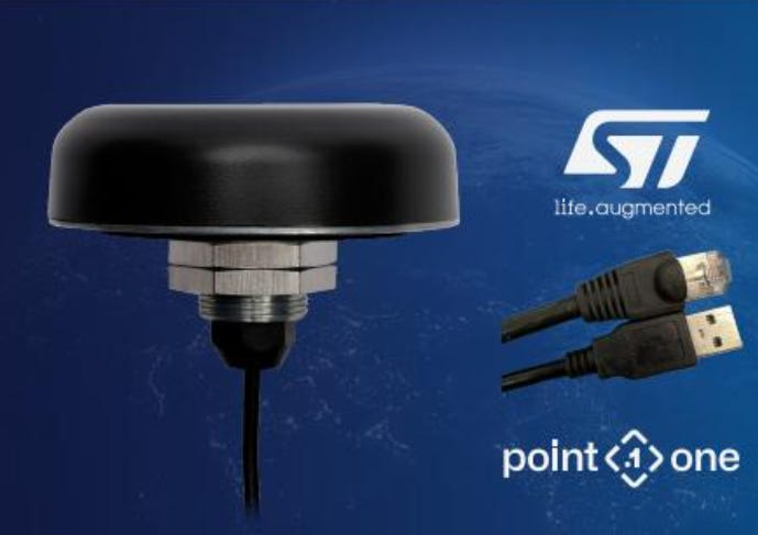
In other company news, Calian has launched three new antennas that support GNSS. The key new feature of the TW3000 XF family of antennas is the support for Galileo’s Global High Accuracy Service (HAS) and QZSS’s regional Centimeter Level Augmentation Service, the company said. The company said the antennas are tailored for unmanned autonomous vehicle navigation, land survey devices, automotive positioning, timing, and other precise positioning applications.
Contact: Calian Group, (343) 804-5333, www.tallysman.com.
Nissan Expands NissanConnect Services in Europe
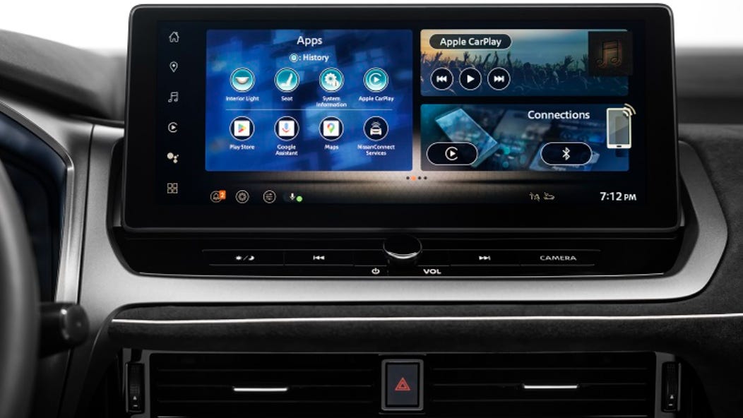
Nissan its next-generation NissanConnect services into Europe. Buyers of the refreshed Nissan Qashqai in Europe, can now experience an even more seamless and personalized experience, through the integration of services such as Google built-in, the company said.
The next-generation system features Google built-in, which allows drivers to use Google Maps and, once signed-in with a personal Google account, access their favorite locations and points of interest, the company said. With Google Assistant, drivers can adjust functions such as the air conditioning and set navigation, the company said.
Contact: Nissan, nissan_japan_communications@mail.nissan.co.jp.
Panasonic Launches Cirrus 2.0 Connected Vehicle Platform
At ITS America, Panasonic has announced the launch of Cirrus 2.0 to manage vehicle-to-everything (V2X) ecosystems. Panasonic's Cirrus platform offers a cloud toolkit and is marketed to state Departments of Transportation (DOTs) and commercial fleet operators who seek V2X. Features include a management platform using intelligent data collection to enable advanced artificial intelligence and machine learning insights, the company said.
Contact: Panasonic, https://na.panasonic.com/us/smart-mobility/cirrus.
Create a FREE ManyMe Account.
GEODNET Grabs $2 Million in Funding
The GEODNET Foundation has announced more than $2 million in investments from CoinFund, Pantera, VanEck and Santiago R. Santos. GEODNET has added 5,000 GPS/GNSS reference stations to its Real-Time Kinematic (RTK) network that is powering location and intelligent autonomy services. GEODNET enables centimeter location accuracy which is a 100 times improvement over legacy GPS, the company said.
Contact: GEODNET, info@geodnet.com, www.geodnet.com
Stratom to Develop Air Force Machine Learning for Asset Tracking
Stratom has announced it has been selected by the Air Force Research Laboratory to develop the Autonomous Asset Tracking System (AATS) artificial intelligence and machine learning for camera systems to accurately identify and track military logistics assets across various environments and modes of transport, the company said. Stratom's initial phase of the Small Business Innovation Research project focuses on the software component. The text spotting could be used to uniquely identify not only airplanes but any asset with an identifying number, such as rail cars, trailers or pallets.
Contact: Stratom, stratom.com.
Inpixon Rolls Out Smart Tag Module
Inpixon has launched the Swarm UWB V3 smart tag module, which supports indoor location applications, including RTLS, ranging for proximity detection and collision avoidance and two-way data communication. The tag module operates in conjunction with the company’s RTLS anchors and full-stack Inpixon RTLS platform, the company said.
The Inpixon Swarm UWB is a miniaturized radio transceiver module that can be embedded into small tags that transmit a signal allowing them to be located in real-time. These tags can be built into wearable IoT devices -- everything from wristbands and visitor badges to belt clips and mining helmets -- or they can be integrated into tags that are affixed to assets such as equipment for warehouses and factories, the company said.
Contact: Inpixon, www.inpixon.com.
Bicycle Telematics Systems Growing
Bicycle telematics systems in Europe and North America will reach 3.9 million in 2028, up from 1.7 million active units in 2023, according to Berg Insight. There are both aftermarket and OEM telematics solutions available on the market, the company said. Bicycle OEMs have also introduced services such as predictive maintenance and vehicle diagnostics, crash detection services, over-the-air software updates and connected navigation.
Contact: Johan Fagerberg, Berg Insight, 46 31 711 30 91, johan.fagerberg@berginsight.com.
People
Corrado Sciolla has been appointed CEO and board of directors member of telematics company OCTO.
Qualcomm QCOM 0.00%↑ has announced the appointment of Colin Ryan to chief strategy and corporate development officer. In his role, Ryan will have oversight of strategic planning, M&A, Qualcomm Ventures and corporate business development.
Spirent Federal Systems has appointed of retired Gen. David Thompson as an advisor.
Joel Brush has been named vice president of sales, automotive and industrial for HERE Technologies.
5G Automotive Association has announced that Tim Leinmüller is its vice chair.
Pete Costello has been named to a business development position at Drivewyze.
Jobs
Senior Product Manager - Video Telematics. Verizon.
Senior Product Manager. Intrado.
Aviation Program Director (California Residents Only). Woolpert.
Senior Program Assistant. Transportation Research Board.
Program Officer. Transportation Research Board.
Editor. Transportation Research Board.
Open Positions. Linxup.
Solutions Engineering Manager (ASIA). Geotab.
Payroll Professional. Trimble.
Click HERE to Join our growing Location Business News LinkedIn Group!


