New GAO Report Says M-Code Delays Adding Up
Decades of developing a solution to GPS jamming has resulted in program delays
Despite two decades of development, a report issued this week by the Government Accountability Office (GAO) criticizes the Pentagon’s anti-GPS jamming implementation efforts, saying delays continue across all GPS segments. To make matters worse, the GAO says that the Pentagon faces critical user equipment microchip and card shortages that allow aircraft, ships and vehicles to access the anti-jam M-code.
“While the [U.S.] Space Force has made progress in developing user equipment, significant risks remain to delivering capabilities to the warfighter. After years of delay, the first increment of user equipment—microchips and cards that process M-code signals—is approaching its final series of tests,” the report said. “However, discovery of additional deficiencies threatens the program's schedule. Meanwhile, DOD is addressing potential shortages of GPS chips and cards.”
The GAO report says that the space segment has decreased “some technical and manufacturing challenges,” but Space Force has failed to meet deadlines that may preclude having 24 M-code-capable satellites in continuous operation through the 2030s.
GAO said that the much-maligned ground segment modernization has completed key testing, but more is needed before the military can accept the system. The government hopes to have the ground system ready by December 2025.
GPS IIIF Satellite Delivery Running Months Behind Schedule
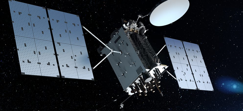
In related news, the Space Force has confirmed that 10 new GPS IIIF satellites’ delivery, part of a $9.2 billion contract, will be delayed from eight to 11 months. The service cited contractor Lockheed Martin LMT 0.00%↑ as having difficulty making complex parts, according to Bloomberg.
The new satellites features greater accuracy and jam-proof signal capability for the GPS constellation. In a biting statement to Bloomberg, the Space Force said that since the program’s beginning in 2018, “the contractor’s technical and programmatic challenges delayed all” the intended available satellite launch dates.
In addition, the Space Force’s delivery of the first GPS IIIF satellite, originally slated for April 2026, would be delayed until November of that year.
Overall, the satellites are put together at Lockheed’s Colorado facility, near Denver. The satellite subcontractor L3Harris Technologies LHX 0.00%↑ is facing Mission Data Unit technology challenges, according to the article. The Mission Data Unit provides the enhanced navigation for the Block IIIF satellites.
Expert nationwide installation services for fleet technologies.
Wireless Carriers Challenge FCC’s $200 Million Location Privacy Fines
Three of the largest wireless carriers are fighting back against Federal Communications Commission (FCC) fines for allegedly selling their customer’s location information without their permission. AT&T T 0.00%↑, T-Mobile TMUS 0.00%↑ and Verizon VZ 0.00%↑ claim that their location-based services programs were ran according to the rules.
Besides T-Mobile, which earlier sued the FCC but has not filed briefs, AT&T filed its brief on Nov. 1, while a Verizon brief was filed on Nov. 4. Verizon claims that the FCC overstepped its authority to enforce statutory consumer data privacy provisions. Both AT&T and Verizon claim that the fines violate their Seventh Amendment right to a jury trial.

The fines, levied in April, are substantial. T-Mobile was fined $80.1 million, while AT&T’s total was $46.9 million. Verizon’s share was $47 million and $12.2 million for its Sprint subsidiary.
During its investigation, which started during the Trump administration, the FCC said that the four carriers sold customer location information to “aggregators,” who resold the data to third-party location-based service providers. The federal agency cited public reports that indicated that a Missouri sheriff used location information, provided by Securus, to track “numerous individuals.”
Both Verizon and AT&T, in their filings, say the FCC over-reached by making the Securus violation the centerpiece of their investigation. Both companies say that the incident happened outside of the fine’s statute of limitations.
The D-Day Visitor's Handbook: Your Guide to the Normandy Battlefields and WWII Paris by Kevin Dennehy and Steve Powers. The guidebook uses location technology from what3words to locate monuments, museums and other attractions. Get your guidebook today!
Amazon Location Service Launches Enhanced Places, Routes and Maps
Amazon Location Service this week announced that it is offering enhanced enhanced the Routes, Places, and Maps functionality to enable developers to add advanced location capability. The company says the new capabilities allow developers to support location-based use cases in industries healthcare, transportation & logistics and retail.
The company said that developers can access advanced route optimization, toll cost calculations, GPS traces snapping, and map styles with static and dynamic rendering options. This allows developers to perform proximity-based search and predictive suggestions that includes detailed information on points of interest, the company said.
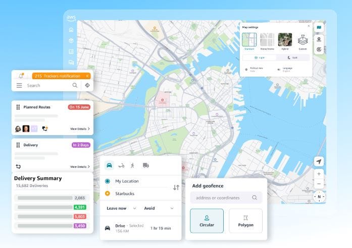
One of the new features include a Geocode search function for addresses. Others include Search Nearby functions to find local businesses and an Autocomplete capability to predict typed addresses and other information, the company said. Search Nearby, for example, allows a food delivery app to find and recommend local restaurants, the company said.
The new enhancements also include Toll Cost calculation and Waypoint Optimization for multi-stop delivery. Yet another feature is Isoline, which supports travel restrictions.
The company said the enhancements offer new standalone SDKs to allow developers to start new mapping projects or migrate their existing workloads to Amazon Location Service.
Other Location News
News tip? Send them to kdennehy@driverlessreport.com. Go to www.locationbusinessnews.com for more news and an archive of stories. Location Business News is looking for your company’s product use cases to feature in each issue. Send us five paragraphs and an image/photo for consideration. Include a contact name, phone, email and web address.
Top News:
💲 Spire Sells Maritime Tracking Business for $241 Million. “Spire Global SPIR 0.00%↑ has announced an agreement to a sell its maritime tracking business to Kpler for $241 million. The company intends to use the proceeds of the sale to retire all outstanding debt and invest in near-term growth opportunities.”
👉 McDonald's Tracks Success of Geofencing To Streamline Mobile Orders. “In 2024, McDonald’s MCD 0.00%↑ began an initiative to expand its U.S. pilot of Ready on Arrival across its top six markets by 2025. The program enables McDonald’s crew members to begin assembling a customer's mobile order prior to their arrival at the restaurant and is part of a larger corporate effort that includes annual net new store growth of 4-5 percent and a technology partnership with Google Cloud GOOG 0.00%↑.”
🛰 Koreasat 6A Communications Satellite Successfully Launched. “Koreasat 6A will also make a key contribution to improving the positioning accuracy and reliability of the Korea Augmentation Satellite System (KASS) with its Satellite-Based Augmentation System (SBAS) payload. Comparable to Europe’s EGNOS system, KASS was developed by Thales Alenia Space in partnership with the Korean space agency KARI. Initially dependent on the MEASAT-3D geostationary satellite, KASS will now be relying on Koreasat 6A’s services to enhance positioning performance of GNSS in a range of sectors, notably air navigation. Ultimately, these services will be extended to other applications like overland transportation, shipping and location-based services.”
🌒 GMV Completes FASTNAV Project Advancing Lunar Rover Capabilities. “GMV has concluded the FASTNAV (Multi-Range Navigation for Fast Moon Rovers) project, showcasing a navigation system that enables rovers to reach speeds of 1 m/s- for autonomous vehicles on planetary surfaces. The project was funded by the European Space Agency.”
🛳 Space Systems Command and U.S. Navy Achieve Major MGUE Program Milestone. “The MGUE Increment 1 program, developed in collaboration with the U.S. Navy, successfully integrated its aviation/maritime GPS receiver into the Navy's GPS-based PNT system. This integration process included embedding PNT into a destroyer, followed by a comprehensive testing phase and the resolution of all Category I Deficiency Reports identified during testing.”
😮 Trimble SketchUp Surpasses One Million Active Subscribers.
📱 Apple Will Let You Share AirTag Locations With Links. “Apple AAPL 0.00%↑ has introduced a new feature that lets users share the location of misplaced items with third parties. The Share Item Location feature was added in the public beta of iOS 18.2, and it will soon be available to all users.”
📌 GPS Does Need a Backup, Terrestrial Is the Answer – But Which Terrestrial? “Another promising technology is the National Association of Broadcasters’ Broadcast Positioning System (BPS). It uses advanced television signals to provide location and timing information and has a range of several hundred miles and may be able to support other applications.”
☹ North Korean GPS Manipulation Disrupted Dozens of Planes and Vessels, South Korea Says. “South Korea’s Joint Chiefs of Staff said North Korean operations to manipulate GPS signals were detected from around the western border city of Kaesong and the nearby city of Haeju on Friday and Saturday, and said the activities disrupted dozens of civilian aircraft and several vessels.”
👍 Globalstar Wins Terrestrial Authority in Mexico.
🛩 FAA Approval Allows ANRA Technologies’ Services to Support BVLOS Waiver Applications. ANRA Technologies said that the Federal Aviation Administration granting it a Letter of Acceptance (LOA) to deploy its drone conflict detection and conformance monitoring services.
😒 AirPods Pro Hacked Using Faraday Cage and Microwave as a Jammer to Fool Geofencing.
Maps:
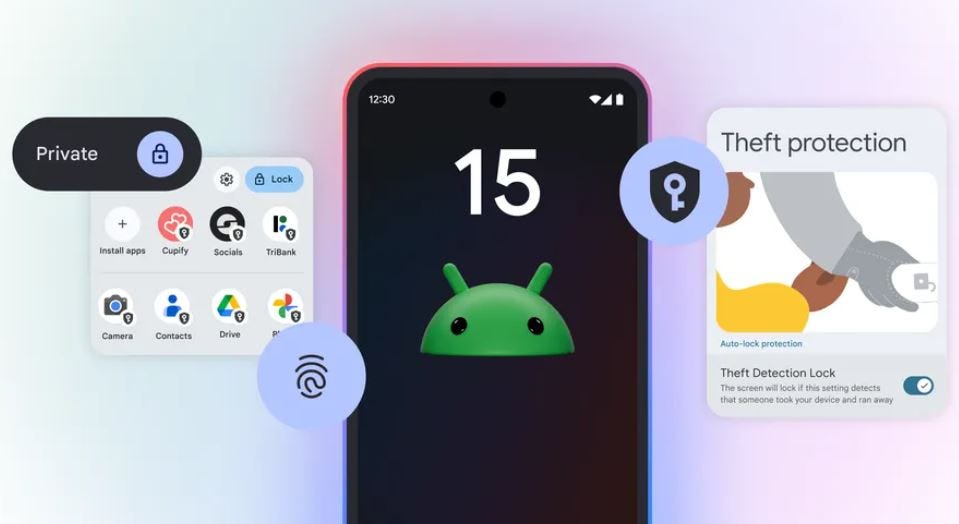
📲 Android 15 Adds Support for Wi-Fi Ranging To Improve Indoor Navigation. “Google Maps works great when you need to get from point A to point B outdoors, but what about when you're trying to get from one end of a shopping mall to another? The latest Android 15 update should make that kind of indoor navigation more straightforward.”
“Android 15 now supports a new location technology known as Wi-Fi Ranging: it uses the varying strength of signals from Wi-Fi access points to figure out whereabouts you are.”
🗺 MapmyIndia and Hyundai Autoever Form a JV for Automotive Map-Based Solutions in South East Asia. MapmyIndia has received official board approval to establish a joint venture with Hyundai Autoever. MapmyIndia will hold a 40 percent stake with a capital investment of $4 million. The joint venture, named PT Terra Link Technologies, will be based in Indonesia and will concentrate on providing map-based solutions for automotive OEMs and other businesses across Southeast Asia.
👍 Millions of Phones Create Most Complete Map Ever of the Ionosphere. “Researchers mapped Earth’s ionosphere, part of the upper atmosphere, using signal data from 40 million phones—a method that could improve GPS accuracy and help track space weather.”
⚡ Discover the New Capabilities in ArcGIS Location Platform. “ArcGIS Location Platform enhancements are now available to Esri’s Platform-as-a-Service (PaaS) solution, including: improved enhancements to the dashboard, better pricing and expanded free tiers for data hosting services, new beta features, such as Last Mile Delivery routing and Batch Geocoding and updated data for some ArcGIS Location Services.
😏 Goodbye, Google Maps? Apple Maps Envisions Revolutionary Traffic Light Navigation Feature. “The new-generation Apple Maps displays stop signs and traffic lights on the map, providing drivers with more time to slow down when approaching the pinned location.”
🤞 Grab Built Its Own Map in Southeast Asia, and Is Now Going after Google. “Like most businesses, the Singapore-based Grab initially relied on third-party navigation platforms such as Google Maps and HERE. But as it expanded, it began getting more complaints from frustrated drivers who had trouble finding locations, said Sriram Iyer, product head at Grab.”
🏆 HERE Technologies Announces 2024 Partner Award Winners. “Grey Matter has been recognized for enhancing HERE’s portfolio by offering advanced mapping and geolocation services that are pivotal for fleet and logistics management globally.”
🚗 Google Maps Is Handing You the Wheel to Customize the Navigation Car.

Webinar Promotion. Are you getting enough industry execs to sign up for your webinars? We’ve been promoting them for 15 years and know the ins and outs of webinar marketing. We will run a one-month campaign (with weekly reminders on our social media as the webinar gets closer). This includes ad placement in the newsletter, social media posts and a dedicated. email blast to our subscribers. We really hit it hard on social media in the final five days as people always register at the last minute. Email us at info@driverlessreport.com for more information, or click here to view our one-page media kit.
Connected and Autonomous Vehicles:
🙂 Waymo Opens Robotaxi Service to Anyone in Los Angeles, Marking Its Largest Expansion Yet. “[Starting this week], anyone in LA will be able to use the Waymo One app to hail a self-driving robotaxi throughout nearly 80 square miles of Los Angeles County, Waymo said.”
🏛 NHTSA Warns Tesla Over Deceptive Autonomous Driving Claims. “The NHTSA is probing Elon Musk’s company over potential safety failings in Tesla’s FSD option, with the latest investigation following a string of incidents, including a fatal collision. Tesla TSLA 0.00%↑ has until December 18 to respond to the letter from the NHTSA, with potential penalties of up to $135.8 million if the EV maker fails to take action.”
💰 From Self-Driving Cars To AI That Writes Enterprise Software: Cogna Founder Raises $15 Million. “Cogna — as the U.K.-based startup is called — is led by Ben Peters, the technical co-founder of Five AI, a self-driving startup that was acquired by Bosch in 2022.”
💲 Vatn Systems Raises $13 Million Seed Round to Advance Autonomous Underwater Vehicles for US Defense.
😕 Self-Driving Cars Will Ruin Cities, Not Fix Them. “With an estimated $160 billion invested so far, companies have already put a ton of money into developing autonomous vehicles, and the promise of replacing drivers with computers has been a futurist dream for a long time.”
Fleet Telematics:
🏛 Trade Commission Offers Insight Into Samsara-Motive Legal Battle. “Megan Wantland, investigative attorney at the Office of Unfair Import Investigations, an independent participant in the ITC investigation who represents the public interest, on Tuesday offered a pre-hearing brief that stated she ‘does not expect the evidence to establish a violation of Section 337 as to the Asserted Patents.’”
🚍 Mack Trucks Reaches 200,000 Connected Class 8 Vehicle Milestone. “Mack Trucks has produced more than 200,000 connected Class 8 trucks since 2014, each equipped with its proprietary telematics gateway, the company announced in a news release commemorating the milestone.”
🚚 Jimi IoT and Fleet Hoster Partner to Enhance Geotab Marketplace Solutions.
🚛 Samsara Charts New Course for Connected Fleet Operations. “Samsara’s newly released Drowsiness Detection feature is now available to all customers.”
Location Industry Briefs
Send your news releases to kdennehy@driverlessreport.com. Go to www.locationbusinessnews.com for more news and an archive of stories.
Trimble Expands Landmine Clearance Collaboration with The HALO Trust
Trimble TRMB 0.00%↑ has announced its expanded support for landmine-clearance non-profit The HALO Trust. The company said it is donating an additional 175 Catalyst GNSS systems, including DA2 GNSS receivers.

The Catalyst GNSS system allows The HALO Trust to deploy mapping capabilities to large field teams across broad geographic areas, Trimble said. Using Catalyst GNSS, the HALO Trust cleared 802 minefields and battlefields across 12 war-torn countries.
Contact: Trimble, www.trimble.com.
HERE Technologies and Astara Partner, Announces ADAS Surveys
HERE Technologies and global mobility company Astara have partnered to integrate HERE’s location data, services and technology into its Astara Connect platform. Connect allows businesses and government agencies to manage fleets, the company said. Among the companies already using the HERE-powered Astara Connect platform is Mitsubishi Motors Chile.
In other company news, HERE announced two surveys, one in India and the other in Thailand that indicated trust and growth in both countries for Advanced Driver Assistance Systems (ADAS). The company also said that another survey in Australia says that drivers there overwhelmingly support the introduction of Intelligent Speed Assistance mandates.
Contact: Sebastian Kurme, HERE Technologies, 49 173 515 3549,
sebastian.kurme@here.com, www.here.com.
Xona Space Systems Partners With QASCOM for PULSAR Integration
Xona Space Systems has partnered with Italy-based defense company QASCOM. Xona will integrate its PULSAR capabilities into QASCOM’s GNSS Software-Defined Radio (SDR) receiver, the QN400-P. The QN400-P receiver features LEO PNT services from Xona’s PULSAR, jamming/spoofing mitigation and multi-frequency, multi-constellation GNSS.
Contact: Xona Space Systems, www.xonaspace.com.
Ituran and Nissan Sign a Contract for Vehicle Tracking and Recovery Services in Chile
Ituran Location and Control ITRN 0.00%↑ has announced that following its long-term partnership with Nissan in Mexico, Ituran's subsidiary in Chile has signed a 5-year contract with Nissan Chile. Under this agreement, Ituran the company said it will provide the Vehicle Location Unit (VLU) and a suite of telematics and stolen vehicle recovery (SVR) services to Nissan and its customers throughout Chile. Following their car purchase, Nissan's customers will have a one year free trial of Ituran's service, which has the VLU unit pre-installed.
Contact: Udi Mizrahi, Ituran, 972 3 557 1348, udi_m@ituran.com, www.ituran.com.
u-blox Launches Tri-Radio Module for IoT, Smart Homes
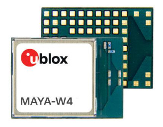
Thalwil, Switzerland-based u-blox has launched the MAYA-W4 tri-radio module. The module supports Wi-Fi 6, Bluetooth Low Energy 5.4, and 802.15.4, the company said.
The unit’s small size and robust design make it ideal for space-constrained applications, u-blox said. The company said samples are available now, with volume production scheduled for the second half of 2025.
Contact: Sven Etzold, u-blox, 41 76 561 0066, sven.etzold@u-blox.com, www.u-blox.com.
Create a FREE ManyMe Account.
Inertial Las Launches New GPS-Aided INS
Inertial Labs has introduced the INS-DM-FI, its latest GPS-aided Inertial Navigation System (INS). This next-generation INS is built to meet the demands of land, marine, and aerial platforms, the company said.
The INS-DM-FI is shielded from electromagnetic interference (EMI) and fully integrates multiple capabilities, the company said. The INS-DM-FI supports embedded multi-constellation GNSS receivers, including NovAtel OEM7, u-blox F9, and Septentrio mosaic-H series.
Contact: Inertial Labs, (703) 880-4222, marketing@inertiallabs.com, www.inertiallabs.com.
Quectel Launches GNSS Module, Antenna, RTK Correction Service Bundle
Quectel Wireless Solutions has rolled out a GNSS module, antenna and real-time kinematic (RTK) correction service bundle. The bundle will be marketed to developers consumer robotics, sports, automotive, micro-mobility and smart agriculture.
The bundle is composed of Quectel’s quadband LG290P GNSS module, YEGN103W8A geodetic antenna or the YEGD006U1A patch antenna. In addition, the company’s recently introduced RTK Correction Services will be included.
Contact: Quectel, media@quectel.com, www.quectel.com.
Zonar Helps Kirkland, Washington Police Improve Fleet Health and Safety Inspections for Patrol Cars
Zonar has announced that the Kirkland Police Department in Washington state has purchased its EVIR Mobile (Electronic Verified Inspection Reporting) and ZTrak GPS-enabled asset tracking solutions. Managed in Zonar's cloud-based system, these solutions allow oversight of important agency assets, as well as verify pre-shift inspections of patrol cars and critical emergency equipment onboard, the company said. Following a successful pilot program, Kirkland PD is the first agency to deploy EVIR Mobile and ZTrak within its fleet, the company said.
Contact: Susan Corscadden, for Zonar, (517) 239-0330, zonarpr@rhstrategic.com, www.zonarsystems.com.
People
Scott Thiele has been named senior vice president, North America commercial erformance and cost at Stellantis.
Erminio Di Paola has been named vice president of global business development at HERE Technologies.
Nino Tarantino has been named senior vice president, international markets, at Cambridge Mobile Telematics. CMT also named Christian Terfi as senior director for the Latin America.
Brandon Sights has been named CTO at OnSight Technology.
Petr Hofman has started a new position as managing director at Volkswagen Group Technology Solutions India.
Roger Hjelm has started a new position as a senior connected car exec at Bentley Motors.
Emeline Bardoux has joined Safran Space as a senior director, strategic market segment, connectivity
Jobs
Director Product Management. HERE Technologies.
Senior Product Manager. HERE Technologies.
Senior Product Manager – Maps Quality Platform. TomTom.
Senior Enterprise Sales (Maps/Geospatial). TomTom.
Product Manager - Maps and Location Referencing. TomTom.
Regional Sales Specialist - West. Telit Cinterion.
Galileo Senior Engineer. CETRA.
Click HERE to Join our growing Location Business News LinkedIn Group!


