Point One Expands Footprint in Europe With Septentrio
Company to compete in competitive industrial autonomy, precision agriculture, logistics and delivery, robots and autonomous vehicles markets
San Francisco-based Point One Navigation, along with European partner Septentrio, have expanded their GNSS positioning solutions throughout Europe. Point One Navigation is providing access to its Polaris RTK network and Sensor Fusion for compatible Septentrio receivers.
“We have also created development kits in our store that are configured to work with our software stack. All of this, combined with our global network, means that users can get centimeter-level accuracy on GNSS,” said Aaron Nathan, Point One Navigation CEO and co-founder. “Our expansion to Europe comes on top of a two solid years of market expansion, including two production automobiles, customers in robotics and drone partnerships.”
The companies are pursuing markets in Europe with tons of competition: industrial autonomy, precision agriculture, logistics and delivery, robots and autonomous vehicles. “Key differentiators are coverage, reliability and developer friendliness. We're the only RTK network with global coverage that has a well-documented API,” Nathan said. “Specifically for autonomy applications, this allows the user to build applications on top of the precision location data.”
For its part, Septentrio said that Point One’s correction services have robustness, accuracy and availability in the Americas. “Their recent expansion into the European Union is key for integrators wanting a transparent RTK service in both continents,” said Gustavo Lopez, Septentrio’s market access manager, in a statement.
Overall, Nathan said that the company has worked with Septentrio in the past, particularly in the autonomous vehicle space, and there is no end date to the relationship.
Expert nationwide installation services for fleet technologies.
OMF Previews Data Schema and Reference System, Adds Member
The Overture Maps Foundation has announced the Overture Reference System and Data Schema that allows developers to add such features as real-time traffic, road closures, construction information, reviews and ratings on top of the maps.
A structured, documented schema is foundational for anyone who wants to use map data to build applications, said Marc Prioleau, OMF executive director. “It gives an understanding of the structure and naming conventions for the data, allowing a developer to use the data in mapping software in a stable, well-defined way,” he said. “The schema has to be consistent but also expandable. As more types of data are built, we want to be able to extend the schema without breaking its backwards compatibility.”
OMF, founded late last year by Meta META 0.00%↑, Amazon Web Services AMZN 0.00%↑, Microsoft MSFT 0.00%↑ and TomTom [TOM2], isn’t dangling incentives to Google GOOG 0.00%↑ and Apple Maps AAPL 0.00%↑ to join, but rather focusing on an open community.

“The reasons to join Overture are not specific to any one company. They are pretty consistent across the board: Overture’s founding premise is that some of the base layers of a worldwide map are best built as a shared, open resource,” Prioleau said. “That could be because the best maps will be the ones that get the best feedback loops and an open community will build that. Or that future map applications will require a shared map database. Or that some layers of the map may just not be worth building and maintaining as a proprietary data set. Those reasons are pretty universally applicable.”
Prioleau said that OMF believes that most companies will build map services from a mixture of open map data and some unique data, which allows for differentiation. “The companies that are joining Overture are thinking through strategies on how open data can allow them to offer best in class map services while focusing their investments on the data sources and experiences that make their service unique,” he said. “Overture is an open organization. Anyone can join. The main criteria is a commitment to collaboration in building open map data. We also ask members to contribute some combination of data, technology or engineering to support that goal.”
Prioleau said that the data contributions do not have to be map data that goes directly into the map. “Members also contribute ‘precursors’ like street level imagery or aerial imagery or road detections that can be processed in Overture’s pipelines to build or maintain map data,” he said.
In other OMF news, Nomoko, a provider 3D data technology, announced that they have joined the organization as a contributor member. Nomoko said it will collaborate with the existing “steering members” to create interoperable, accessible 3D datasets.
Editor’s Note: A more comprehensive interview with OMF, addressing AI and government issues, can be found on our website, www.locationbusinessnews.
Power Your Business with Vetted Digital Marketing Experts
GrowTal's marketing experts are pre-vetted and experienced, so you can focus on taking your business to the next level. Anywhere from social media management and SEO to paid social channels and high-level strategists. GrowTal experts are ready to work.
Esri UK Awarded $58.6 Million Contract From United Kingdom MoD
The United Kingdom’s Ministry of Defense has awarded a $58.6 million contract with Esri UK for ArcGIS and location-based information access worldwide. The three-year contract will support the MoD’s digital transformation efforts—and create 25 jobs, the agency said.
The contract allows military personnel to have access to such contextual tools as maps, apps, imagery, dashboards and reports, the agency said. The location technology will also enable users to conduct high-end geospatial information (GEOINT) analysis from deployed front-line units to UK-based defense intelligence analysts, the agency said.
“Our partnership with Esri UK delivers critical operational outcomes and will save £21 million over the next three years. This agreement forms part of our strategic approach to address digital spend and leverage our scale across the defense enterprise,” said Victoria Cope, UK MoD’s defense digital commercial director, in a statement.
Your First Draft, Fast
Looking for some words of inspiration to kickstart your creative process? Magic Write in Canva Docs is your very own AI text generator to help you get out a first draft, fast. Simply start with a prompt and watch as copy, blog outlines, lists, bio captions, content ideas, brainstorms, and more appear in seconds.
Sheeva.AI Adds SheevaConnect to In-Vehicle Commerce Product Suite
Sheeva.AI has launched SheevaConnect to allow activation and contactless payments for such contextual services as fueling, EV charging and parking. The new solution uses proprietary algorithms to detect vehicle location layered with mapping and geofencing, the company said.
SheevaConnect works with company’s SheevaLocate and SheevaFence technologies. Those technologies detect a vehicle at the specific gas pump, parking spot, EV charger, or drive-through lane, the company said.
“Marrying the desire to transact with an easy, simple way to start and complete that transaction, using hyper-precise location and digital payments, is what will drive broad adoption of in-car transactions and connected vehicle technology altogether,” says Lokesh Kumar, CTO of Sheeva.AI, in a statement.
Contact: Trevor Curwin, Sheeva.AI, (415) 646-6063, www.sheeva.ai.
Get smarter in 5 minutes with Morning Brew (it's free)
There's a reason over 4 million people start their day with Morning Brew - the daily email that delivers the latest news from Wall Street to Silicon Valley. Business news doesn't have to be boring...make your mornings more enjoyable, for free.
Other Location News:
News tip? Send them to kdennehy@driverlessreport.com. Go to www.locationbusinessnews.com for more news and an archive of stories.
Top News:
💰 Raytheon Rebrands as RTX, Injects Collins Aerospace With $2.7 Billion.
🚗 Hyundai Motor Group and Vodafone Business Expand Partnership. “Agreement brings in-car Infotainment features to Hyundai, Kia and Genesis models sold in Europe for the first time, starting with in-car Audio Streaming Service.”
🤔 Scientists Conduct First Test of a Wireless Cosmic Ray Navigation System. “Japanese researchers have developed an alternative wireless navigation system that relies on cosmic rays, or muons, instead of radio waves, according to a new paper published in the journal iScience.”
🛰 Pentagon Gearing Up to Launch 1st Experimental Navigation Satellite. “The spacecraft, called Navigation Technology Satellite-3 (NTS-3), will be the first U.S. experimental navigation satellite to take flight since NTS-1 and NTS-2 launched in the 1970s. NTS-3, developed by L3Harris Technologies LHX 0.00%↑, recently completed testing at Edwards Air Force Base in California.”
Maps:
📱 Google Maps Immersive View Just Keeps Getting Better. “You can now explore 3D maps of four new cities and over 500 new landmarks thanks to Google’s GOOG 0.00%↑ AI.”
😕 Google Maps Is No Longer the Top Navigation App. Prove Me Wrong. “Google Maps is slowly but surely losing its navigation focus. Most of Google's improvements in this regard and the race for increasing revenue turned Google Maps into a money-making machine whose priority is no longer getting people from where they are to where they want to be.”
👏 4 Benefits of Indoor Mapping for Stadiums and Arenas. “Indoor mapping solutions enable stadiums to deliver in-seat experiences that simply were not possible before.”
Reach nearly 15,000 subscribers and 70,000 more via social media by advertising in Location Business News!
We can promote your webinar, service or product to a focused group of industry executives. Email us at info@driverlessreport.com for more information, or click here to view our one-page media kit.
Connected and Autonomous Vehicles:
🚚 Fernride Raises €29 Million to Solve Autonomous Trucking. “FERNRIDE, a German autonomous trucking company, has secured roughly €29 million in Series A funding to accelerate the transition towards automated and sustainable logistics by creating the world’s leading human-machine collaboration technology.”
😲 Bay Area Driver Arrested After Allegedly Rear-Ending, Following Autonomous Car. “A driver rammed a Honda Accord twice into the back of a Pony.ai autonomous car, according to a collision report filed with the California DMV, and then followed the car a mile back to the startup’s Fremont headquarters.”
🚛 TuSimple Completes 39-Mile Driverless Run in China Traffic. “TuSimple successfully traveled nearly 39 miles on an open public road in China. The truck had no human occupant or outside help, the company said.”
Drones:
👍 American Valkyrie Drones to Be Flown by AI Pilots, Become Immune to Electronic Warfare. “Kratos said last week it is going to give control of the drone to an artificial intelligence pilot, one that doesn't need GPS and communications to do its thing.”
🛩 Colorized Lidar Mapping With Long-Range DeltaQuad Evo Drone. “Dutch drone maker DeltaQuad says its latest Evo aircraft with a flight time of up to 2.5 hours is now integrated with a combined Yellowscan LiDAR and RGB system.”
😉 New Inertial Nav System Solves GPS Vulnerability. “At the 2023 Paris Airshow, British company Flare Bright is showing its new inertial navigation system (INS) enhancement device that the company claims makes an INS more accurate thanks to machine-learning software.”
Financial:
💲 Safran Nears $1.8 Billion Deal to Acquire Raytheon's Flight Controls Unit. “Safran SA is nearing an approximately $1.8 billion deal to acquire a Raytheon RTX 0.00%↑ unit that makes flight controls for aircraft, helicopters and missiles.”
✔ Ball Corp Explores Sale of Aerospace Unit for More Than $5 Billion.
Engaging Short-Form Video for B2B SaaS
Spacebar Visuals creates engaging short-form videos for B2B SaaS companies by turning your written content, such as blog posts, eBooks, surveys and more into engaging video content to drive top- and mid-funnel lead gen.
Location Industry Briefs
Send your news releases to kdennehy@driverlessreport.com. Go to www.locationbusinessnews.com for more news and an archive of stories.
Verizon Has NG911 i3 Deployment
Verizon VZ 0.00%↑ has announced an NG911 deployment, this time in Livingston Parish, La. Verizon’s i3-based and Real Time Text (RTT) service allows a 911 center (Public Safety Answering Point) to determine wireless call routing based on device location and local, real time conditions, the company said. Verizon continues to work with NG911 providers and PSAP authorities across the country to enable this advanced, end-to-end i3 and RTT service, the company said.
Contact: Karen Schulz, Verizon, (864) 561-1527, karen.schulz@verizonwireless.com.
Septentrio Timing GNSS Module Supports Fugro AtomiChron
Septentrio has announced that its GNSS timing module, mosaic-T, now supports the AtomiChron timing service from Fugro [FUR]. The mosaic-T module includes several layers of security against GNSS jamming and spoofing with AIM+ integrated technology and OSNMA Galileo authentication, the company said.
AtomiChron strengthens the anti-spoofing security of the mosaic-T receiver by offering Navigation Message Authentication (NMA) on all 4 major GNSS constellations, the company said.
Contact: Fugro, www.fugro.com.
Comtech Joins the AWS Partner Network
Comtech CMTL 0.00%↑ has announced today that it has joined the Amazon Web Services Partner Network (APN) and completed the AWS Technical Review. As an APN member, Comtech will provide customers access to the company’s portfolio of technologies, including location-based services and IoT device services, on AWS, the company said.
Contact: Jamie Clegg, Comtech, (480) 532-2523, jamie.clegg@comtech.com, www.comtech.com.
Geotab Completes Marketplace Premier Partner Day
Geotab recently hosted a Marketplace Premier Partner Day in North America to showcase its ecosystem of partners in data intelligence, operational performance, safety and sustainability solutions. The company said that the Geotab Marketplace has grown its solutions portfolio by more than 200 percent.
The company said its open platform allows organizations to customize their telematics solution. Some of these solutions are tailored to fleet safety, trailer and asset tracking, maintenance, risk management, fuel efficiency, routing and dispatching, sustainability and more, the company said.
Contact: Geotab, www.geotab.com.
Rauland Australia Strengthens Partnership With Pole Star
Rauland Australia has announced it strengthened its technology partnership with Pole Star by integrating Pole Star’s location technology into its solutions for healthcare markets. The companies say that the partnership, which began two years ago, have been particularly successful in installing real-time locating system (RTLS) solutions in hospitals and residential aged care facilities. Healthcare organizations who use Cisco’s CSCO 0.00%↑ wireless network infrastructure can find Rauland Australia and Pole Star’s location-based systems on the Spaces App Store, the company said.
Contact: Pole Star, www.polestar.eu
MapsPeople and EzyMob Partner
MapsPeople has announced a strategic partnership with EzyMob to improve mobility for people with disabilities. EzyMob develops mobile solutions to improve accessibility for people with disabilities.

MapsPeople has integrated its maps into a joint solution with EzyMob. The joint solution has been deployed at several trade shows, sporting events, museums and other venues, the company said.
Contact: MapsPeople, www.mapspeople.com.
RapidDeploy Rolls Out RapidONE
RapidDeploy has announced its RapidONE service that combines 911 call handling and mapping. The majority of calls received by 911 centers are processed using outdated on-premises call handling solutions, the company said. RapidONE is embedded in RapidDeploy’s primary call-taking map, Radius Mapping, which provides a single platform for unified communications and supplemental data, including mobile location, situational awareness and GIS data, the company said. “Our cloud-native platform is unifying call handling and mapping into one solution to simplify mission-critical workflows, from the moment the call is answered to the moment resources are dispatched into the field,“ said Steve Raucher, CEO of RapidDeploy.
Contact: RapidDeploy, rapidone@rapiddeploy.com, www.rapiddeploy.com.
Create a FREE ManyMe Account.
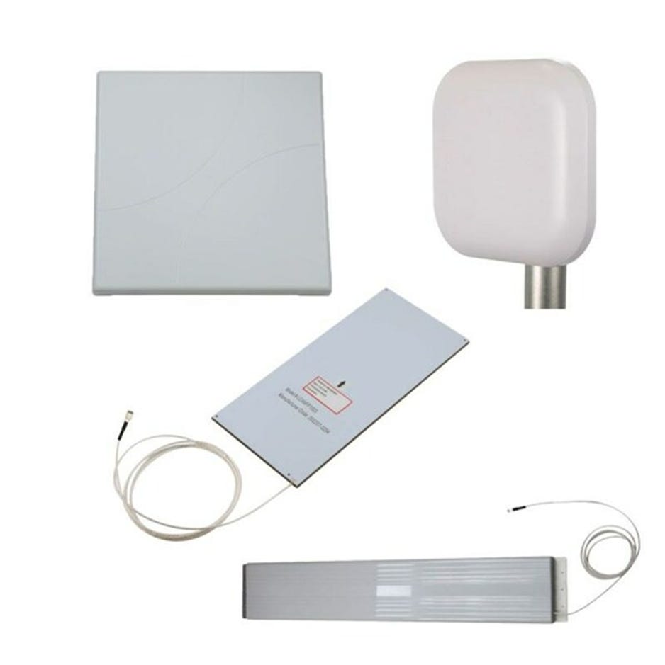
Pasternack Debuts New Line of RFID Antennas
Pasternack has announced the release of its latest RFID antennas. Pasternack's new RFID antennas are designed for inventory control, asset tracking and other applications.
The antennas operate within the 900 MHz and 2400 MHz frequency bands, allowing RFID tag scanning. The new RFID antennas are in stock and available for same-day shipping, the company said.
Contact: Peter McNeil, Pasternack, (978) 682-6936.
Pikmykid Partners With RapidSOS
Pikmykid has partnered with RapidSOS to integrate its emergency alert system with RapidSOS’s intelligent safety platform so that it can be shared with 911 dispatchers. Some of the information shared include location, type of emergency and other details, the company said. The companies say first responders can arrive on the scene faster equipped with critical insights to mitigate potential risks.
Contact: Loren Bolton, RapidSOS, (214) 585-3564, lbolton@rapidsos.com, www.rapidsos.com.
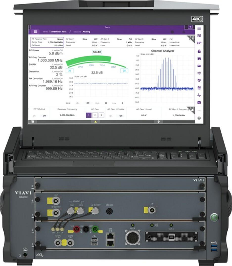
VIAVI Unveils CX700 ComXpert
Viavi Solutions VIAV 0.00%↑ has introduced the CX700 ComXpert Radio Test System. This radio test solution allows testing for radio manufacturers as well as depot-based and field-deployed military personnel, the company said.
The CX700 meets MIL-PRF-28800 Class 3 environmental requirements and has a GNSS-enabled "no-cal" chassis time base and user-replaceable modules, the company said.
Contact: Martin Smith, for Viavi, viavi@sonuspr.com.
ALIVE Geolocation Application Gets Awarded Patent
Trellist Marketing and Technology has been awarded a geolocation patent through an application for its ALIVE product. The United States Patent and Trademark Office granted Trellist a patent titled, "Interacting with Objects Based on Geolocation." Leveraging a digital profile system, transitory geographic locations, and advanced algorithms, the technology allows individuals access to information about physical objects in their vicinity, the company said.
Contact: Andy Lally ALIVE, (302) 757-7423, news@andylallyalive.com.
If you're a student in the US looking for a better way to pay for higher education, Bold provides thousands of students with $25k scholarships every year. Enter to win one of our monthly $25,000 scholarship to go towards your tuition, student loan debt, or other education related expenses!
Apply to a Bold scholarship today
People
Lytx has named Casey McGee as the company's new chief revenue officer. McGee joins the company after serving as the vice president of Global ISV and Digital Native Sales at Microsoft MSFT 0.00%↑.
Matt Higgins appeared on this year's King's Birthday Honours List, receiving the Public Service Medal. He is the president of the International Global Navigation Satellite Systems Association and a member of the U.S. government’s National Space-Based PNT Advisory Board.
Prasad Kavuri has been named director, infrastructure and services, at HERE Technologies.
Actility CTO Alper Yegin has been re-elected as vice-chair of the LoRa Alliance.
Jobs
Careers. Comtech.
Careers. Trimble.
Job Openings. u-blox.
Click HERE to Join our growing Location Business News LinkedIn Group!


