


TomTom Cuts 300 Jobs in AI Pivot
Analysts predict more location companies will follow with AI-driven layoffs...

Dutch navigation specialist TomTom recently announced plans to eliminate 300 jobs—nearly 10 percent of its global workforce—as part of a strategic realignment aimed at accelerating its shift toward artificial intelligence (AI) and more product-focused development. The cuts, affecting staff in application-layer development, sales and support, reflect the company’s effort to modernize its mapping platform and deliver AI-enhanced offerings such as TomTom Orbis Maps.
TomTom CEO Harold Goddijn said, “With a modernized technology stack, we are becoming a truly product‑led company,” reinforcing a strategy to shorten implementation cycles and boost end-user experience through AI integration.

The layoffs will allow the company to reallocate resources to its AI-driven location and navigation technologies—an essential move given shrinking demand for standalone GPS devices in favor of smartphone-integrated mapping apps. The timing reflects a broader industry trend among digital-mapping providers and GPS-centric firms facing pressure from smartphone navigation services like Google Maps. According to Autoevolution, TomTom itself cited its “big bet on artificial intelligence” as a key driver behind job reductions. In parallel, competitor firms have similarly downsized to direct investment into machine-learning systems and cloud-based mapping platforms.
The trend highlights how automation and intelligent systems are reshaping location services, reducing demand for legacy development processes and traditional support staff.
The company, after taking significant losses in 2024, had an encouraging start to 2025 with growing revenues and strategic progress in the first quarter. However, TomTom forecasts revenue decline from €574 million in 2024 to between €505 million and €565 million in 2025, underscoring urgency in streamlining operations and reorienting toward scalable, AI-enhanced products.
NextBillion.ai and TomTom Partner
In other company news, TomTom has partnered with NextBillion.ai to provide mapping capabilities through its Orbis Maps platform for global clients. These include adding mapping capability for logistics, delivery, mobility and transportation sectors, the company said.
NextBillion.ai said Orbis Maps’ scalability and speed, which TomTom hopes will be an alternative to mapping solutions from Google GOOG 0.00%↑ and Apple AAPL 0.00%↑, allows it to meet rising demand for tailored location services in expanding markets across North America, India, and Southeast Asia.
We’re Back…With New Opportunities Coming
We are now publishing biweekly (on the second and fourth Thursdays each month). Since our short break, we noticed that our “competition” didn’t run many location business stories (they never report on maps, fleet/asset tracking/telematics, big business deals, people/jobs, etc.).
We have decided to publish twice a month to promote our upcoming events—along with continuing to give you actionable industry news. While we are still taking advertising in the newsletter and website, we won’t be hounding you for sales or for a paid subscription (we never liked the hard sell anyway). Contact me at kdennehy@driverlessreport.com with any questions. Thank you for supporting this newsletter over the past four-and-a-half years.
Xona Secures $92 Million to Launch “Unhackable” LEO Navigation Constellation
Xona Space Systems recently announced a $92 million Series B funding round to support the launch and expansion of its Pulsar low‑Earth orbit position, navigation and timing (PNT) satellite constellation. The round, led by Craft Ventures with participation from Stellar Ventures, Seraphim Ventures, Toyota Ventures and SpaceWERX, brings Xona’s total funding to more than $150 million.
Xona, which hopes to offer an “unhackable” alternative to GPS, will deploy hundreds of Pulsar satellites in LEO. The satellites, 326 miles above the planet, will operate 40 times closer than conventional GPS satellites. The company says this close proximity produces signals that are roughly 100 times stronger, making them more resistant to jamming, interference and spoofing, while delivering centimeter-level accuracy.

The company recently launched Pulsar-0, which broadcast a range-authenticated navigation signal from space on Monday. "Navigation and timing are invisible infrastructure—critical to everything from aviation and shipping to agriculture, finance, and autonomous systems," said Brian Manning, Xona’s co-founder and CEO, in a statement. "As we scale, we're building a new layer of infrastructure to power the next generation of progress."
The company said the new capital will fuel increased manufacturing capacity and team expansion it transitions to large-scale deployment. The company also believes that early adapters will include companies in the agriculture, logistics, robotics, defense and autonomous transportation sectors.
The round also included a $20 million non-dilutive Strategic Funding Increase award from the U.S. Space Force’s SpaceWERX initiative.
Trimble, KT Partner to Launch Centimeter-Level Positioning in South Korea
Trimble TRMB 0.00%↑ and KT Corporation announced Tuesday they will jointly offer bundled telecom and high-precision positioning services in South Korea, integrating Trimble’s RTX Fast correction network with KT’s communications infrastructure. The packaged solution is aimed at the automotive, IoT, smart-city, and robotics markets by delivering real-time centimeter-level GNSS accuracy over KT’s wired and wireless platforms, the companies say.
Trimble’s RTX Fast, which covers more than seven million square miles in North America and Europe, will now be available across urban centers, rural regions, and remote islands in South Korea. "With an existing footprint in North America and Europe, we are building on our strategy to extend RTX Fast to other regions around the world,” said Olivier Casabianca, Trimble’s vice president, advanced positioning, in a statement.

Wontae Kim, head of KT’s strategic customer business, said the collaboration will allow companies to “easily use, test and validate their automotive and IoT systems” under local conditions.
South Korea already has a precision positioning service in Swift Navigation’s Skylark via SK Telecom, which launched last year. Swift’s Skylark, which also delivers centimeter-grade corrections nationwide, touts the service as one that delivers lane-level accuracy for autonomous vehicles.
The service, which will be marketed to OEMs and IoT companies in the country, will allow entities to offer positioning and correction services for vehicles equipped with advanced driver assistance systems (ADAS) or vehicle-to-everything (V2X) capabilities, the companies say. Trimble and KT expect early deployments to be with not only automotive OEMs and utilities, but drone operators later this year.

Are you ready for your next Trade Show? JB Media is your one-stop shop for printing, promotional products and corporate wearables. Let us help you prepare for your next show! Visit our website, e-mail us at Service@JimBrownMedia.com or call us direct at (720) 588-0493.
U.S. States Turn to GPS-Based Speed-Limiting Tech as Europe and Digital Maps Push Ahead
A wave of new state-level initiatives is driving the adoption of GPS-enabled speed-limiting technology, placing the U.S. on a parallel path with European regulations that require automakers to curb dangerous driving through intelligent speed assistance (ISA). Recent laws in Washington and Virginia mandate the use of speed-governing devices for certain drivers, joining New York City’s aggressive measures to curb reckless speeding on urban roads.
In Washington, Gov. Bob Ferguson signed House Bill 1596—known as the BEAM Act—into law this year. Starting in 2029, drivers who have lost their licenses due to reckless driving or excessive speeding must install a speed-limiting device in their vehicles to regain driving privileges. The system uses GPS technology to monitor vehicle speed and compare it to posted limits. “What’s behind this bill is a really simple goal, which is to save lives,” Ferguson said in published reports.

Virginia, too, has passed a similar mandate that takes effect in July 2026. Both states are among the first in the U.S. to legally require GPS-linked governors that physically prevent repeat offenders from exceeding speed limits. The technology reflects a broader trend in traffic enforcement that is less reliant on punitive fines—which often disproportionately affect low-income drivers—and more focused on physical enforcement mechanisms.
These U.S. efforts mirror Europe’s push for widespread adoption of ISA systems, which became mandatory for new vehicle models sold in the European Union starting in July 2022. The systems use a combination of GPS data and digital mapping—provided by tech firms like TomTom, Mapbox and HERE Technologies—to automatically limit vehicle speed. The regulatory shift in Europe has had ripple effects across the global digital mapping industry, spurring demand for more accurate, real-time road data that can inform automated vehicle behavior.
However, not all U.S. states are embracing the shift. California, despite its progressive reputation in environmental and traffic safety policy, rejected similar ISA-related legislation in 2023. Critics in the state cited concerns over personal freedom, enforcement costs, and questions around data privacy. That decision puts California at odds with not only Europe but also with emerging American norms in places like New York, Washington, and Virginia.
Still, experts say that GPS-based speed controls represent the next evolution in traffic enforcement—and the legal frameworks unfolding in U.S. states are likely to shape the future of connected vehicle technology. With cities like New York planning to drop speed limits to 20 mph by 2025 and investing heavily in automated camera systems, the growing intersection between legislation, digital infrastructure, and public safety may eventually set a new standard nationwide.

Expert nationwide installation services for fleet technologies.
Geotab, Mercedes-Benz USA Launch Integrated Telematics Solution for Fleets
Geotab and Mercedes-Benz USA have launched an integrated telematics solution for fleet operators with access to real-time vehicle data directly from Mercedes-Benz commercial vehicles. The announcement, made at the recent 2025 Geotab Connect conference in Las Vegas, said that fleet managers will now have key performance metrics—including GPS location, vehicle health, engine diagnostics and fuel efficiency.
By leveraging embedded telematics already built into Mercedes-Benz vehicles, the system allows for faster onboarding, greater data accuracy and a more streamlined fleet management experience, the company said.

Mercedes-Benz vans equipped with factory-installed telematics will now be compatible with the Geotab platform, allowing users to analyze vehicle and driver data through a single unified interface. “This year, we found that the average fleet includes vehicles from 13 different manufacturers. This can make fleet data management extremely complex,” said Rob Minton, associate vice president of connected car business development at Geotab, in a statement.
The integration reflects a broader industry trend toward embedded connectivity, especially as fleet operators face rising pressure to improve efficiency, reduce carbon emissions and meet regulatory compliance standards, the company said. The integrated solution is expected to be available for model year 2023 and newer vehicles in the U.S. later this year.
Geotab Introduces GO Anywhere Asset Tracker Across European Markets
In other company news, Geotab has launched its battery-operated GO Anywhere asset tracker across Europe. The tracker, which integrates with the MyGeotab platform, features a weatherproof design and a battery life of up to five years, the company said.
“Addressing the significant financial impact associated with lost or under‑utilized assets presents itself as a cost‑saving opportunity,” said Stephano Peduzzi, vice president of technology solutions and operations at Geotab Europe.
Specifically, Geotab said the rollout is supported in eight European countries including France, Germany, Spain and the UK.
Weekly Location Industry News
News tip? Send them to kdennehy@driverlessreport.com. Go to www.locationbusinessnews.com for more news. Location Business News is looking for your company’s news, products and use cases to feature in each issue.
Top News:
🛰 Third Satellite Launched by TrustPoint. “This milestone strengthens TrustPoint’s position in delivering PNT services from Low Earth Orbit (LEO).”
🏛 Comment Dates Extended for Proposed Rules on Improvements to Next Generation 911 Networks. “On July 8, 2025, the FCC released an order granting an extension of time for comments on the Further Notice of Proposed Rulemaking (FNPRM) proposing improvements to ensure the resiliency, reliability, interoperability, and accessibility of Next Generation 911 (NG911) networks.”
🤔 NextNav Files Supplemental Report with FCC. “NextNav NN 0.00%↑ filed a supplemental report with the FCC reaffirming that 5G operations can coexist with unlicensed devices across the entire Lower 900 MHz band.”
😟 Nebraska Sues GM, OnStar Over Alleged Sale of Driver Data Recorded by Vehicle Tech. “State Attorney General Mike Hilgers accuses GM GM 0.00%↑ and OnStar of installing telematics systems in their vehicles that collect data, including speed, seatbelt usage, driving habits, and location. That data was then allegedly sold to third-party data brokers who used it to create driving scores for individual drivers.”
👍 Sateliot Advances its Constellation with 5 New Satellites. “The launch of these satellites is scheduled for 2026, in line with Sateliot’s roadmap to provide global 5G connectivity.”
😦 A Signal Point of Failure: Integrating BeiDou into U.S. Positioning, Navigation, and Timing Systems. “Integrating China’s BeiDou system as a backup PNT system for civilian application can boost resilience, interoperability, and deterrence. Despite the perceived risk to national security, bringing BeiDou into the fold is both practical and feasible.” Editor’s Note: Yeah, no.
🚀 Globalstar Signs Launch Services Agreement with SpaceX. “Globalstar GSAT 0.00%↑has announced that it signed an agreement with SpaceX for a Falcon 9 launch for the next set of satellites.”
📱 Tile Trackers Are Being Fully Integrated Into LIFE360. “Life360 LIF 0.00%↑, a family safety and location app, purchased Tile’s Bluetooth device-tracking business for $205 million in 2022.”
😧 DHS Warning to Cops: 830% Increase in Seizures of Chinese Signal Jammers.
😮 They Said It:
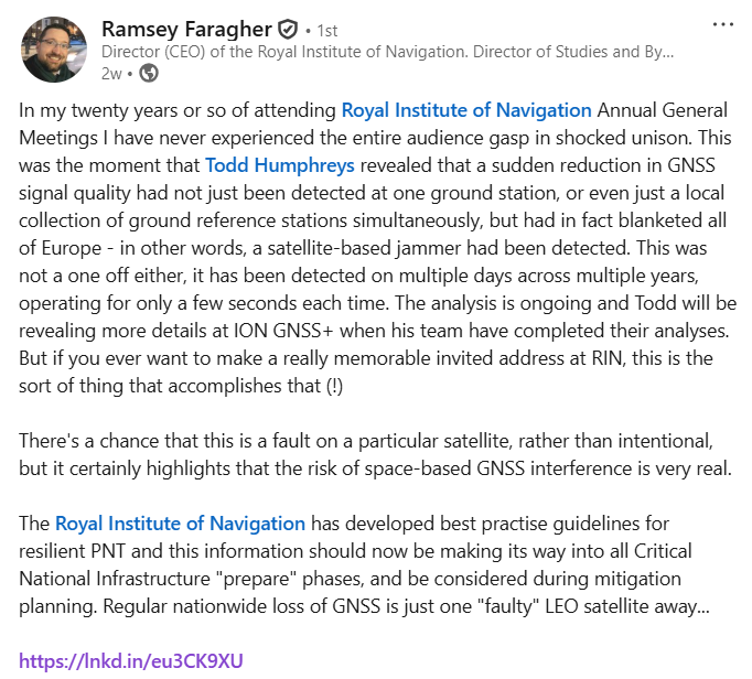
😕 Baltic GPS Disruption Traced to Russian Electronic Warfare Sites.
📌 Space Force Boosting an Ecosystem of GPS Alternatives in Low-Earth Orbit. “A half-dozen companies, including two with research contracts from Space Force or Air Force tech incubators, are currently planning low-Earth orbit (LEO) constellations of hundreds of small satellites that will offer position, navigation, and timing services to augment or back up GPS.”
🛩 RTX, Shield AI Announce New Partnership for Drone & Counter-Drone Tech.
🎖 How a 1990s Japanese Game Console Became One of the World's First GPS Navigation Systems. Editor’s Note: Sadly, I’m old enough to remember Car Marty.
Products:
😏 New X1 Firmware Unlocks 360° Spins, Indoor Tracking, Quiet Audio.
⌚ Google Maps Finally Arrives on Select Garmin Smartwatches for Easy Navigation.
⚡ Pointr Introduces Pointr Maps v9.0 with Multi-modal MapScale.
🚘 All New TomTom GO Puts Drivers Back on the Map.
Expert nationwide installation services for fleet technologies.
Maps:
🗺 The Overture Maps Foundation Overture Maps Launches GERS. The Overture Maps Foundation on June 25 rolled out the Global Entity Reference System (GERS), a universal ID system assigning unique identifiers to every geographic feature—buildings, roads, addresses and more—positioning it as a new global standard for mapping interoperability.

By embedding GERS identifiers directly into its open-map datasets—covering 2.6 billion buildings, 321 million road segments, nearly 447 million addresses and 64 million places—Overture aims to eliminate the “hidden tax” of conflating disparate spatial data sources, which can consume weeks of engineering time and exceed licensing costs.
📲 Leak Reveals Apple Maps in iOS 26 Could Get Two Unannounced New Features. “Apple’s AAPL 0.00%↑ new “search the way you talk” feature is powered by Apple Intelligence, and has made a big difference in apps that have implemented it.”
🤔 Maxar and Bee Maps Are Transforming Road Network Mapping. “Maxar and Bee Maps, powered by Hivemapper, have tested a three-layer approach that combines satellite change detection, crowdsourced street-level imagery and high-resolution satellite imaging.”
And…
🚓 ADMT Tests Bee Maps Mapping and PUDO Precision for Autonomous Mobility. “Volkswagen Group of America’s autonomous vehicle testing subsidiary, Volkswagen ADMT has selected Bee Maps’ real-time spatial intelligence to support its autonomous vehicle testing operations.”
🌏 Petal Maps and GrabMaps Sign Memorandum of Cooperation (MoC) to Deepen Mapping Data Partnership. “Petal Maps and GrabMaps, signed a Memorandum of Cooperation (MoC) on June 18th that aims to enhance the accuracy and reliability of Petal Maps’ data in Southeast Asia to deliver smarter navigation and a better travel experience for global users.”
🙂 What's New in ArcGIS Location Platform during the Summer of 2025. “Precision matters in routing, and with the new Snap to Roads capability in the ArcGIS Routing service, developers gain the ability to automatically align location data with the most accurate road geometries.”
🤨 Apple Maps Ignores Users' Settings, Sends Them on Toll Routes. “A reader told me earlier this month that Apple Maps has started ignoring the setting to avoid toll roads. Its suggested routes often include roads where drivers would otherwise have to pay tolls.”
😑 Waze "Considering" New Routing Option To Eliminate Newly Added Feature. “As I said from the beginning, literally days after Waze announced support for speed bumps, this feature can turn into a major annoyance on city roads. The reason is simple: these roads are filled with speed bumps, and having an alert on the screen all the time eventually affects the navigation experience.”
😐 MapmyIndia Mappls App Integrates with India Post's DIGIPIN System.
👉 Botched Google Maps Update Causes Widespread Navigation Issues on CarPlay. “Posts on Reddit reveal that Google Maps loses orientation after the first turn when users enable navigation, as the app can't rotate to follow them on the map.”
😟 Google Maps Navigation Is So Bad It Makes Me Want To Switch to a Paper Map. Editor’s Note: Bull <cough> $h!t.

We average 50,000 views on our websites each month. Advertising starts at only $150 per issue. Please contact us at info@driverlessreport.com for more information…or go to our updated Advertising Page. We are planning a pre-CES conference with tabletop displays and sponsorships. Sponsors will get free ads on the website, newsletter and dedicated mailings. Contact us for more information on speaking and sponsoring.
Connected and Autonomous Vehicles:
🚗 Tesla Completes First Fully Autonomous Delivery. “The Model Y ran Tesla’s TSLA 0.00%↑ AI-based, camera-only FSD system, which the company has been refining through its Robotaxi initiative. This delivery marks the first time the technology has been used to autonomously hand off a vehicle directly to a consumer.”
😕 What We Saw at Tesla's Supervised, Invite-Only Robotaxi Launch. “One vehicle drove on the wrong side of the road, one vehicle stopped in the middle of traffic, one braked suddenly on a 40 mph street and another vehicle dropped off a passenger in the middle of an intersection.”
😐 Ford CEO Shuts Down Tesla Full Self-Driving Deal, Says Waymo is Better.
✔ Waymo Starts Robotaxi Testing in Philadelphia and NYC.

👍 Stellantis Introduces Simplified, Value-packed Connected Services for U.S. Customers. Stellantis on July 8 rolled out a two-tier connected services structure for U.S. customers across Dodge, Jeep, Ram and FIAT vehicles, featuring the free Connect ONE package with 10-year coverage of OTA updates, vehicle health reports, SOS calls, remote lock/unlock, digital key and basic navigation. The premium Connect Wi‑Fi PLUS subscription adds an onboard Wi‑Fi hotspot, advanced remote operations, stolen vehicle tracking, drive alerts, voice assistant integration and connected navigation for $17.99 per month after a three-month trial.
🤔 Why Volkswagen is Convinced Waymo and Tesla are Vulnerable in the $500 billion Robotaxi Race. “The German carmaker is preparing to enter the market for autonomous ride-hailing services next year with its Volkswagen ID. Buzz AD. But instead of competing against existing transportation providers, it aims to work with them as a partner. The different approach comes amid continued popular resentment towards robotaxis.”
And…
📌Volkswagen's ID.Buzz Robotaxi To Hit U.S. Roads With Uber In 2026.
🤞 Volkswagen, BMW and Mercedes-Benz Team Up to Develop Connected Vehicle Software.
🌍 TCS launches New Software-Defined Vehicle Hubs in Europe.
👌 Zoomcar Partners with CARS24 to Raise the Bar on Self-Drive Car Quality and Safety through Tech-Enabled Inspections. “As part of this collaboration, CARS24 will conduct Pre-Delivery Inspections (PDIs) and install GPS tracking devices on newly onboarded host vehicles, ensuring greater transparency, safety, and guest satisfaction.”
📲 May Mobility Launches Ride-Hail API, Signaling Readiness to Scale Autonomous Deployments Globally.
🌏 Can New Policies Help Korea Catch Up in Autonomous Driving? “Industry urges government to open more roads for self-driving vehicles, work with taxi and bus drivers to ease their concerns”
Fleet Telematics and Asset Management:
💲 Cognosos Acquires Cox 2M to Expand Leadership in AI-Powered Location Intelligence. “Cognosos has announced its acquisition of Cox 2M, the connected asset tracking and IoT business founded by Cox Communications.”
🤞 Targa Telematics Rebrands, Launches New Website. “Targa Telematics has launched a new website, completing its rebranding and integration process after acquiring Viasat.”
🚛 Teletrac Navman’s TN360 Connects With Leading Vehicle Manufacturer Telematics Systems.
🚙 Nevada State Fleets Drive Toward a Smarter, More Efficient Future with Geotab Telematics.
✔ 46 Labs and Mozee Partner to Launch Secure, Scalable Network for Connected Vehicle Fleets.
🚍 Fleet Use of Telematics Data Predicted To Grow Significantly.
🚚 Jungo Expands Portfolio for AI Telematics and Driver Monitoring Twith US Patent.

The D-Day Visitor's Handbook: Your Guide to the Normandy Battlefields and WWII Paris by Kevin Dennehy and Steve Powers. The guidebook uses location technology from what3words to locate monuments, museums and other attractions. Get your guidebook today.
Location Product News
Send your news releases to kdennehy@driverlessreport.com. Go to www.locationbusinessnews.com for more news and an archive of stories.
Trimble and TDK Launch High-Precision Navigation System for Autonomous Tech
Trimble TRMB 0.00%↑ and TDK’s InvenSense unit have partnered to develop a high-precision navigation solution combining Trimble’s ProPoint Go positioning engine and RTX correction services with TDK’s automotive-grade inertial measurement units (IMUs). The integrated system is aimed at autonomous vehicles, robotics, drones and industrial machinery, providing reliable, centimeter-level accuracy even in challenging environments.

Executives from both companies said the collaboration will accelerate innovation in automotive and IoT markets, with a shared focus on safety and performance. The solution is now available for testing through a Trimble Evaluation Kit that includes both positioning and IMU hardware.
Contact: Trimble, https://positioningservices.trimble.com.
CMT Rolls Out Expanded CrashAssist Integration to Millions of Road Users
Cambridge Mobile Telematics (CMT) has announced that it has integrated its CrashAssist crash detection and emergency response technology into the AARP SafeTrip app. The service alerts emergency contacts when a user reports a crash, the company said.

CMT said that the deployment will be available in both iOS and Android platforms and telematics platforms. CrashAssist's integration is part of CMT’s DriveWell platform, which has helped prevent over 93,000 crashes worldwide and protected more than 50,000 people from serious injuries, the company said.
Contact: Lisa Marie Pascuccio, CMT, lpascuccio@cmtelematics.com.
NIO’s Firefly EV Harnesses HERE Maps for Smarter Connected Driving, Partners with Genesys International in India
NIO’s new Firefly electric vehicle is tapping HERE Technologies’ mapping and location services to enhance advanced driver assistance systems (ADAS), navigation and Intelligent Speed Assistance (ISA) across its global markets, the companies announced Monday.

The partnership includes integration via HERE’s collaboration with Telenav, delivering real-time traffic updates and in-car navigation.
In other company news, HERE partnered with Genesys International to develop an in-car navigation system that targets distracted driving in India.
Contact: Vanessa Lee, HERE Technologies, 65 9188 6199, vanessa.lee@here.com.
Septentrio Expands GNSS Corrections Partnerships with Onocoy
Septentrio on July 8 announced that its Agnostic Corrections Partner Program now fully supports decentralized RTK correction services from Onocoy, broadening high-precision positioning options across its receiver lineup. The initiative enables users in industries such as robotics, agriculture, and UAVs to access centimeter-level accuracy even in remote locations by choosing from a wider array of correction networks, the company said. The additions reflect rising demand for flexible positioning infrastructures capable of supporting diverse deployment environments and cost-effective scalability, the company said.
Contact: Septentrio, info@septentrio.com, www.septentrio.com/corrections-program.
Taoglas Debuts 18‑in‑1 Patriot Antenna for Connected Fleets
Taoglas has unveiled the Patriot series, a low‑profile roof‑mount antenna that integrates up to 18 radio elements, including 5G/4G, dual GNSS, Wi‑Fi, SDARS, LMR/TETRA and a P25 whip, all in a rugged, IP67/IK08‑rated housing. Designed for emergency response, utility and commercial fleets—and specifically developed for Ford F 0.00%↑ Interceptor vehicles—the antenna replaces OEM units with minimal modification, the company said.
Patriot supports simultaneous mission‑critical communication and positioning functions without cluttering vehicle roofs, the company said.
Contact: Taoglas, www.taoglas.com.

Create a FREE ManyMe Account.
VectorNav Technologies Acquires New 100,000-Square-Foot Facility
VectorNav Technologies has announced the purchase of a 100,000-square-foot facility in the Dallas-Fort Worth metroplex. VectorNav, which has manufactured more than 100,000 units since its 2008 founding, is expanding its infrastructure to support the people, processes, and technologies driving PNT, autonomous vehicles and other innovation, the company said.
Contact: Zane Woodson, VectorNav, woodson@vectornav.com, www.vectornav.com.
Point One Debuts Rugged Atlas Duo INS System for Precise Navigation
Point One Navigation has introduced the Atlas Duo INS, a compact, rugged inertial navigation system that combines positioning with orientation tracking for autonomous vehicles, drones, robotics and mapping applications. The system delivers location and angle data without relying on post‑processing, making it suitable for both field deployment and fleet-level operations, the company said.

Its design allows integration into industrial and outdoor environments, the company said.
Contact: Point One, info@pointonenav.com, www.pointonenav.com.
Safran Introduces Skylight, Resilient Dual-Mode GNSS Receiver for Defense Applications
Safran Electronics & Defense unveiled Skylight during the Paris Air Show, introducing the world’s first dual-mode GNSS receiver capable of processing both GPS M‑Code and Galileo PRS signals for enhanced military navigation in contested environments. The compact receiver, compatible with SkyNaute inertial navigation systems and anti-jamming antennas, delivers encrypted, spoof-resistant signals that demonstrated reliable performance during flight trials aboard combat aircraft, the company said.

Skylight’s integrated design also includes a certified civil GPS channel, removing the need for a separate receiver in civilian airspace operations and reducing system weight and cost for platform integrators.
Contact: Safran, safran-navigation-timing.com
OEM-Embedded Telematics to Reach 60 Million Two-Wheelers by 2029
According to a new report by Berg Insight, the number of motor-powered two-wheelers—such as motorcycles, scooters, and mopeds—with active original equipment manufacturer embedded telematics systems is projected to climb from 16.7 million in 2024 to nearly 60 million by 2029, reflecting a compound annual growth rate of 29 percent. The adoption is being driven by rising demand for safety and security features like emergency assistance and stolen-vehicle tracking, with electric two-wheelers further accelerating integration. At the same time, aftermarket telematics units are expected to grow modestly from 17.2 million to 30.8 million over the same period, offering opportunities for service providers.
Contact: Berg Insight, info@berginsight.com, www.berginsight.com.
People
Comtech CMTL 0.00%↑ has appointed Steve Black as COO, Mark Dale as CTO and Brent Norman as CFO.
Diligent Robotics has named two former Cruise execs, Rashed Haq as CTO and Todd Brugger as COO, to its management team.
GeoLinks has named Sanyogita Shamsunder as CTO. Shamsunder held leadership positions at Verizon VZ 0.00%↑, Google GOOG 0.00%↑ and NextNav NN 0.00%↑.
Ryan Naylor has been named vice president of sales, IoT solutions & connectivity at Telit Cinterion.
Marek Ziebart has been elected to be the chair of the Royal Institute of Navigation Technical Committee.
Rakean Zakir has been named global business development manager at Geotab.
Jobs
North American Sales Manager, GNSS. Quectel.
Sr. GNC Software Engineer. Xona Space Systems.
Director Strategic Partners (Seattle). TomTom.
Lead Software Engineer. HERE Technologies.
Business Development Specialist (Dutch speaker). HERE Technologies.
Sr Account Manager, Automotive Technology. HERE Technologies.
Key Account Manager Automotive EMEA. u-blox.
Cloud Software Developer. u-blox.
Senior Field Application Engineer. Septentrio.
Aviation Marketing Manager 1. Garmin.
Senior Customer Marketing Manager. QNX.
Firestone Senior Brand Manager. Bridgestone Americas.
Manager, Internal Communications. Bridgestone Americas.

Click HERE to Join our growing Location Business News LinkedIn Group!